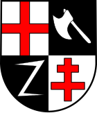
Neef
| coat of arms | Germany map | |
|---|---|---|

|
Coordinates: 50 ° 6 ′ N , 7 ° 8 ′ E |
|
| Basic data | ||
| State : | Rhineland-Palatinate | |
| County : | Cochem cell | |
| Association municipality : | Zell (Moselle) | |
| Height : | 90 m above sea level NHN | |
| Area : | 6.51 km 2 | |
| Residents: | 431 (Dec. 31, 2019) | |
| Population density : | 66 inhabitants per km 2 | |
| Postal code : | 56858 | |
| Area code : | 06542 | |
| License plate : | COC, ZEL | |
| Community key : | 07 1 35 068 | |
| LOCODE : | DE NFE | |
| Association administration address: | Corray 1 56856 Zell (Moselle) |
|
| Website : | ||
| Local Mayor : | Harald Franzen | |
| Location of the local community Neef in the district of Cochem-Zell | ||

Neef is a municipality in the Cochem-Zell district in Rhineland-Palatinate . It belongs to the Verbandsgemeinde Zell (Mosel) .
geography
The wine village is located directly on the right bank of the Moselle between Cochem in the north and Zell in the south.
history
Traces of settlement in the Hochkessel reach as far back as the Middle Stone Age, around 4000 BC. Neef is presumably as early as 698 in a deed of donation from St. Irmina to the monastery Echternach with vien-nense listed. The place was first mentioned in a document in 1049 as "vicus Navis iuxta fluvium Moselanum". The castle in Neef was first mentioned in 1248. Heinrich von Heinsberg exchanged castle and property in Neef, Kastellaun and Kirchberg with his brother Simon von Sponheim . Thus Neef belonged to the front county of Sponheim . In 1299 Eberhard von Sponheim-Kreuznach founded a new branch named after Neef. In the middle of the 15th century Neef Castle came to the Lords of Metzenhausen as a Trier fief . The Archbishop of Trier Johann III. von Metzenhausen was born in the castle. In 1552 the castle in Neef was attacked by the troops of Albrecht von Brandenburg and badly destroyed. The rulership of the place was shared for a long time by the monastery Stuben , Kurtrier and noble landlords.
From 1794 Neef was under French rule, the Stuben monastery has been in ruins since the French revolutionary troops marched in. In 1815 the place was assigned to the Kingdom of Prussia at the Congress of Vienna . Since 1946 it has been part of the then newly formed state of Rhineland-Palatinate .
- Statistics on population development
The development of the population of Neef, the values from 1871 to 1987 are based on censuses:
|
|
Municipal council
The local council in Neef consists of eight council members, who were elected by a majority vote in the local elections on May 26, 2019 , and the honorary local mayor as chairman.
Economy and Infrastructure
The two areas viticulture and tourism are the pillars of Neefer farms. A variant of leading through the village Mosel bike path and opened in April 2014 Mosel sidewalk bring each year thousands of tourists in the place, often overnight guests, which are supplemented by day visitors. Viticulture begins in the residential area of the town, with vines growing up to heights of 280 meters. The vineyards in the area of the Moselle loop near Neef are special: locations such as the Frauenberg or the Calmont are among the steepest vineyards in Europe.
traffic
A district road runs through the village and is connected to federal highway 49 by a bridge on the outskirts . In addition, regional trains stop hourly in Neef on the Moselle route Koblenz-Trier of Deutsche Bahn, which previously crossed the Petersberg tunnel .
In addition to the numerous cargo ships, the Moselle is also used by excursion ships. The St. Aldegund lock is on the outskirts . The next larger municipality is Bullay , 4 km south on the same side of the Moselle , structurally more important are Zell (Mosel) (10 km) and Cochem (23 km), the seat of the district of Cochem-Zell.
See also
Web links
- Website of the local community Neef
- The Chronicle of Neef
- General Directorate for Cultural Heritage Rhineland-Palatinate (Ed.): Informational directory of cultural monuments - Cochem-Zell district. Mainz 2020, p. 20 ff. (PDF; 4.6 MB).
- Neef (Neugartenstraße) in the SWR television program Hierzuland
- Literature about Neef in the Rhineland-Palatinate State Bibliography
Individual evidence
- ↑ State Statistical Office of Rhineland-Palatinate - population status 2019, districts, communities, association communities ( help on this ).
- ↑ State Statistical Office Rhineland-Palatinate - regional data
- ^ The Regional Returning Officer Rhineland-Palatinate: Local elections 2019, city and municipal council elections


