
Binningen (Eifel)
| coat of arms | Germany map | |
|---|---|---|

|
Coordinates: 50 ° 12 ' N , 7 ° 15' E |
|
| Basic data | ||
| State : | Rhineland-Palatinate | |
| County : | Cochem cell | |
| Association municipality : | Kaisersesch | |
| Height : | 300 m above sea level NHN | |
| Area : | 6.66 km 2 | |
| Residents: | 700 (Dec. 31, 2019) | |
| Population density : | 105 inhabitants per km 2 | |
| Postal code : | 56754 | |
| Area code : | 02672 | |
| License plate : | COC, ZEL | |
| Community key : | 07 1 35 009 | |
| Association administration address: | Am Römerturm 2 56759 Kaisersesch |
|
| Website : | ||
| Local Mayor : | Günter Urwer | |
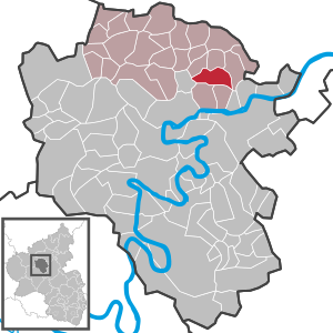
| Location of the local community Binningen in the district of Cochem-Zell | ||
  |
||

Binningen is a municipality in the Rhineland-Palatinate district of Cochem-Zell . It has been a member of the Kaisersesch community since July 1, 2014 .
_001x.jpg)
_002x.jpg)
geography
Binningen is located in the Eastern Eifel and on the Pommerbach (Moselle) . The hamlet of Elzerhöfe and the residential areas Mühlenhof, Pommernmühle and Tüllenhof also belong to the community.
history
The place was first mentioned in 1266 under the name "Binningh". Later mentions were "Binninc" (1297) and "Brumminck" (1473).
The local history is closely linked to the history of the Rosenthal monastery , which was located in the current area of the municipality in the Pommerbachtal. The monastery was the largest landlord in the village.
Until the end of the 18th century, Binningen belonged to Kurtrier . From 1794 the place was under French rule and from 1798 to 1814 belonged to the canton of Münstermaifeld . The Rosenthal monastery was dissolved in 1802 and sold for demolition. In 1815 the place was assigned to the Kingdom of Prussia at the Congress of Vienna . The church in Binningen was built in 1855. Since 1946 the place has been part of the then newly formed state of Rhineland-Palatinate.
- Statistics on population development
The development of the population of the municipality of Binningen, the values from 1871 to 1987 are based on censuses:
|
|
Municipal council
The municipal council in Binningen consists of twelve council members, who were elected by a majority vote in the local elections on May 26, 2019 , and the honorary local mayor as chairman.
Culture and sights
The ruins of the Cistercian convent Rosenthal are located in the district, in the Pommerbachtal, and the village of Binningen has Georgs-Lay in the Rosental.
Personalities
- Benedikt Oster (* 1988), politician (SPD) and member of the Rhineland-Palatinate Member of the Land since 2011, lives in Binningen
literature
- Ortgemeinde Binningen (Hrsg.): Binningen: the history of an Eifel village. Rhein-Mosel-Verlag, Alf / Mosel 2003, ISBN 3-929745-99-2 .
Web links
- Internet presence of the municipality of Binningen
- Short portrait of Binningen on SWR television
- Literature about Binningen in the Rhineland-Palatinate State Bibliography
Individual evidence
- ↑ State Statistical Office of Rhineland-Palatinate - population status 2019, districts, communities, association communities ( help on this ).
- ↑ State Statistical Office Rhineland-Palatinate (ed.): Official directory of the municipalities and parts of the municipality. Status: January 2018 [ Version 2020 is available. ] . S. 22 (PDF; 2.2 MB).
- ↑ Elmar Rettinger: Historical local dictionary Rhineland-Palatinate. Volume 1: Former district of Cochem , Stuttgart: Franz Steiner Verlag, 1985. ISBN 3-515-04173-7 , p. 16 ( Google Books )
- ↑ State Statistical Office Rhineland-Palatinate - regional data
- ^ The Regional Returning Officer Rhineland-Palatinate: Local elections 2019, city and municipal council elections

Alf | Alflen | Altlay | Alt-trimmed | Auderath | Bad Bertrich | Beilstein | Beuren | Binningen | Blankenrath | Brachtendorf | Bremm | Briedel | Brieden | Briedern | Brohl | Bruttig-Fankel | Büchel | Bullay | Cochem | Dohr | Durfus | Düngenheim | Ediger-Eller | Ellenz-Poltersdorf | Eppenberg | Serious | Eulgem | Faid | Felt | Forst (Eifel) | Forst (Hunsrück) | Gamling | Gevenich | Gillenbeuren | Greimersburg | Grenderich | Hambuch | Haserich | Hauroth | Hesweiler | Illerich | Kaifenheim | Kail | Kaisersesch | Kalenborn | Kliding | Klotten | Country core | Laubach | Leienkaul | Lie | Liesenich | Lütz | Lutzerath | Masburg | Mesenich | Medium- bodied | Möntenich | Moritzheim | Mosel core | Tired (Moselle) | Müllenbach | Neef | Nehren | Panzweiler | Peterswald -öffelscheid | Pomerania | Pünderich | Reidenhausen | Roes | Sankt Aldegund | Showers | Schmitt | Senheim | Sosberg | Tellig | Treis cards | Elms | Urmersbach | Urschmitt | Valwig | Wagenhausen | Walhausen | Hamlet | Wirfus | Wollmerath | Zell (Mosel) | Zettingen