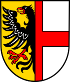
Ellenz-Poltersdorf
| coat of arms | Germany map | |
|---|---|---|

|
Coordinates: 50 ° 7 ' N , 7 ° 14' E |
|
| Basic data | ||
| State : | Rhineland-Palatinate | |
| County : | Cochem cell | |
| Association municipality : | Cochem | |
| Height : | 95 m above sea level NHN | |
| Area : | 7.4 km 2 | |
| Residents: | 813 (Dec. 31, 2019) | |
| Population density : | 110 inhabitants per km 2 | |
| Postal code : | 56821 | |
| Area code : | 02673 | |
| License plate : | COC, ZEL | |
| Community key : | 07 1 35 025 | |
| LOCODE : | DE EPR | |
| Association administration address: | Ravenéstrasse 61 56812 Cochem |
|
| Website : | ||
| Local Mayor : | Heinz Wolfgang Dehren | |
| Location of the local community Ellenz-Poltersdorf in the district of Cochem-Zell | ||
Ellenz-Poltersdorf is a wine village in the district of Cochem-Zell in Rhineland-Palatinate . The local community belongs to the Cochem Association .
geography
Ellenz-Poltersdorf is located on a bend in the Moselle in the center of the Cochemer Krampens . The location is on a sliding slope that slopes flat in a south-easterly direction towards the Moselle.
Geographical location
The district town of Cochem , which is also the seat of the municipal administration , is about 7 km downstream. After Mayen is about 30 km, Koblenz is 50 km away. Directly opposite on the other side of the Moselle is the small town of Beilstein , a cable ferry connects the two towns.
Expansion of the municipal area
While the Ellenz-Poltersdorf district extends through its large forest areas on both sides of the Moselle, the two spatially separated districts of Ellenz and Poltersdorf are on the left-hand side of the Moselle . The majority of the vineyards and therefore vineyards that belong to the municipality are also located here. The best known of these is the Ellenz gold tree.
The land use is as follows (as of December 31, 2018):
| surface | in ha | in % |
|---|---|---|
| settlement | 35 | 4.7 |
| traffic | 38 | 5.1 |
| vegetation | 633 | 85.4 |
| Waters | 36 | 4.9 |
| total | 742 | 100 |
history
Ellenz is mentioned for the first time around 1100 in an inventory of the Karden monastery. The first written mention of Poltersdorf comes from the year 1178. The Reichsvogtei Ellenz-Poltersdorf existed until the early 14th century. The subsequent rule of Kurtrier expired in 1794 with the occupation by the French revolutionary army , until 1814 Ellenz belonged to Mairie Eller in the canton of Cochem . In 1815 Ellenz-Poltersdorf was assigned to the Kingdom of Prussia at the Congress of Vienna and belonged to the Rhine Province until 1945 . The local community has been part of the then newly formed state of Rhineland-Palatinate since 1946 .
Municipal council
The council in Ellenz-Poltersdorf consists of twelve council members, who in the local elections on May 26, 2019 in a majority vote were elected, and the honorary mayor as chairman.
Attractions
- Historic half-timbered town hall from 1541 (inscription) in the Ellenz district
- St. Andrew's Church in the Poltersdorf district
See also: List of cultural monuments in Ellenz-Poltersdorf
Economy and Infrastructure
RWE Power AG's central control room is located at the Fankel barrage about 500 m downstream from Ellenz . All hydropower plants along the Moselle and Saar are controlled from here.
Personalities
- Heinrich Engelen (* after 1460–1523), clergyman, Premonstratensian, prior in Niederehe and provost in St. Gerlach (Houthem near Maastricht)
Web links
- Internet presence of the local community Ellenz-Poltersdorf
- Literature about Ellenz-Poltersdorf in the Rhineland-Palatinate state bibliography
Individual evidence
- ↑ State Statistical Office of Rhineland-Palatinate - population status 2019, districts, communities, association communities ( help on this ).
- ↑ State Statistical Office Rhineland-Palatinate: My village, my city. Retrieved July 30, 2019 .
- ^ The Regional Returning Officer Rhineland-Palatinate: Local elections 2019, city and municipal council elections. Retrieved July 30, 2019 .


