
Nehren (Moselle)
| coat of arms | Germany map | |
|---|---|---|

|
Coordinates: 50 ° 5 ' N , 7 ° 12' E |
|
| Basic data | ||
| State : | Rhineland-Palatinate | |
| County : | Cochem cell | |
| Association municipality : | Cochem | |
| Height : | 91 m above sea level NHN | |
| Area : | 0.76 km 2 | |
| Residents: | 102 (Dec. 31, 2019) | |
| Population density : | 134 inhabitants per km 2 | |
| Postal code : | 56820 | |
| Area code : | 02673 | |
| License plate : | COC, ZEL | |
| Community key : | 07 1 35 069 | |
| Association administration address: | Ravenéstrasse 61 56812 Cochem |
|
| Website : | ||
| Local Mayor : | Frank Liebfried | |
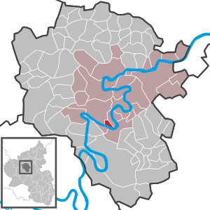
| Location of the local community Nehren in the district of Cochem-Zell | ||
  |
||


Nehren is a wine village on the Moselle in the Cochem-Zell district in Rhineland-Palatinate . The local community belongs to the Cochem Association .
geography
The place is at the southern end of a wide ridge of vineyards behind an oxbow lake of the Moselle.
history
The place was mentioned for the first time in 634 and emerged from the Roman Villa Nogeria . Since 1815 it was part of the Prussian Rhine Province . Since 1946 it has belonged to the state of Rhineland-Palatinate.
Municipal council
The local council in Nehren consists of six council members, who were elected by a majority vote in the local elections on May 26, 2019 , and the honorary local mayor as chairman.
Attractions
- Reconstructed protective temple in the vineyards with two Roman burial chambers
- Late Gothic church of St. Agatha with baroque furnishings
- Roman wine press on the parish square
See also: List of cultural monuments in Nehren
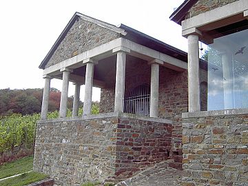
Reconstructed protective temple
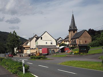
Moselle road with St. Agatha
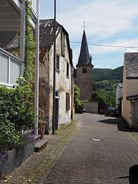
Kirchstrasse


Web links
- Nehren local parish
- Local community of Nehren at the Cochem community
- Information about Nehren
- Literature about Nehren in the Rhineland-Palatinate state bibliography
Individual evidence
- ↑ State Statistical Office of Rhineland-Palatinate - population status 2019, districts, communities, association communities ( help on this ).
- ^ The Regional Returning Officer Rhineland-Palatinate: Local elections 2019, city and municipal council elections

Alf | Alflen | Altlay | Alt-trimmed | Auderath | Bad Bertrich | Beilstein | Beuren | Binningen | Blankenrath | Brachtendorf | Bremm | Briedel | Brieden | Briedern | Brohl | Bruttig-Fankel | Büchel | Bullay | Cochem | Dohr | Durfus | Düngenheim | Ediger-Eller | Ellenz-Poltersdorf | Eppenberg | Serious | Eulgem | Faid | Felt | Forst (Eifel) | Forst (Hunsrück) | Gamling | Gevenich | Gillenbeuren | Greimersburg | Grenderich | Hambuch | Haserich | Hauroth | Hesweiler | Illerich | Kaifenheim | Kail | Kaisersesch | Kalenborn | Kliding | Klotten | Country core | Laubach | Leienkaul | Lie | Liesenich | Lütz | Lutzerath | Masburg | Mesenich | Medium- bodied | Möntenich | Moritzheim | Mosel core | Tired (Moselle) | Müllenbach | Neef | Nehren | Panzweiler | Peterswald -öffelscheid | Pomerania | Pünderich | Reidenhausen | Roes | Sankt Aldegund | Showers | Schmitt | Senheim | Sosberg | Tellig | Treis cards | Elms | Urmersbach | Urschmitt | Valwig | Wagenhausen | Walhausen | Hamlet | Wirfus | Wollmerath | Zell (Mosel) | Zettingen