
No one
| No one | ||
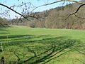
 Road bridge over the Nieme near Löwenhagen |
||
| Data | ||
| Water code | EN : 434 | |
| location | District of Göttingen , Lower Saxony ( Germany ) | |
| River system | Weser | |
| Drain over | Weser → North Sea | |
| origin | Eastern flank of the Bramwald near Varlosen 51 ° 29 ′ 32 ″ N , 9 ° 40 ′ 42 ″ E |
|
| Source height | 302 m above sea level NHN | |
| muzzle | in Bursfelde in the Weser Coordinates: 51 ° 32 '26 " N , 9 ° 37' 20" E 51 ° 32 '26 " N , 9 ° 37' 20" E |
|
| Mouth height | 109 m above sea level NHN | |
| Height difference | 193 m | |
| Bottom slope | 12 ‰ | |
| length | 16.7 km | |
| Catchment area | 40.41 km² | |
The Nieme is a 16.7 km long, eastern and orographically right tributary of the Weser in the southern Lower Saxony district of Göttingen ( Germany ).
course
The brook arises on the eastern roofing of the Bramwald above the village of Varlosen (district of Niemetal ) through the confluence of the three source brooks Wesperke, Buirke and Valenke. Their sources are located northeast of the municipality of Bühren ; The origin of the Schede , a further or a little more southern tributary of the Weser, lies a little southwest of Bühren .
The Nieme, which runs exclusively in the Münden Nature Park , flows - without flowing through it - initially east of the Bramwald in a north-easterly direction to Varlose (district of Niemetal ) to flow through the village eastwards. Then the Vöhre from the west of Ellershausen (district of Niemetal) joins. The Nieme continues past Imbsen (district of Niemetal), after which it bends to the west and flows through Löwenhagen (district of Niemetal). Then it cuts through the Bramwald flowing to the northwest, touching the Totenberg nature reserve to the south .
Finally, the Nieme reaches Bursfelde (northernmost district of Hann. Münden ), where, a few hundred meters after crossing under the state road 561, which connects Bursfelde in the south with Oedelsheim (part of the north Hessian community Wesertal ) in the north, it joins the Weser flowing to the North Sea flows out, which here forms a section of the Hessian-Lower Saxony border. Due to a renaturation project , the Niem estuary is roughly following the course that existed around 200 years ago.
Opposite the confluence of the Nieme on the western edge of the Bramwald and thus on the other or western bank of the Weser is the eastern roof of the Hessian Reinhardswald .
Valley of the Nieme in front of Bursfelde

Neem and meadow

The Quarmke flows into the Nieme


Catchment area and tributaries
The catchment area of the Nieme is 40.41 km². Their tributaries include (viewed downstream):
|
|
|