Nikumaroro
| Nikumaroro | |
|---|---|
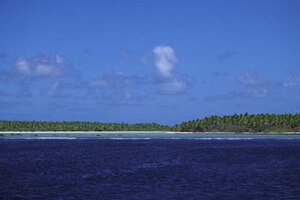
| Nikumaroro seen from the sea | |
| Waters | Pacific Ocean |
| archipelago | Phoenix Islands |
| Geographical location | 4 ° 40 ′ S , 174 ° 32 ′ W |
| Number of islands | 2 |
| Main island | Nikumaroro |
| length | 7.5 km |
| width | 2.5 km |
| Land area | 4.1 km² |
| Lagoon area | 8 km² |
| Residents | uninhabited |
| Map of Nikumaroro | |
Nikumaroro (former names: Gardner Island , also Motu Oona ) is an atoll located in the Pacific . It is the westernmost of the Phoenix Islands group belonging to the island nation of Kiribati .
geography
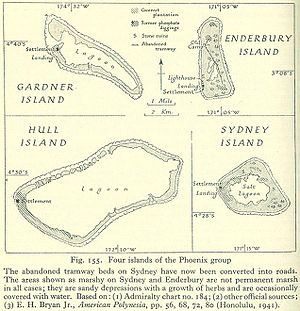
The elongated atoll, 7.5 km long from north to south and a maximum of 2.5 km wide, consists of a narrow strip of land that borders the central lagoon ; the land area is 4.1 km². The atoll is surrounded by a dense coral reef , there is a shallow access to the lagoon from the open sea in the west, which is partially dry at low tide and is only suitable for boats, the Tatiman Passage . The Bauke Passage on the south side is only temporarily flooded and not navigable.
The island is populated by thousands of palm thieves.
history
Nikumaroro was discovered in 1824 by Captain C. Kemiss (other forms of name Kemin, Kemish) from the British whaling ship Eliza Ann . The name Gardner comes from Captain Joshua Coffin II of the Ganges whaler from Nantucket , who sighted the island again in late 1825.
In 1856, the USA took possession of the area with reference to the Guano Islands Act in order to mine the local guano and export it to the USA as fertilizer.
On November 29, 1929, the British freighter SS Norwich City with a crew of 35 stranded during a storm on the coral reef in the north-west of the island. A fire broke out in the engine room, whereupon the crew left the ship; 11 people died in the process. After several days on the island, the survivors were rescued. The wreck could be seen long before the coast, but broke into numerous parts over the decades, of which only the engine and two tanks are temporarily visible today.
From 1938 the atoll was settled under the Phoenix Islands Settlement Scheme . The small settlement on the south side of the Tatiman Passage , the only entrance to the lagoon in the west, was called Karaka . The lack of drinking water (there is no spring on the island) finally led to the settlement being abandoned in 1963.
The settlers divided the land area of the atoll into initially five and later eight land units (clockwise, starting in the northwest):
- Nuritan
- Taraia (originally to Aukairame)
- Aukairame North (originally to Aukairame)
- Ameriki (originally for Aukairame, location of the USCG LORAN station July 1944 to December 1945)
- Aukairame South (originally to Aukairame)
- Tekibeia
- Noriti
- Ritiati (with the village of Karaka )
Since 1979 the atoll, today uninhabited, belongs to the island nation of Kiribati ; this is where today's (official) name comes from.
Some aviation historians argue that the American pilot Amelia Earhart, in her attempt to become the first woman to cross the Pacific in an airplane in 1937, did not crash into the sea over the South Pacific, but instead made an emergency landing on Gardner Island and survived there for some time Has. In 2012, a Tighar expedition set out to search for the remains of the pilot's Lockheed Electra in the deep sea off the island's coast. In 2017 an expedition with sniffer dogs tried to look for the bones of Earhart and her navigator Fred Noonan on the island. The anthropologist Richard Jantz came to the conclusion after a forensic study published in 2018 that bones found on the island most likely match Earhart, but there is also methodological criticism of his study that casts the result into doubt.
See also in the main article: Amelia Earhart # Nikumaroro thesis
literature
- AGE Jones: Ships employed in the South Seas trade. Volume 1: 1775-1861. Canberra 1986. Volume 2: 1775-1859. Burwood, Vic. 1992
- Henry Evans Maude: Of islands and men: Studies in Pacific history. Oxford University Press, Melbourne 1968
- Edouard A. Stackpole: The sea-hunters: The New England whalemen during two centuries; 1635-1835. Lippincott, Philadelphia 1953
Web links
Individual evidence
- ↑ UNEP Islands Directory (English)
- ↑ http://tighar.org/Projects/Earhart/Archives/Research/Bulletins/80_LongFarewell/80_LongFarewellNC.html
- ↑ Tighar.org: Place Names on Nikumaroro
- ↑ Christiane Heil: The skeleton of Nikumaroro in: FAZ of July 2, 2012 page 7, accessed on November 24, 2016
- ↑ New search for Amelia Earhart's remains in: scinexx.de from July 29, 2017, accessed on July 29, 2017
- ↑ The mystery of the missing aviation pioneer apparently solved , orf.at, accessed on March 9, 2018
- ↑ Jennifer Raff: Have we really found Amelia Earhart's bones? March 16, 2018, accessed June 19, 2018 .


