Makin (archipelago)
| Makin | ||
|---|---|---|
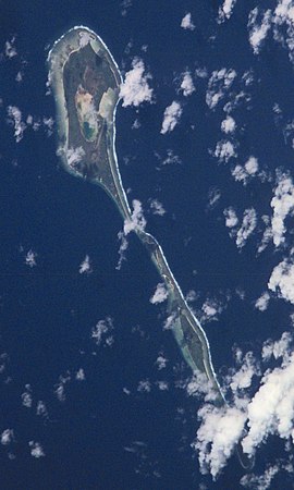
| ISS picture by Makin | ||
| Waters | Pacific Ocean | |
| archipelago | Gilbert Islands | |
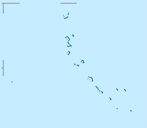
| Geographical location | 3 ° 20 ′ N , 172 ° 59 ′ E | |
|
|
||
| Number of islands | 6th | |
| Main island | Makin | |
| length | 13 km | |
| width | 2 km | |
| Land area | 7.86 km² | |
| Lagoon area | 34 ha | |
| Residents | 1798 (2010) | |
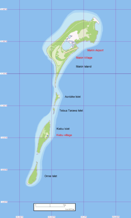
| Map of Makin | ||
Makin (formerly Pitt's Island ) is a group of islands in the Gilbert Islands archipelago in the central Pacific Ocean . Politically, it belongs to the island nation of Kiribati . Since the neighboring atoll Butaritari was also called "Makin" earlier, the archipelago was also called "Little Makin" ( Makin Meang ) to distinguish it.
geography
Makin is located about 7 km northeast of Butaritari in the north of the Gilbert Islands and thus forms their northernmost land mass. However, it does not represent the northernmost land mass of Kiribati, as Teraina and Tabuaeran in the Line Islands are even further north. Makin consists of two inhabited and four uninhabited islands on a rectilinear coral reef that stretches from north to south for a length of 13 km. The islands are (from north to south):
| island | Hectares | 2010 census | Remarks |
|---|---|---|---|
| Bikini egg egg | 3.2 | north of Makin | |
| Makin | 623.8 | 1364 | Main island with the main town Makin and the airfield |
| Aonbike | 12.5 | ||
| Tebua Tarawa | 2.0 | ||
| Kiebu | 98.0 | 434 | with the village of Kiebu Village |
| Onne | 46.9 | ||
| Makin (archipelago) | 786.4 | 1798 | |
| lagoon | 34.3 | main island open lagoon |
All islands together have a land mass of 7.86 km². Makin has 1798 inhabitants (as of 2010), who are spread over the two villages Makin and Kiebu Village. The village of Makin is the largest village in the Gilbert Islands outside the capital city of Tarawa . The islands can be reached from the air via Makin Airport ( ICAO code NGMN, IATA code MTK).
Population development
| census | 1947 | 1963 | 1968 | 1973 | 1978 | 1985 | 1990 | 1995 | 2000 | 2005 | 2010 |
|---|---|---|---|---|---|---|---|---|---|---|---|
| total | 969 | 1292 | 1387 | 1445 | 1419 | 1777 | 1762 | 1830 | 1691 | 2385 | 1798 |
Web links
- Makin Island Report 2012. Office of the Beretitenti, Republic of Kiribati Island Report Series: 1. Makin. Accessed January 13, 2014
Individual evidence
- ↑ a b Report on the Kiribati 2010 Census of Population and Housing. Volume 1. Bairiki, August 2012, p. 31. ( Memento of the original from November 7, 2016 in the Internet Archive ) Info: The archive link was inserted automatically and has not yet been checked. Please check the original and archive link according to the instructions and then remove this notice. (PDF; 6.6 MB). Retrieved November 12, 2016.
- ^ Republic of Kiribati: Report on the 1978 Census of Population and Housing. Volume I: Basic Information and Tables, Appendix 5 List of Kiribati Land Areas, Bairiki 1980, p. 180.
- ↑ a b Report on the Kiribati 2010 Census of Population and Housing. Volume 1. Bairiki, August 2012, p. 34. ( Memento of the original from November 7, 2016 in the Internet Archive ) Info: The archive link was inserted automatically and has not yet been checked. Please check the original and archive link according to the instructions and then remove this notice. (PDF; 6.6 MB). Retrieved November 12, 2016.
- ↑ Kiribati: 2005 Census. Vol. 2: Analytical Report. 2007 ( Memento of the original from January 13, 2014 in the Internet Archive ) Info: The archive link was inserted automatically and has not yet been checked. Please check the original and archive link according to the instructions and then remove this notice. Final Report, p. 118. Retrieved April 17, 2010 (English)


