Arorae
| Arorae | ||
|---|---|---|
| NASA image of Arorae | ||
| Waters | Pacific Ocean | |
| Archipelago | Gilbert Islands | |
| Geographical location | 2 ° 38 '37 " S , 176 ° 49' 54" E | |
|
|
||
| length | 9 km | |
| width | 1 km | |
| surface | 7.5 km² | |
| Residents | 1279 (2010) 171 inhabitants / km² |
|
| main place | Roreti | |
| Arorae is one of the southern atolls of the Gilbert Islands | ||
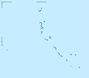
Arorae (formerly also known by the names Arorai , Arurai , Hope Island or Hurd ) is an upscale atoll in the southern Gilbert Islands of the state of Kiribati in the Pacific Ocean near the equator . It is the southernmost island in the archipelago and is 85 km southeast of the nearest island, Tamana .
geography
Arorae is an upscale atoll that consists only of an elongated coral island . The island is 9 km long, around one kilometer wide and covers an area of around 7.5 km². The sea level is no more than 2 meters. In 2005 Arorae had 1,256 mostly Protestant residents. The largest settlements on the atoll are from north to south: Tamaroa , Taribo and the main town Roreti (formerly also called Koreti ). These places also have one of the typical meeting houses of a clan, the maneabas . Post office, hospital and police station are located in Taribo, which also has a boat canal through the narrow reef surrounding the island. The northern end of Barbaroroa and the southern end of Batitotai are uninhabited. The climate is dry and periods of drought are common.
population
Demographic statistics
| census | 1978 | 2005 | 2010 |
|---|---|---|---|
| Tamaroa | 755 | 492 | 426 |
| Roreti (main town) | 772 | 764 | 853 |
| total | 1527 | 1256 | 1279 |
Population development
| census | 1947 | 1963 | 1968 | 1973 | 1978 | 1985 | 1990 | 1995 | 2000 | 2005 | 2010 |
|---|---|---|---|---|---|---|---|---|---|---|---|
| total | 1558 | 1760 | 1830 | 1626 | 1527 | 1470 | 1440 | 1248 | 1225 | 1256 | 1279 |
Culture
Since Protestant Samoan missionaries settled on Arorae, the culture on Arorae, in contrast to the culture of the rest of the Gilbert Islands, was mainly influenced by Samoa and the population largely converted to Protestantism. Another effect of the Samoan culture is the dance style of Taubati , the island is known for. Here the music is supported visually and percussionistically by clapping and stamping with the feet.
In the central and southern Gilbert Islands, the traditional administrative structure with village elders, the unimane , in more recent spelling also unimwane , has been preserved. Arorae sends a member to the Kiribati parliament on South Tarawa .
The fishermen of Arorae are very skilled at catching tuna and sharks with the hand line. The shark fins of caught sharks are exported as an ingredient for the delicacy shark fin soup , an important source of income in addition to copra production . However, the islanders tradition forbids cutting only the fins of caught sharks. Instead, the animals must first be brought ashore so that the rest can be used as food. Shark teeth are used to make shark tooth swords, the tebutje , for which Arorae is known.
Arorae is also known for the navigation stones placed long ago at the northern end , partly made of non-island granite and volcanic rock, which should help boat travelers set the right course to the neighboring islands of up to 1,000 km in Micronesia and on to Polynesia to find.
traffic
The island can mainly be reached by ship. At the northern tip is the Arorae airfield , three and a half kilometers from the center of Tamaroa. Arorae is served by the state Air Kiribati via Tamana , North Tabiteuea and Onotoa .
Web links
- Arorae janeresture.com. Illustrated information on history and culture, engl. (Retrieved April 20, 2010)
- Arorae ( December 23, 2010 memento on the Internet Archive ) Oceandots.com (Retrieved April 20, 2010)
Individual evidence
- ↑ ordnance Gilbert Islands 1: 25000: Tamana (Series X042 (DOS 367P)) Sheet Tamana & Arorae 1979
- ^ Report of the 1978 Census of Population and Housing. Republic of Kiribati 1980, Vol. 1, p. 15 (period from independence 1979)
- ↑ Kiribati 2005 Census of Population and Housing. Provisional Tables (Accessed March 29, 2010)
- ↑ a b Report on the Kiribati 2010 Census of Population and Housing. Volume 1. Bairiki, August 2012, p. 31. Table 1a ( Memento from November 7, 2016 in the Internet Archive ) (PDF; 6.6 MB). Retrieved November 12, 2016.
- ↑ Kiribati 2005 Census. Vol. 2: Analytical Report. 2007 ( Memento of the original from January 13, 2014 in the Internet Archive ) Info: The archive link was inserted automatically and has not yet been checked. Please check the original and archive link according to the instructions and then remove this notice. Final Report, p. 134. Retrieved April 17, 2010.


