Tabiteuea
| Tabiteuea | ||
|---|---|---|
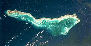
| NASA image of Tabiteuea ( north is left ) | ||
| Waters | Pacific Ocean | |
| archipelago | Gilbert Islands | |
| Geographical location | 1 ° 21 ′ S , 174 ° 48 ′ E | |
|
|
||
| Number of islands | > 10 | |
| Main island | Buariki and Nuribenua | |
| Land area | 38 km² | |
| Residents | 4898 (2005) | |
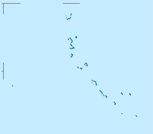
| Map of the atoll | ||
Tabiteuea , formerly also: Drummond's Island , is the name of an atoll in the Pacific archipelago of the Gilbert Islands . The atoll belongs to the state of Kiribati and is located south of the capital atoll Tarawa .
Tabiteuea means "land without chiefs" in Kiribati . This is due to the fact that the population of the islands has always been egalitarian .
The atoll consists of many small islands and two main islands that stretch from northwest to southeast on the east side of the atoll. The northern island of Nuribenua has an area of 26 km² and in 2001 a population of 2,990 people. The southern island of Buariki is 12 km² and has 1,293 inhabitants. The north island of Nuribenua is connected to the slightly smaller island of Tauma to the south via a narrow headland directly south of the airfield .
Due to the distance between the two main islands, there are two airfields on this atoll: Tabiteuea North and Tabiteuea South .
At the end of the 19th century, the islands were the scene of a religious war when the North Island converts to Christianity conquered the South Island, whose population had not converted but still practiced the traditional religion.
Personalities
- Koru Tito (* 1960), Roman Catholic clergyman and bishop of Tarawa and Nauru
literature
- Gerd Koch : Material culture of the Gilbert Islands. Nonouti, Tabiteuea, Onotoa. Museum of Ethnology, Berlin 1965.
- William H. Geddes: Social individualization on Tabiteuea atoll. In: The Journal of the Polynesian Society , Vol. 86, 1977, No. 3, pp. 371-392.
- Henry E. Maude : Tioba and the Tabiteuean religious wars. In: The Journal of the Polynesian Society. Vol. 90, 1981, No. 3, pp. 307-336.
- Camus G., "Le cas de l'atoll de Tabiteuea", In: Bambridge T. et Latouche JP., Les atolls du Pacifique face au changement climatique, Karthala, 2016, pp. 121-172
Individual evidence
- ↑ 2005 census (English)


