Canton (Kiribati)
| Canton (Abariringa) | |
|---|---|
| Satellite image of the canton | |
| Waters | Pacific Ocean |
| archipelago | Phoenix Islands |
| Geographical location | 2 ° 49 ′ S , 171 ° 41 ′ W |
| Number of islands | 2 |
| Main island | Canton |
| Land area | 9.2 km² |
| Lagoon area | 50 km² |
| Residents | 20 (2015) |
| Map of the canton atoll | |
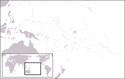
Canton ( English Canton Island , formerly Canton , also Abariringa ) is the largest, northernmost and currently only inhabited atoll of the Phoenix Islands in the Pacific island state of Kiribati . It is located in the central Pacific Ocean , about halfway between Fiji and Hawaii .
geography
Canton is a ring-shaped coral atoll , but consists only of a narrow, almost closed main island, which extends over a circumference of 37 km, with only one interruption in the west, where the small island ( Motu ) Spam Island (4.4 Hectare ). Musick Light is located at the entrance to the lagoon south of Spam Island . The land area amounts to a total of almost 9 km², but encloses a relatively large lagoon of 50 km². 38 people live on the main island in the only settlement in the west of the Tebaronga atoll (as of March 2019). In the north of the atoll is Canton Island Airport ( IATA code CIS, ICAO code PCIS), with a length of 1.9 km (6230 feet). It was built during the Second World War, but closed in 1975 and is only available as an emergency landing site.
history
The canton was discovered on August 5th, 1824 by two British whaling ships from London: The 'Phoenix', Capt. John Palmer and the 'Mary', Capt. Edward Reed. The island was named 'Mary Ballcotts (actually Boulcott's) Island' after the wife of the ship's owner of the 'Mary'.
The present name of the atoll can be traced back to a shipwreck: On March 4, 1854, the whaler Canton ran aground off the reefs of the island. Commander RW Meade , a survivor of the ship's crew who reached Guam with the dinghies on a 49-day odyssey , named the island in 1872 in memory of this adventure after the stranded whaler.
Great Britain and the United States agreed in 1939 to jointly control the atoll for 50 years.
At times, the canton was an important base for transpacific air traffic.
In 2010, Alex Bond, who was sailing from Hawaii to Fiji on a yacht, discovered that the island's residents were suffering from food shortages. An important supply ship had not arrived, so they had only had to eat coconuts and fish for several months. Bond used his satellite phone to contact the US Coast Guard, who arranged for food deliveries.
Population development
| census | 1947 | 1963 | 1968 | 1973 | 1978 | 1985 | 1990 | 1995 | 2000 | 2005 | 2010 | 2015 |
|---|---|---|---|---|---|---|---|---|---|---|---|---|
| Tebaronga | 984 | 1018 | 0 | 0 | 0 | 24 | 45 | 83 | 61 | 41 | 31 | 20 |
| total | 984 | 1018 | 0 | 0 | 0 | 24 | 45 | 83 | 61 | 41 | 31 | 20 |
literature
- William Dalton: The Dalton journal. Two whaling voyages to the South seas, 1823-1829. Edited by Niel Gunson. National Library of Australia, [Sydney] 1990, ISBN 0-642-10505-7 .
Web links
- Canton Island on janeresture.com . With maps and further information (English).
Individual evidence
- ↑ a b 2015 Population and Housing Census. Volume 1. Bairiki, September 2016, p. 31 (PDF; 6.6 MB). Retrieved November 22, 2017.
- ↑ T31EU - DXpedition to a forgotten atoll (PDF; 1.75 MB).
- ↑ news.bbc.co.uk (English).
- ↑ Kiribati: 2005 Census. Volume 2: Analytical Report. 2007 ( Memento of January 13, 2014 in the Internet Archive ) Final Report, p. 142. Retrieved on January 13, 2014 (English).


