Pfannenberg (Siegerland)
| Pfannenberg | ||
|---|---|---|
|
The Pfannenberg from Leyenkopf seen from |
||
| height | 499.2 m above sea level NHN | |
| location | North Rhine-Westphalia , Germany | |
| Mountains | Northern Hellerbergland , Siegerland | |
| Coordinates | 50 ° 48 '56 " N , 8 ° 0' 7" E | |
|
|
||
| particularities | Pfannenberg Tower ( AT ) | |
The Pfannenberg (also known as Pammerich in dialect ) is 499.2 m above sea level. NHN high mountain in the southern Siegerland on the border between Neunkirchen and Siegen in the North Rhine-Westphalian district of Siegen-Wittgenstein . It lies between Salchendorf and Eiserfeld (Siegen) . In the 18th century the Pfannenbergkopf was also called the Schotteler Spitz .
The Pfannenberg is the second highest elevation in the northern Hellerbergland and the highest on North Rhine-Westphalian soil. It is also the highest point in the urban area of Siegen.
Mining and observation tower

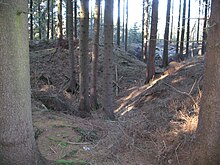
The mountain is criss-crossed by tunnels and shafts, most of which belonged to the Pfannenberger Einigkeit mine . On the Pfannenbergkopf stands the Pfannenberg Tower , an almost 20 m high observation tower that was built in 1934. It is an old headframe of the mine , which was no longer needed in 1932 and was finally dismantled. From the tower you have a very good view over large parts of the Siegerland and Westerwald . In addition to Pfannenberg unity, the Eisenzecher Zug mine (Eiserfeld, WNW from Pfannenbergkopf) and the Adolfschacht (also Eiserfeld, NE of Pfannenbergkopf at 425 m above sea level) were on the Siegen side . Ore was mined here from 1910 to 1958. He belonged to the nearby Brothers Union . The die of the Schottel and Streitberg pit west of the Pfannenbergkopf was allegedly more than 160 m deep and in 1812 could have been the first shaft in what was then the Salchendorf community.
In 1747 were by a Markscheider the tunnels of the mines lyre pit and Poppelszeche in the territory of Nassau-Siegen and Spielmann mine , Schotteler mine , Ochser mine and Saltz Rumb in the territory "Free reason Seel- and Burbach" ( Freehold , divided into Seelbach and Burbach ) examined for its extent and thus confirmed the suspicion of iron ore theft. According to this, two brothers drove a tunnel from the Leyer mine to the Ochser Zeche without authorization and unauthorized mining of iron ore there. Hence the name of the later mine Consolidation Ochs including Streitberg , which belonged to Pfannenberger Einigkeit from 1920 onwards.
"Cabinets"
Situated on the road between Salchendorf and Eiserfeld located at an altitude of 387 m , the cabinets a former border crossing ridge between Nassau-Siegen and the outdoor reason. This point is on the border between the municipality of Neunkirchen and the city of Siegen or the places Salchendorf and Eiserfeld.
On the cupboard, but already in the Eiserfeld area, there are sports and tennis courts next to a restaurant . A small road branches off here, which ends in the center of the town of Iron on the passage there. The Pfannenberg Tower can only be reached by hiking or cycling anyway , but it is very easy to get to from the cupboard.
Individual evidence
- ↑ a b Map services of the Federal Agency for Nature Conservation ( information )
- ↑ a b Gerhard Weyl: The Pfannenberger Einigkeit iron ore mine 1810–1962 in Salchendorf / Neunkirchen ; Vorländer publishing house, Siegen 2005.


