Pontefract
| Pontefract | ||
|---|---|---|
| Town Hall (1745) | ||
| Coordinates | 53 ° 41 ′ N , 1 ° 19 ′ W | |
|
|
||
| Residents | 28,250 (as of: 2001) | |
| administration | ||
| Post town | PONTEFRACT | |
| ZIP code section | WF8 | |
| prefix | 01977 | |
| Part of the country | England | |
| region | Yorkshire and the Humber | |
| Shire county | West Yorkshire | |
| District | City of Wakefield | |
| British Parliament | Normanton, Pontefract and Castleford | |
| Website: http://www.pontefractus.co.uk/ | ||
Pontefract is a middle town in the Borough City of Wakefield in the English county of West Yorkshire . According to the 2001 census, it had a total of 28,250 inhabitants.
geography
Pontefract is about 18 kilometers southeast of Leeds near the junction of the M62 and A1 (M) motorways . The soil around the city is sandy and deep, which allows the cultivation of liquorice , the subsoil consists of sandstone .
history
The name of the city is derived from the Latin pons fractus ("broken bridge"). Locally it is also called Ponte or Ponty for short , in the time of Elizabeth I Pomfret (also in Shakespeare's works ). Pontefract's motto is Post mortem patris pro filio (lat. "After the death of the father for the son"), which recalls the royalist attitude of the city during the English Civil War .
During construction work in 2007, the remains of a Neolithic henge were discovered near Pontefract .

The present-day town of Pontefract emerged from the settlement of Tanshelf on an old Roman road, which was mentioned in the Anglo-Saxon Chronicle in 947 and in the Domesday Book in 1086 , and the nearby Kirkby near a crossing over the River Aire . Pontefract itself is not mentioned in the Domesday Book , but only four years later as Pontefracto . In the Middle Ages, Pontefract developed into a market town.
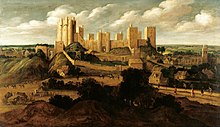
Already around 1070 the Norman nobleman Ilbert de Lacy had Pontefract Castle built. It was considered one of the strongest fortifications in all of England. In 1400 Richard II died in the castle; presumably he was murdered or died by suicide.
1090 was Pontefract Priory , a monastery of Cluny , founded by Robert de Lacy and dedicated to St. John the Evangelist. It was dissolved by royal orders in 1539 .
During the English Civil War , the castle, which Oliver Cromwell considered to be one of the strongest fortifications in England, suffered three sieges. During this time Pontefract became impoverished and lost residents. When the parliamentarians finally took Pontefract Castle in 1649, the citizens of the city, fearing further fighting, asked the conquerors to destroy the castle, which was complied with in the same year. Today only ruins remain.
Culture and sights
The city is best known for its liquorice , which is sold as a regional specialty in the form of a slice with the city's coat of arms embossed as a Pontefract Cake , as well as the regular horse races .
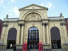
Pontefract has a covered market that is open every day except Sundays and Thursday afternoons. Pontefract Museum is located in an earlier Andrew Carnegie donated library. Under the Pontefract General Hospital there is a former hermitage that can be visited on certain days. The town hall was built in 1745. In place of the All Saints Church, which was damaged in the English Civil War, a new one was built within the old church walls.
In Pontefract there are two secondary schools, Carleton Community High School and The King's School, and NEW (North East Wakefield) College Pontefract, a college for obtaining advanced level qualifications.
Economy and Transport
Although liquorice is no longer grown in Pontefract , there are still two companies that process it. These belong to Haribo and Monkhill Confectionery (part of the Cadbury Group).
There is a large coal- fired power station in nearby Ferrybridge . However, coal mining in the region ceased for the most part in the 1990s.
Pontefract has three train stations:
- Pontefract Monkhill on the Pontefract Line to Castleford , Knottingley and Goole as well as Wakefield , long-distance trains between Bradford and London King's Cross also stop here
- Pontefract Tanshelf on the Pontefract Line to Wakefield (route reopened in 1992, only in operation on weekdays)
- Pontefract Baghill on the Dearne Valley Line between York and Sheffield
To the north-west and east of the city there are access roads to the M62 motorway , and to the south-east there is a connection to the A1 (M) road , which is expanded to the north of the motorway. The A639 road, which runs approximately from south to north, from the A1 to Castleford, follows the course of a Roman road , it is crossed in Pontefract by the A645 road, which is part of a connection between Wakefield and Goole .
There is regular bus service to most of the area , including Barnsley , Doncaster , Leeds, Selby and Wakefield. The responsible transport company is West Yorkshire Metro .
Personalities
- Darren Appleton (born 1978), pool player
- Charles Coleman (1807–1874), painter
- Jane Collins (* 1962), politician
- Toby Kebbell (born 1982), actor
Individual evidence
- ↑ Office for National Statistics: Census 2001: Urban Areas: Table KS01: Usual Resident Population Read on August 26, 2009
- ↑ Eric Houlder: Ancient Roots North: When Pontefract Stood on the Great North Road. (Pontefract: Pontefract Groups Together, 2012) p. 7.
- ^ Frank Barlow: William I and the Norman Conquest. The English Universities Press, London 1965, p. 95. David Crouch: The Normans: The History of a Dynasty. Hambledon and London, London 2002 p. 105.
- ^ Yorkshire's Castles: Pontefract Castle. ; H2G2.com, Not Panicking Ltd.
- ^ A b Lorenzo Padgett: Chronicles of Old Pontefract. 1905. Facsimile: Old Hall Press, Leeds 1993.
- ^ National Rail
- ↑ Metro. Transport for West Yorkshire ( Memento of the original from July 22, 2015 in the Internet Archive ) Info: The archive link was automatically inserted and has not yet been checked. Please check the original and archive link according to the instructions and then remove this notice.
Web links
- The City website (English)


