
Trieste Province
| Trieste Province | |
|---|---|

|
  |
| State : | Italy |
| Region : | Friuli Venezia Giulia |
| Area : | 211.82 km² ( 106. ) |
| Residents : | 233,276 (Dec. 31, 2019) |
| Population density : | 1,101 inhabitants / km² |
| Number of municipalities: | 6th |
| License plate : | TS |
| ISO-3166-2 identification : | IT-TS |
 |
|
Coordinates: 45 ° 38 ' N , 13 ° 48' E
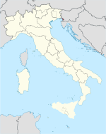
The province of Trieste (Italian Provincia di Trieste , Slovenian Tržaška pokrajina ) was one of the four provinces of the Italian region Friuli-Venezia Giulia until September 30, 2017 . It had an area of about 212 km² and 234,638 inhabitants (as of December 31, 2017). The main town was the city of Trieste .
As in the case of the other three provinces of Friuli-Venezia Giulia ( Gorizia , Pordenone and Udine ), which have also been abolished as independent institutions, this former province also continues to exist as an administrative district of decentralized state administrations or as a statistical area.
Italian and Slovenian were the official languages .
geography
The province of Trieste was the smallest Italian province with an area of 212 km². It comprised a narrow coastal strip 41 km long and about 5 to 10 km wide between the border with Slovenia in the east and the Gulf of Trieste , part of the Adriatic Sea , in the south-west. In the northwest it bordered the province of Gorizia .
In the north of the former province is the Karst (Italian: Carso ), a hilly landscape that is interspersed with many caves. The best known is the Grotta Gigante ("giant cave").
Between the hills and the sea running state road 14 , the A4 motorway Turin -Trieste and a railway line.
Between Trieste and Muggia is the Bay of Muggia.

There are ports in the former province of Trieste in Aquilinia (near Muggia), Grignano (near the Miramare Castle ) and in Sistiana (near Duino ).
history
Since the beginning of the Habsburg rule in the 13th century, the area of today's province of Trieste was divided between the princes of Duino (with the current municipalities of Duino-Aurisina , Sgonico and Monrupino ), Trieste, San Dorligo and Muggia.
In 1809 the area was occupied by the Napoleonic troops. A large part of today's province was administered from Trieste, but San Dorligo from Postojna (Adelsberg).
After the end of Napoleon's rule, the municipalities of Duino-Aurisina, Sgonico and Monrupino were attached to the county of Gorizia , while the city of Trieste received an independent status within the Austrian monarchy . San Dorligo and Muggia became part of Istria .
With the Rapallo border treaty of November 1920, the entire province of Trieste and parts of Istria became part of Italy.
From 1947, today's province of Trieste formed Zone A of the neutral Free Territory of Trieste . By the London Memorandum of October 5, 1954, the province of Trieste became part of Italy again and received its later borders. With the signing of the Italo- Yugoslav Treaty of Osimo on November 10, 1975, this was finally recognized.
Communities and population
The province of Trieste had a population density of 1,120 inhabitants per km². Most of the population lived in the city of Trieste . It comprised six parishes.
| local community | German / Slovenian name | Residents (December 31, 2011) |
|---|---|---|
| Trieste | Trieste / Trst | 205.194 |
| Muggia | Mugls / Milje | 13,410 |
| Duino-Aurisina | Tybein-Naberschin / Devin-Nabrežina | 8,721 |
| San Dorligo della Valle | Ortisei / Dolina | 5,920 |
| Sgonico | Sgonegg / Zgonik | 2,098 |
| Monrupino | Reppenberg / Repentabor | 886 |
Local transport
The regular service in the province of Trieste was operated by Trieste Trasporti .
Web links
Individual evidence
- ↑ Statistiche demografiche ISTAT. Monthly population statistics of the Istituto Nazionale di Statistica , as of December 31 of 2019.
- ↑ Consiglio regional del Friuli Venezia Giulia: Soppressione delle Province del Friuli Venezia Giulia , accessed on July 7, 2019