
Räuchlisberg
| Räuchlisberg | |||
|---|---|---|---|
 |
|||
| Country: |
|
||
| Cantons : | Thurgau (TG) | ||
| Districts : | Arbon | ||
| Political community : | Amriswil | ||
| Postal code : | 8580 | ||
| former BFS no. : | 4464 | ||
| Coordinates : | 739521 / 266866 | ||
| Height : | 501 m above sea level M. | ||
| Area : | 5.06 km² | ||
| Residents: | 66 (December 31, 2018) | ||
.jpg) Räuchlisberg |
|||
| map | |||
|
|||

Räuchlisberg is a settlement of the political municipality Amriswil in the district of Arbon in the canton of Thurgau in Switzerland .
The local community of Räuchlisberg, formed in 1803, belonged to the municipality of Amriswil in the then Bischofszell district until 1978 . On January 1, 1979 , the local community Räuchlisberg merged to form the unitary community Amriswil .
geography
The still rural part of the community with the villages of Hagenwil bei Amriswil and Räuchlisberg and the hamlets of Bergermühle, Giezenhaus and Spitzenrüüti is located on a hill southwest of Amriswil.
history

The settlement was first mentioned in 1413 as Roüchlisberg . Since the Middle Ages, Hagenwil and Räuchlisberg formed a judicial fiefdom of the St. Gallen Abbey , which also had the right to team and pay homage . 1684-1798 the abbey to manage and who practiced Thurgauische Landvogt the high jurisdiction of.
Räuchlisberg probably always shared the fate of the Sommeri parish . In 1871 the Catholics were assigned to the parish of Hagenwil.
| year | 1850 | 1900 | 1950 | 1970 |
| Residents | 424 | 414 | 415 | 451 |
In Hudelmoos owned corporations 70 Jucharten peat , called Turbenland. Fruit, meadow and arable farming as well as forestry dominated, cattle and dairy farming were added at the end of the 19th century. The mill mentioned in 1593 ceased operations in 1911. From 1885 to 1898 Jakob and Johann Laib produced jerseys in a factory in Räuchlisberg .
→ see also section history in the article Hagenwil bei Amriswil
photos


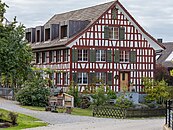
Räuchlisberg 6 / a

Räuchlisberg schoolhouse
.jpg)
.jpg)

.jpg)
Attractions
→ see section Sights in the article Hagenwil bei Amriswil
literature
- Erich Trösch: Räuchlisberg. In: Historical Lexicon of Switzerland .
This article is largely based on the entry in the Historisches Lexikon der Schweiz (HLS), which, according to the HLS's usage information, is licensed under the Creative Commons - Attribution - Distribution under the same conditions 4.0 International (CC BY-SA 4.0) license .
Individual evidence
- ↑ Swiss land use statistics. Completed on July 1, 1912. Published by the Federal Statistical Bureau. ( Memento from April 12, 2016 in the Internet Archive )
- ↑ List of settlements. Canton of Thurgau, edition 2019 . On the website of the Statistical Office of the Canton of Thurgau (Excel table; 0.2 MB), accessed on May 10, 2020.
Amriswil | Arbon | Dozwil | Egnach | Yeast oven | Horn | Kesswil | Roggwil | Romanshorn | Salmsach | Sommeri | Uttwil
Former municipalities: Biessenhofen | Frasnacht | Hemmerswil | Mühlebach | Niederaach | Lower summer | Oberaach | Upper summer | Räuchlisberg | Schocherswil
Canton of Thurgau | Districts of the Canton of Thurgau | Municipalities of the Canton of Thurgau