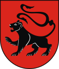
Radłów
| Radłów | ||
|---|---|---|

|
|
|
| Basic data | ||
| State : | Poland | |
| Voivodeship : | Lesser Poland | |
| Powiat : | Tarnów | |
| Gmina : | Radłów | |
| Area : | 16.17 km² | |
| Geographic location : | 50 ° 5 ' N , 20 ° 51' E | |
| Residents : | 2771 (December 31, 2016) | |
| Postal code : | 33-130 | |
| Telephone code : | (+48) 14 | |
| License plate : | KTA | |
| Economy and Transport | ||
| Street : | DW975 Biskupice Radłowskie - Wojnicz | |
| Next international airport : | Krakow-Balice | |
Radłów [ˈradwuf] is a city in Poland in the Lesser Poland Voivodeship . It is the seat of the town-and-country municipality of the same name in the Powiat Tarnowski .
history
The first written mention of today's Radłów comes from the year 1080 when the parish was mentioned. The second written mention comes from 1236 when the Kraków bishop Wisław visited the place. When the Mongols invaded in 1241, the church was burned down and residents fled their homes. It is not known whether the place was subsequently desolate or was inhabited. Evidence of the existence of Radłów is only available again from the 14th century. A new church was built in 1337. During the Second Northern War from 1655 to 1660 there was fighting in the Radłów area and parts of the village burned down. During the first partition of Poland in 1772, the place became part of Austria . After the First World War , the village became part of the re-established Poland . At the beginning of the Second World War , the German Wehrmacht occupied on 7/8. September 1939 the area. At the end of the war, the area was taken by the Red Army . The place became part of the People's Republic of Poland . On January 1, 2010, the village of Radłów was named a town.
Culture and sights
The oldest preserved building in the village is the church, the history of which goes back to 1337. The current shape, however, comes from the renovation in the years 1643–1645. During the First World War, the church was destroyed and then rebuilt and a bell tower was added.
Another building worth seeing is the palace, which was built in its current form in 1830.
local community
The urban and rural community ( gmina miejsko-wieska ) Radłów has an area of 86.02 km², on which about 10,000 people live. The municipality includes the school authorities Biskupice Radłowskie, Brzeźnica, Glów, Łęka Siedlecka, Marcinkowice, Niwka, Przybysławice, Sanoka, Siedlec, Wał-Ruda, Wola Radłowska, Zabawa and Zdrochec.
Economy and Infrastructure
The Voivodship Road 975 ( droga wojewódzka 975 ) runs through the city . In the north it ends after four kilometers in Biskupice Radłowskie. In a southerly direction it leads after 14 kilometers through Wojnicz and crosses the state road 4 ( droga krajowa 4 ), which also forms the European route 40 .
The nearest international airport is John Paul II Airport, Krakow-Balice, 75 kilometers to the west .
Personalities
sons and daughters of the town
- Richard Buchta (1845–1894), Austrian explorer of Africa
- Andrzej Seremet (* 1959), Prosecutor General of Poland from March 31, 2010
Honorary citizen of Radłów
- Józef Kowalczyk (* 1938), Polish clergyman, former diplomat of the Holy See, retired Archbishop of Gniezno, retired Primate of Poland
- Franciszek Ziejka (1940–2020), professor of philology, rector of the Jagiellonian University
- Andrzej Seremet (* 1959), lawyer, attorney general
Other personalities associated with the city
- Rudolf Moroder (1877–1914), South Tyrolean sculptor, is buried here.
Web links
- City website (Polish, partly English)
Individual evidence
- ^ Website of the Radłów Municipality, Historia Radłowa , accessed on January 3, 2010
- ↑ Dziennik Ustaw 2009 No. 120 poz. 1000 Rozporządzenie Rady Ministrów from July 28, 2009 ( Online (PDF))
- ↑ Honorowi obywatele at gminaradlow.pl. Retrieved November 24, 2019.

