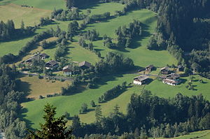
Rain (municipality of Virgen)
|
Virgen ( hamlet ) village of Niedermauern |
||
|---|---|---|
|
|
||
| Basic data | ||
| Pole. District , state | Lienz (LZ), Tyrol | |
| Pole. local community | Virgen | |
| Coordinates | 46 ° 59 '55 " N , 12 ° 25' 24" E | |
| height | 1158 m above sea level A. | |
| Residents of the village | 214 (January 1, 2020) | |
| Post Code | 9972 | |
| Statistical identification | ||
| Locality code | 16886 | |
| Counting district / district | Niedermauern-Welzelach (70734 001) | |
 The hamlet of Rain seen from Budam |
||
| Source: STAT : index of places ; BEV : GEONAM ; TIRIS | ||
Rain is a hamlet in the municipality of Virgen ( East Tyrol ). The district was inhabited by 17 people in 1991 and is part of the Niedermauern fraction .
geography
Along with the Rotte Niedermauern and the Rotte Gries, Rain is one of the three local parts of Niedermauern. Rain is located to the right of the mouth of the Mullitzbach in the Isel at an altitude of around 1,150 meters. The hamlet is connected to the Rotte Gries in the northeast, which also belongs to the Niedermauern fraction, by a road that leads from Niedermauern via Gries and Rain to the Welzelach fraction . In 1991, Rain housed a total of five houses with three agricultural and forestry facilities, with four apartments in the five houses. The state of Tyrol currently records the farms Oberrainer (Niedermauern-Rain 1), Mühlinger (Niedermauern-Rain 2), Uler (Niedermauern-Rain 8) and Innerrainer (Niedermauern-Rain 11) as well as another building (Niedermauern-Rain 10) for Rain. .
history
For a long time, Statistics Austria did not specifically name Rain, but included it in the case of Niedermauern. Rain was only shown separately in the course of the 1951 census, whereby the part of the village was classified as a single layer , which consisted of two houses with nine residents and two alpine huts. In 1961, three houses with twelve residents were identified by the statisticians for Rain. At that time, Rain was already considered a hamlet. In 1971 there were four buildings and eleven residents in Rain, in 1981 there were also four buildings, with three inhabited buildings with a total of 17 residents being reported. In 1991, Statistics Austria reported four out of five buildings for Rain as inhabited. That year 17 people were counted in the hamlet.
Buildings
With the Einhof Rainer-Ueler and two farm buildings in the same direction as the ridge, Rain is home to an ensemble of art-historical significance. The building of the yard has been documented since 1780. It is at the farm to a free pin of the Holy Spirit Hospital in Lienz. The vulgar name "Ueler am Rain" has been documented since 1818. The single courtyard of the ensemble was built in the 19th century over an older core as a diagonally divided building with a clapboard purlin roof. The living area in the northern part of the building was designed as an eaves side floor plan, the basement and ground floor of which were bricked. A square block building was erected above it. There is a gable wall on the north facade. The farm wing has a stable on the eaves side and a slope-side entrance to the barn; the utility wing was designed in a combined timber construction.
There are two farm buildings in the immediate vicinity, but they do not belong to the Ueler-Hof. On the one hand, it is a two-storey building with a knee-high floor and a block purlin roof from the 17th century, which was used as a stable and threshing floor and was built from a combined timber construction over a rubble foundation. The building also has a stage with drying rods on the north facade. On the other hand, there is a two-storey farm building, which was built in a combined timber construction over rubble foundations. It has a knee-high and block purlin roof and probably also dates from the 17th century. The ground-level stable and the threshing floor on the upper floor were accessed from the eaves.
Individual evidence
- ↑ a b c Austrian Central Statistical Office (ed.): Ortverzeichnis 1991. Tirol. Vienna 1993, p. 242
- ^ Austrian Central Statistical Office (Hrsg.): Ortverzeichnis von Österreich. Edited on the basis of the results of the census of June 1, 1951. Vienna 1953, p. 203 Tir.
- ^ Austrian Central Statistical Office (Hrsg.): Ortverzeichnis von Österreich. edited on the basis of the results of the census of March 21, 1961 according to the territorial status of January 1, 1964. Vienna 1965, ST 300
- ^ Austrian Central Statistical Office (ed.): Ortverzeichnis 1971. Tirol. Edited on the basis of the results of the census of May 12, 1971. Vienna 1974, p. 70
- ^ Austrian Central Statistical Office (Hrsg.): Ortsverzeichnis 1981. Tirol. Vienna 1984, p. 125
literature
- Bundesdenkmalamt (Ed.): The art monuments of the political district of Lienz. Part III. Iseltal, Defereggental, Kalsertal, Virgental. Verlag Berger, Horn 2007 ISBN 978-3-85028-448-6 (Austrian Art Topography, Volume LVII)

