Riedholz SO
| SO is the abbreviation for the canton of Solothurn in Switzerland and is used to avoid confusion with other entries of the name Riedholz . |
| Riedholz | |
|---|---|
| State : |
|
| Canton : |
|
| District : | Livers |
| BFS no. : | 2554 |
| Postal code : | 4523 Niederwil 4533 Riedholz |
| UN / LOCODE : | CH RIE |
| Coordinates : | 609 803 / 231047 |
| Height : | 471 m above sea level M. |
| Height range : | 417–624 m above sea level M. |
| Area : | 7.15 km² |
| Residents: | 2310 (December 31, 2018) |
| Population density : | 323 inhabitants per km² |
| Website: | www.riedholz.ch |
| Location of the municipality | |
Riedholz (in the local dialect Riedhouz ) is a municipality in the Lebern district in the canton of Solothurn in Switzerland .
On January 1, 2011 Niederwil merged with Riedholz.
geography
Riedholz lies at 471 m above sea level. M. , 4 km northeast of the canton capital Solothurn (air line). The village extends on the terrace of a moraine deposited by the Ice Age Rhone glacier north of the Aare , in the Unterleberberg region , in the Solothurn Mittelland at the southern foot of the Jura .
The area of the 4.9 km² municipal area includes a section at the southern foot of the Jura . The southern border runs along the Aare, which flows here on the northern edge of a wide valley. From the Aare, the municipality extends northward to the forest-covered moraine range ( Brästenberg , 481 m above sea level , and Attisholzwald , 474 m above sea level ), which is divided by the valley of the Attisholzer Bach. To the north of this forest area, the terrace of Riedholz and the wooded ridge of the Verena chain connect, one of the small anticlines in front of the Weissenstein chain . At 604 m above sea level M. the highest point of Riedholz is reached on this chain. In 1997, 18% of the municipal area was in settlements, 40% in forests and woodlands, 38% in agriculture and a little more than 4% was unproductive land.
Riedholz includes the Attisholz industrial estate ( 427 m above sea level ) on the left bank of the Aare, the Weieren districts ( 469 m above sea level ) on the terrace of Riedholz, Hofmatt ( 512 m above sea level ), Wallierhof ( 528 m above sea level) . M. ), Rüti ( 578 m above sea level ) and Viertel ( 513 m above sea level ) on the slope above the village and Hinterriedholz ( 498 m above sea level ) on the eastern edge of the Verena chain. These districts are growing together more and more due to the lively residential construction activity. Neighboring communities of Riedholz are Feldbrunnen-Sankt Niklaus , Rüttenen , Balm bei Günsberg , Günsberg Hubersdorf , Flumenthal , Deitingen , Luterbach and Zuchwil .
population
With 2310 inhabitants (as of December 31, 2018), Riedholz is one of the medium-sized communities in the canton of Solothurn. 95.8% of the residents speak German, 0.8% speak Italian and 0.7% speak Albanian (as of 2000). The population of Riedholz was 400 inhabitants in 1850 and 541 in 1900. In the course of the 20th century, the population rose continuously to 1459 people until 1970. Since then, only relatively minor population fluctuations have been recorded.
economy
For a long time, Riedholz was predominantly an agricultural village. Riedholz experienced a significant development boost after the cellulose factory was founded in Attisholz in 1881.
Today arable and fruit growing as well as cattle breeding only play a minor role in the income structure of the population. Numerous other jobs are available in local small businesses and in the service sector. Information technology, mechanical engineering and precision engineering workshops are also represented in the community. Riedholz is the location of the Wallierhof Education Center, an agricultural and home economics school with a conference center. In the last few decades the village has developed into a rural suburb of Solothurn.
Thanks to the cellulose plant, Riedholz had more commuters than out-commuters. However, the former Attisholz cellulose factory was closed at the end of 2008 by its last owner Borregaard , a subsidiary of the Norwegian conglomerate Orkla .
traffic
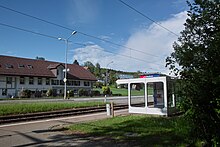
The community has good transport connections. It is only a little off the main road 5 from Solothurn to Olten . The closest connection to the A5 motorway (Solothurn-Biel) is around 6 km from the village. On January 9, 1918, the Solothurn-Niederbipp-Bahn railway line with the Riedholz, Bei den Weihern and Hinteres Riedholz stops was put into operation, although the Hinteres Riedholz station is no longer used today. Riedholz is also connected to the public transport network through the Postbus course , which covers the route from Solothurn to Balm bei Günsberg and up to the Balmberg .
history
The municipality of Riedholz was inhabited very early, which has been proven by finds of numerous ceramic objects from the Roman era near Attisholz. The first documentary mention of the place took place in 1367 under the name Rietholtz ; from 1494 the name Riedtholtz has been handed down. The name means something like the reed-covered forest .
In the Middle Ages, Riedholz was subordinate to the Sankt-Ursen-Stift in Solothurn and in 1344 came directly to the city of Solothurn, which from then on exercised both lower and higher jurisdiction. The village was later incorporated into the Flumenthal Vogtei. After the collapse of the Ancien Régime (1798), Riedholz belonged to the Solothurn administrative district during the Helvetic and from 1803 to the Lebern district. Bad Attisholz, which has been in operation since the 15th century, was particularly popular in the 18th and 19th centuries and well known beyond the region.
Attractions
coat of arms
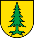
- Yellow-green uprooted fir
Personalities
- Walther von Wartburg - linguist (1888–1971)
Web links
- Official website of the municipality of Riedholz
- Max Banholzer: Attish wood. In: Historical Lexicon of Switzerland .
- Thomas Franz Schneider: Riedholz. In: Historical Lexicon of Switzerland .
Individual evidence
- ↑ Permanent and non-permanent resident population by year, canton, district, municipality, population type and gender (permanent resident population). In: bfs. admin.ch . Federal Statistical Office (FSO), August 31, 2019, accessed on December 22, 2019 .
- ^ Franz Schaible: Return to the origin - Borregaard is called Attisholz again . In: Solothurner Zeitung . January 4, 2012. Retrieved May 6, 2012.


