
Luterbach
| Luterbach | |
|---|---|
 |
|
| State : |
|
| Canton : |
|
| District : | Water authority |
| BFS no. : | 2527 |
| Postal code : | 4542 |
| Coordinates : | 611 172 / 229876 |
| Height : | 431 m above sea level M. |
| Height range : | 423–441 m above sea level M. |
| Area : | 4.52 km² |
| Residents: | 3480 (December 31, 2018) |
| Population density : | 770 inhabitants per km² |
| Website: | www.luterbach.ch |
 Saint Joseph Church |
|
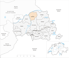
| Location of the municipality | |
  |
|
Luterbach (in the local dialect Lutrbach ) is a municipality in the Wasseramt district of the canton of Solothurn in Switzerland .
geography

Luterbach is 431 m above sea level. M. , 3.5 km east of the canton capital Solothurn (linear distance). The village extends on the gravel plain east of the Emme , in front of the southern foot of the Jura , in the Solothurn Mittelland .
The area of the 4.5 km² municipal area comprises a section of the groundwater-rich gravel plain in the inner water authority. The Aare forms the natural municipality boundary in the north, the Emme borders Luterbach in the area of the so-called Emmenspitz from Zuchwil to the west. In the past, large parts of the Luterbach plain were often flooded during floods, which is why the original village was built around 1 km from the rivers. To the east, the municipality extends over the plain with the canalized creek beds of the Dorfbach and the Rüttibach into the thorn forest and into the Affolterwald , which form a forest belt in the flood plain. The highest elevation of Luterbach reaches the municipality with 436 m above sea level. M. on the southern edge. In 1997, 32% of the municipal area was in settlements, 25% in forests and woodlands, 39% in agriculture and around 4% was unproductive land.
The Vorholz settlement ( 431 m above sea level ) on the Rüttibach on the western edge of the forest belt belongs to Luterbach . The neighboring communities of Luterbach are Deitingen , Derendingen , Zuchwil and Riedholz .
history
The first written mention of the place took place in 1052 under the name lutere Bach ; The current name has been handed down from 1287. The place name goes back to a water body name and means clear or light stream .
Since the Middle Ages, Luterbach has been under the control of St. Ursenstift in Solothurn. In 1356 it came under the direct administration of the city of Solothurn. From 1466 it belonged to the Vogtei Kriegstetten and was assigned to the court of Zuchwil. The high level of jurisdiction was initially incumbent on the Counts of Kyburg and Buchegg, fell to Bern in 1406 and also to Solothurn in 1516. After the collapse of the Ancien Régime in 1798, Luterbach belonged to the Biberist district during the Helvetic Republic and from 1803 to the Kriegstetten district, which was officially renamed the Wasseramt district in 1988.
The Luterbach hydropower plant existed on the aare from 1900 to 1968. There used to be a hammer forge on the Emme. In 1872 the worsted spinning mill Schoeller & Lang was founded on the border with Derendingen , which was soon supplemented by a worsted yarn weaving mill. The proximity of this factory in Luterbach led to a marked increase in population from 396 inhabitants (1870) to 1050 inhabitants (1900).
population
With 3480 inhabitants (as of December 31, 2018), Luterbach is one of the medium-sized communities in the canton of Solothurn. 90.6% of the residents speak German, 2.9% speak Italian and 1.9% speak Serbo-Croatian (as of 2000). The population of Luterbach was 447 inhabitants in 1850, and 1050 in 1900. In the course of the 20th century the population continued to grow.
politics

The number of seats in the Luterbach municipal council has been gradually reduced over the last few decades. There were 16 seats left in 1997, eleven in 2001 and only 9 in 2009.
The Free List Luterbach party, founded in 1997, was able to win three seats on the municipal council in its first term of office 1997–2001. Two terms later (2005-2009) she managed to rise to the strongest party in Luterbach with four seats, while her party founder Hugo Schumacher was elected mayor at the same time. After the party already lost half of its seats in the following term of office 2009-2013, and Hugo Schumacher decided to switch to SVP and could not find a successor, the dissolution of the party was announced in 2012.
Since there were no more candidates than seats for the 2013-2017 term of office, there was a silent election .
| Political party | 2013-2016 | (+/-) | 2009-2017 | (+/-) | 2005-2009 |
| Christian Democratic People's Party | 4th | 2 | |||
| Social Democratic Party | 2 | 3 | |||
|
FDP. The Liberals ( Free Democratic Party until 2009 ) |
1 | 2 | |||
| Swiss People's Party | 1 | - | |||
| Bourgeois Democratic Party | 1 | - | |||
| Free list Luterbach | - | 4th |
economy
Until the beginning of the 20th century, Luterbach was a village dominated by agriculture . The water power of the village stream was previously used to operate a mill. Today arable and fruit growing as well as cattle breeding have only a marginal role in the employment structure of the population.
Numerous other jobs are available in local small businesses and in the service sector. Various companies have settled in Luterbach since the 1960s thanks to the good traffic situation. Commercial and industrial zones are located near the train station north of the village. Today, businesses in the electrical and electronics industries ( Schaffner Holding ), construction and transport, information technology, horticulture, precision mechanics, a sawmill and other mechanical workshops are represented in the community.
The Attisholz cellulose factory on both sides of the Aare (based in Riedholz on the northern bank of the Aare) was also characteristic of the village for decades . The factory had a large timber warehouse in Luterbach between the train station and the Aare . The last owner of the company, the Norwegian group Borregaard , closed the factory with 440 jobs in January 2009.
In the last few decades the village has developed into a residential community on the edge of the Solothurn agglomeration. Many workers are commuters who mainly work in the Solothurn region.
traffic
The community is well developed in terms of traffic, although the village itself is located off the main thoroughfares on a road connecting Solothurn to Deitingen . Nearby lie feeder road of the A1 motorway in Wangen an der Aare , Kriegstetten , and the access Solothurn-east of the A5 motorway . Southeast of the village is the Luterbach junction , where the A5 (Biel-Solothurn) joins the A1.
Luterbach has a train station (Luterbach-Attisholz) on the Gäubahn, which opened in 1876, between Olten and Solothurn. The BSU bus line has been set up for regional public transport, serving the route from Solothurn to Luterbach with four bus stops on the municipal floor.
A section of the national cycle route 5 ( Mittelland route ) for cyclists runs through Luterbach .
Attractions

- The Catholic Church of St. Joseph was built in 1786 and redesigned several times during the 20th century.
- The Reformed Church dates from 1966.
- The water clock at the parish hall is a landmark of the village.
- Synthorama, a museum for electronic musical instruments (synthesizers).
- The Emme Canal industrial trail leads to numerous industrial plants from the 19th and the beginning of the 20th century.
coat of arms
- In white, blue wavy bars, overlaid by a blue five-pointed star
Personalities
- Hansjörg Flückiger (* 1938), painter
- Walter Kämper (1914–1998), lawyer, federal judge
- Peter Ochsenbein (1940–2003), Abbey Librarian in St. Gallen
- Rolf Ritschard (1944–2007), politician, councilor
- Willi Ritschard (1918–1983), politician, Federal Councilor
Web links
- Official website of the municipality of Luterbach
- Website of the community of Luterbach
- Urs Zurschmiede: Luterbach. In: Historical Lexicon of Switzerland .
Individual evidence
- ↑ Permanent and non-permanent resident population by year, canton, district, municipality, population type and gender (permanent resident population). In: bfs. admin.ch . Federal Statistical Office (FSO), August 31, 2019, accessed on December 22, 2019 .
- ^ A b Solothurner Zeitung : After 16 years the Free List disappears from the scene
- ↑ Minutes of the Luterbach residents' community assembly: Partial revision of the municipal regulations (Thursday, June 3, 2009, page 2; PDF; 289 kB)
- ↑ a b Luterbach community: elections 2013 (PDF; 145 kB)
- ↑ Solothurner Tagblatt : Municipal elections ( Memento of the original from May 14, 2015 in the Internet Archive ) Info: The archive link was inserted automatically and has not yet been checked. Please check the original and archive link according to the instructions and then remove this notice. (Edition of Monday, April 25, 2005, page 26; PDF; 381 kB)
- ↑ Stefan Blank: The Emme Canal industrial trail in the Solothurn water authority. (Swiss Art Guide, Volume 715, Series 72). Ed. Society for Swiss Art History GSK. Bern 2002, ISBN 3-85782-715-7 .
Aeschi |
Beaverist |
Bolken |
Deitingen |
Derendingen |
Three courtyards |
Etziken |
Gerlafingen |
Hold |
Horriwil |
Hüniken |
Kriegstetten |
Lohn-Ammannsegg |
Luterbach |
Obergerlafingen |
Oekingen |
Recherswil |
Subingen |
Zuchwil
Former communities: Ammannsegg | Burgäschi | Heinrichswil | Heinrichswil-Winistorf | Hersiwil | Wages | Steinhof | Winistorf
Canton of Solothurn | Districts of the Canton of Solothurn | Municipalities of the Canton of Solothurn