
Recherswil
| Recherswil | |
|---|---|
 |
|
| State : |
|
| Canton : |
|
| District : | Water authority |
| BFS no. : | 2530 |
| Postal code : | 4565 |
| Coordinates : | 611 816 / 223670 |
| Height : | 458 m above sea level M. |
| Height range : | 454–474 m above sea level M. |
| Area : | 3.36 km² |
| Residents: | 2009 (December 31, 2018) |
| Population density : | 598 inhabitants per km² |
| Website: | www.recherswil.ch |
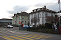
 Town center |
|
| Location of the municipality | |
  |
|
Recherswil (in the local dialect Recherswiu ) is a municipality in the Wasseramt district of the canton of Solothurn in Switzerland .
geography

Recherswil lies at 458 m above sea level. M. , 7 km southeast of the canton capital Solothurn (straight line), in the plain between the Emme in the west and the Ösch in the east, in the southern Solothurn Mittelland .
The 3.4 km² large community area extends from the groundwater-rich gravel plain in the central water office to the east over the canalized stream of the Ösch to the adjacent ground moraine landscape , which was formed by the Ice Age Rhone glacier . In the Jäggenenwald is at 475 m above sea level. M. the highest elevation. In the south the undergrowth belongs to the municipality , in the northwest next to the A1 motorway the meadowland of the Gerkmatten . In 1997, 20% of the municipal area was settlements, 24% forest and wood and 56% agricultural area. Extensive new building quarters belong to Recherswil.
The village borders the Solothurn municipalities of Obergerlafingen , Kriegstetten , Halt and Drei Höfe . The southern municipal boundary corresponds to the border between the canton of Solothurn and the canton of Bern with the municipalities of Koppigen and Willadingen .
population
With 2009 inhabitants (as of December 31, 2018) Recherswil is one of the medium-sized communities in the canton of Solothurn. 95.7% of the residents speak German, 2.1% speak Italian and 0.6% speak Serbo-Croatian (as of 2000). The population of Recherswil was 404 in 1850 and 864 in 1900. During the first half of the 20th century, the population fluctuated between 800 and 900 people. Since 1950 (989 inhabitants) there has been a significant increase in population.
economy
Until the second half of the 20th century, Recherswil was a village dominated by agriculture . Even today, arable farming and fruit growing as well as cattle breeding have an important place in the income structure of the population. Further jobs are available in local small businesses and in the service sector. Thanks to the good traffic situation, various small and medium-sized companies in the construction and transport industry, IT, mechanical engineering, telecommunications, precision engineering workshops and a printing company are represented in Recherswil. In the last few decades the village has also developed into a residential community. Many employed people are therefore commuters who work mainly in the Solothurn and Bern regions.
traffic
The community is very well developed in terms of transport. It is located on a connecting road from Kriegstetten to Koppigen . The next connection to the A1 motorway (Bern-Zurich), which crosses the municipality and was opened in 1965, is around 2 km from the town center near Kriegstetten. By the bus line 1 of the BSU which as a diameter line Solothurn the region of the connection between Recherswil via SBB central station Solothurn to Oberdorf (SO) operated, the village is connected to the network of public transport.
history
The first written mention of the place with the name Reicherswile comes from the year 1248. Later the names Richirswile (1278), Richerswile (1324), Richerzwile (1367) and Richardswil (1376) can be found; The name Recherswil has only been passed down since the 17th century . The place name goes back to the Old High German personal name Richher and means at the courts of Richher .
Recherswil has been under the rule of Halt since the Middle Ages . With this it came to the city of Solothurn in 1466 and was assigned to the Vogtei Kriegstetten. It was not until the Wyniger Treaty in 1665 that the high level of jurisdiction was transferred from Bern to Solothurn. After the collapse of the Ancien Régime (1798), Recherswil belonged to the Biberist district during the Helvetic Republic and from 1803 to the Kriegstetten district, which was officially renamed the Wasseramt district in 1988.
As a result of industrialization in the nearby communities of Gerlafingen and Biberist , more and more farmers gave up agriculture from around 1880 and began to work in the region's factories.
In 1919, the project for a narrow-gauge railway from Solothurn to Recherswil was ready for construction and had received a concession from the federal government. Due to the poor financial situation, however, the construction of the line was never started, which became obsolete in 1930 with the opening of a bus line to Solothurn.
Attractions
- The St. Joseph's Chapel was built in 1724 and rebuilt in 1870. Recherswil belongs to the parish of Kriegstetten.
- In the forest of Recherswil is located on the Luterbrunnen-Ösch a Kneipp place 612612 / 222650 .
- The hall roof of the former Kilcher company, a so-called Isler shell .
photos

Entrance to the village coming from Willadingen

Kneipp area on the Ösch

Concrete shell roof from Isler

Half-timbered house in the village center
school

Village center

Dorfbach
_345.JPG)


_347.JPG)
_354.JPG)
_349.JPG)
_359.JPG)
coat of arms
- Ploughshare standing upright in red from below; above two yellow six-pointed stars
Web links
- Official website of the municipality of Recherswil
- Stefan Frech: Recherswil. In: Historical Lexicon of Switzerland .
Individual evidence
- ↑ Permanent and non-permanent resident population by year, canton, district, municipality, population type and gender (permanent resident population). In: bfs. admin.ch . Federal Statistical Office (FSO), August 31, 2019, accessed on December 22, 2019 .
- ^ Andres Kristol : Lexicon of Swiss community names . Huber, Frauenfeld and Payot, Lausanne 2005, p.729.
Aeschi |
Beaverist |
Bolken |
Deitingen |
Derendingen |
Three courtyards |
Etziken |
Gerlafingen |
Hold |
Horriwil |
Hüniken |
Kriegstetten |
Lohn-Ammannsegg |
Luterbach |
Obergerlafingen |
Oekingen |
Recherswil |
Subingen |
Zuchwil
Former communities: Ammannsegg | Burgäschi | Heinrichswil | Heinrichswil-Winistorf | Hersiwil | Wages | Steinhof | Winistorf
Canton of Solothurn | Districts of the Canton of Solothurn | Municipalities of the Canton of Solothurn