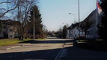
Oekingen
| Oekingen | |
|---|---|
| State : |
|
| Canton : |
|
| District : | Water authority |
| BFS no. : | 2529 |
| Postal code : | 4566 |
| Coordinates : | 612549 / 225 524 |
| Height : | 450 m above sea level M. |
| Height range : | 441–491 m above sea level M. |
| Area : | 2.39 km² |
| Residents: | 839 (December 31, 2018) |
| Population density : | 351 inhabitants per km² |
| Website: | www.oekingen.ch |
|
Oekingen |
|
| Location of the municipality | |
Oekingen ( Ökinge in the local dialect ) is a municipality in the Wasseramt district of the canton of Solothurn in Switzerland .
geography
Oekingen lies at 450 m above sea level. M. , 6 km east-southeast of the canton capital Solothurn (linear distance). The village extends along the Ösch , which was channeled from 1971 , on the eastern edge of the wide alluvial plain of the Emme , in the southern Solothurn Plateau .
The area of the 2.5 km² municipal area includes a section of the groundwater-rich gravel plain in the central water office. The municipality floor extends from the plain and the edge of the oak tree eastward over the course of the Ösch stream to the adjacent, slightly undulating ground moraine landscape , which was formed by the Ice Age Rhone glacier . The Höchi ( 480 m above sea level ) forms an open plateau, which merges to the east into the extensive forest area of the undergrowth . In the Buechwald lies at 490 m above sea level. M. the highest point in Oekingen. In 1997, 12% of the municipal area was accounted for by settlements, 24% for forests and woodlands and 64% for agriculture.
Some individual farms belong to Oekingen. Neighboring communities of Oekingen are Subingen , Horriwil , Drei Höfe , Halt , Kriegstetten and Derendingen .
population
With 839 inhabitants (as of December 31, 2018), Oekingen is one of the smaller communities in the canton of Solothurn. 97.4% of the residents speak German, 1.2% speak Portuguese and 0.6% speak French (as of 2000). The population of Oekingen was 273 in 1850 and 401 in 1900. In the course of the 20th century the population increased slowly but steadily. Since 1980 (530 inhabitants) there has been an increased population growth. Today the settlement area of Oekingen has grown together almost completely with that of Kriegstetten.
economy
Until the second half of the 20th century, Oekingen was predominantly an agricultural village. Even today, arable farming and fruit growing as well as cattle breeding have an important place in the income structure of the population. Other jobs are available in local small businesses and in the service sector, including in a computer science company and in mechanical workshops. In the last few decades the village has also developed into a residential community. Many employed people are therefore commuters who work mainly in the Solothurn and Bern regions.
traffic
The community has good transport links. It is located on a connecting road from Kriegstetten to Etziken . The closest connection to the A1 motorway (Bern-Zurich) is around 2 km from the town center. Oekingen itself is only connected to the public transport network by a BSU bus line (line 16) between Subingen and Kriegstetten or Steinhof , which runs two to three times a day from Monday to Friday and is primarily used for school traffic. However, the bus routes that serve Kriegstetten are easy to reach from Oekingen.
history
The municipality of Oekingen was settled early on, which was proven by the discovery of a shallow grave from the younger Iron Age . The origin of the village can be traced back to the time of the first Alemannic settlement around 600 AD. The place was first mentioned in a document in 1263 under the name Otechingen . Later, the names Othichingen (1264), Otkingen (1274), Oedkingen (1401), Oeigkingen (1450) and Oeckhingen (1730) appeared. The place name goes back to the Germanic personal name Oticho .
Since the Middle Ages, Oekingen has been under the rule of Halt, which in 1466 came to the city of Solothurn and was assigned to the Vogtei Kriegstetten. It was not until the Wyniger Treaty in 1665 that the high level of jurisdiction was transferred from Bern to Solothurn. After the collapse of the Ancien Régime (1798), Oekingen belonged to the Biberist district during the Helvetic Republic and from 1803 to the Kriegstetten district, which was officially renamed the Wasseramt district in 1988. Oekingen does not have its own church; it belongs to the parish of Kriegstetten.
school
The primary school Oekingen has since 17 August 2006, the neighboring communities hold and Kriegstetten together to Hoek. The upper school students attend the school in the new upper school center OZ13 in Subingen .
coat of arms
- In red over green plan, white horse fleeing to the right
literature
- Trevisan, Paolo: Oekingen. Village chronicle. Aspects of the historical development of a Solothurn community . [New edition of the 1985 edition with 3 updated statistics and additional illustrations]. Oekingen (2013).
Web links
- Official website of the municipality of Oekingen
- Stefan Frech: Oekingen. In: Historical Lexicon of Switzerland .
Individual evidence
- ↑ Permanent and non-permanent resident population by year, canton, district, municipality, population type and gender (permanent resident population). In: bfs. admin.ch . Federal Statistical Office (FSO), August 31, 2019, accessed on December 22, 2019 .


