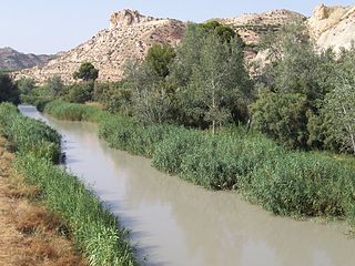
Segura River
| Segura River | ||
|
Río Segura - source |
||
| Data | ||
| location | Provinces Jaén , Albacete , Murcia , Alicante ( Spain ) | |
| River system | Segura River | |
| source | near Santiago-Pontones , Jaén | |
| Source height | 1413 msnm | |
| muzzle | at Guardamar del Segura in the Mediterranean Coordinates: 38 ° 6 ′ 44 ″ N , 0 ° 38 ′ 18 ″ W 38 ° 6 ′ 44 ″ N , 0 ° 38 ′ 18 ″ W |
|
| Mouth height | 0 msnm | |
| Height difference | 1413 m | |
| Bottom slope | 4.3 ‰ | |
| length | 325 km | |
| Catchment area | 18,870 km² | |
| Drain at the Cieza gauge (Murcia) |
MQ |
26.3 m³ / s |
| Left tributaries | Río Mundo | |
| Right tributaries | Taibilla , Río Alhárabe , Río Argos , Quípar , Río Mula , Guadalentín | |
| Reservoirs flowed through | Embalse de Anchuricas , Embalse de la Fuensanta , Embalse del Cenajo | |
| Big cities | Murcia | |
| Medium-sized cities | Orihuela | |
| Small towns | Calasparra , Cieza , Abarán , Archena , Alguazas | |
| Residents in the catchment area | about 1.7 million | |
The Río Segura (Latin Thader , Arabic وادي الأبيض Wadi al-Abyad ) is an approximately 325 km long coastal river in the provinces of Jaén , Albacete , Murcia and Alicante in southeastern Spain .

course
The Río Segura rises near the village of Fuente Segura in the municipality of Santiago Pontones in the Andalusian province of Jaén and initially flows through the province of Albacete in a north and east direction . In the province of Murcia , it is the first major city on its course to reach Cieza , where it turns south. He irrigates the orchards and fields of the Valle de Ricote and the surrounding area. After that it flows mainly in an easterly direction; behind Orihuela it is canalised and flows into the Mediterranean about 2 km north of Guardamar del Segura in the province of Alicante .
Amount of water
Because of the large amounts of water being withdrawn for irrigation purposes, the middle and lower reaches of the Río Segura are characterized by drought from late spring to autumn. However, due to the deforestation of the riparian zones, floods occur after heavy autumn and winter rainfall in almost every decade - for example in 2000. The measured flow rates rise to over 1800 m³ / s. The construction of reservoirs only partially alleviated the problem. Since 1990 the lower part of the river has been canalized, also to reduce the damage caused by the floods.
Tributaries
- Taibilla
- Río Mundo
- Río Alhárabe or Río Moratalla
- Argos River
- Quípar
- Río Mula
- Rambla Salada
- Guadalentin
ecology
A few years ago, the lower reaches of the Río Segura were considered to be one of the dirtiest rivers in Europe due to the entry of untreated sewage as well as fertilizers and agrochemicals . However , the situation has been improved by the construction of sewage treatment plants .
history
As numerous rock paintings along its bank zones prove, the Río Segura was already a river course in the Stone Age . The Iberians , Romans and perhaps the Visigoths also settled on its banks. The former Moorish , d. H. The Berber settlement of Siyâsa near Cieza is the most important site of its kind on the Iberian Peninsula ; the city of Murcia is also a Moorish foundation (around 825). However, under Christian rule (from 1243) most places experienced their heyday.
