Abaran
| Abarán municipality | ||
|---|---|---|
 Abarán - town view
|
||
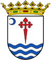
| coat of arms | Map of Spain | |

|
|
|
| Basic data | ||
| Autonomous Community : |
|
|
| Comarca : | Vega Alta del Segura | |
| Coordinates | 38 ° 12 ′ N , 1 ° 24 ′ W | |
| Height : | 175 msnm | |
| Area : | 114.94 km² | |
| Residents : | 12,964 (Jan 1, 2019) | |
| Population density : | 112.79 inhabitants / km² | |
| Postal code : | 30550 | |
| Municipality number ( INE ): | 30002 | |
| administration | ||
| Website : | Abaran | |
Abarán is a southern Spanish town and one from the main town, three villages and several hamlets (Pedanías) existing municipality ( municipio ) with a total of 12,964 inhabitants (as of January 1 2019) in the center of the province of Murcia in the same autonomous region of Murcia .
location
The small town of Abarán is located in the north of the Valle de Ricote on a hill in a loop of the Río Segura almost 50 km (driving distance) northwest of the city of Murcia at an altitude of about 170 to 190 m above sea level. d. The climate in winter is temperate, in summer it is warm to hot; the low amounts of precipitation (approx. 300 mm / year) fall - with the exception of the almost rainless summer months - distributed throughout the year.
Population development
| year | 1877 | 1900 | 1950 | 2000 | 2016 |
| Residents | 2,652 | 3.834 | 8,422 | 12,241 | 13,183 |
The continuous increase in population is mainly due to the ongoing immigration from the rural area. The relative proximity to the Murcia area also plays a role.
economy
Abarán is located in the north of the agriculturally used core zone of the province of Murcia - grain, grapevines as well as olive and fruit trees of all kinds were planted; Vegetables came from the house gardens. Today mainly citrus fruits and olives are harvested. Small traders, craftsmen and service companies of all kinds have settled in the village.
history
The oldest finds that testify to the presence of humans in the region are dated to the Bronze Age (around 2000 BC). Small Iberian , Carthaginian and Roman finds were also made, while Visigoth or Byzantine finds are missing. In the years after 711 the area was overrun by the Moors ; the place was named Fauaran . After the end of the Caliphate of Córdoba that arose Taifa Kingdom Murcia, which after the reconquest ( reconquista ) of the region by Castilian troops under Alfonso X in 1243 in a Christian kingdom was converted, which, however closely with the Crown of Castile was intertwined . The region of the Valle de Ricote was given to the Order of Santiago , but from 1296 to 1304 it came temporarily under Aragonese rule and in 1477 briefly under the rule of the Nasrid rulers of Granada .
Attractions
- The current building of the Ermita de los Santos Médicos (meaning the Saints Cosmas and Damian ) dates from the 1950s and replaces a previous church from the 1830s that was destroyed during the civil war and which in turn is the successor to a building from the 16th century. Century was. The new church includes elements of neo-Romanesque and neo-baroque styles .
- The bridge called Puente Viejo originates from medieval times; However, this was repeatedly destroyed by floods of the Río Segura. Today's bridge is a building from the late 19th century with an iron track.
- There are numerous water pumping wheels ( norias ) in the municipality , which are reminiscent of Islamic irrigation techniques .
Web links
Individual evidence
- ↑ Cifras oficiales de población resultantes de la revisión del Padrón municipal a 1 de enero . Population statistics from the Instituto Nacional de Estadística (population update).
- ↑ Abarán - Map with altitude information
- ↑ Abarán - climate tables
- ↑ Abarán - population development
- ↑ Abarán - Economy etc.
- ↑ Abarán - History
- ↑ Abaran - Ermita de los Santos Médicos
- ↑ Abarán - Puente Viejo
- ↑ Abarán - Bucket Wheels


