San Pedro del Pinatar
| San Pedro del Pinatar municipality | ||
|---|---|---|
| coat of arms | Map of Spain | |

|
|
|
| Basic data | ||
| Autonomous Community : | Murcia | |
| Province : | Murcia | |
| Comarca : | Mar Menor | |
| Coordinates | 37 ° 50 ′ N , 0 ° 47 ′ W | |
| Height : | 13 msnm | |
| Area : | 22.32 km² | |
| Residents : | 25,476 (Jan 1, 2019) | |
| Population density : | 1,141.4 inhabitants / km² | |
| Postal code : | 30740 | |
| Municipality number ( INE ): | 30036 | |
| administration | ||
| Mayor : | José María García Ruiz (PSRM-PSOE) | |
| Location of the municipality | ||

|
||
San Pedro del Pinatar is a municipality in the region of Murcia in Spain with 25,476 inhabitants (as of January 1, 2019).
Demographics
San Pedro del Pinatar is one of the smaller cities in the region of Murcia with an area of only 21.7 km² and a population density of 1141 inhabitants per km². The population is mainly concentrated in three core areas: San Pedro del Pinatar, Lo Pagán and EL Mojón. The development of the population since the last century is reflected as follows:
| 1857 | 1877 | 1887 | 1900 | 1910 | 1920 | 1930 | 1940 | 1950 |
|---|---|---|---|---|---|---|---|---|
| 1,650 | 2.012 | 2,306 | 2,647 | 3,061 | 3,259 | 3,299 | 4,261 | 5,006 |
| 1960 | 1970 | 1981 | 1986 | 1991 | 1996 | 2001 | 2006 |
|---|---|---|---|---|---|---|---|
| 5,436 | 6,520 | 8,959 | 10,902 | 12,221 | 13,644 | 16,269 | 21,234 |
geography
The place borders the province of Alicante and is 49 km from Murcia . San Pedro Pinatar is located between the Mar Menor and the Mediterranean. The neighboring municipalities are San Javier and Pilar de la Horadada .
It is a small peninsula with fourteen kilometers of coastline. The beaches on the Menor Sea are:
- Villananitos,
- Puntica and
- Mota.
On the Mediterranean, it's the beaches
- LLana,
- la Plage des Salines,
- Barraca Quemada and
- Punta de Algas as well
- Torre Derribada and
- El Mojón.
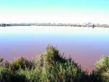
Between EL Mojón and Lo Pagán you will find the 900 hectare wetland and the salt and sand banks of San Pedro del Pinatar, which are important for the Murcia region. Albatrosses and seagulls are native to this park, and it has moving dunes with characteristic flora.
climate
The climate is a dry Mediterranean climate. Average temperatures range between 17 ° C in winter and 23 ° C in summer with around 3,000 hours of sunshine a year. The main winds come from the northeast ( Levante ), from the southwest ( Leveche ) and from the west ( Poniente ).
Industry and other productive sectors
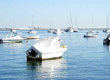
The place has only a modest agriculture due to the small community area. However, there is fishing and related industries. In addition, the service sector is being expanded in the course of increasing tourism. A small port on the Mediterranean Sea and the Menor Sea are used to transport the extracted salt and private and sporting moorings.
The traditional industry since Roman times has been the salt pans , which are still in operation today , as well as drinking water treatment through desalination . Since 2005, a modern desalination plant using reverse osmosis has been producing drinking water that is intended for human consumption for the entire coastal area as far as Cartagena . Another system has been in operation since 2007.
history
The city got its official name in the 17th century. Before that, the village was only called "Pinatar" , which meant something like pine forest . On September 16, 1836 the first town hall was built, the first mayor was José Imbernón Ruíz.
Festivities
- Processional parades in Semana Santa
- End of June patron saint of San Pedro Apostol .
- On July 16, Romería to the Blessed Mother of Mount Carmel
Web links
Individual evidence
- ↑ Cifras oficiales de población resultantes de la revisión del Padrón municipal a 1 de enero . Population statistics from the Instituto Nacional de Estadística (population update).


