Rotwandlspitze
| Rotwandlspitze | ||
|---|---|---|
|
The Brunnensteinspitze forms a double peak with the Rotwandlspitze at the southwestern end of the northern Karwendel range |
||
| height |
2192 m above sea level NHN 2191 u m. A. |
|
| location | Border between Bavaria ( Germany ) and Tyrol ( Austria ) | |
| Mountains | Northern Karwendel range , Karwendel | |
| Dominance | 0.57 km → Kirchlspitze | |
| Notch height | 100 m ↓ north of the Tiroler Hütte | |
| Coordinates | 47 ° 24 '25 " N , 11 ° 17' 18" E | |
|
|
||
| rock | Wetterstein lime | |
| Age of the rock | Triad | |
|
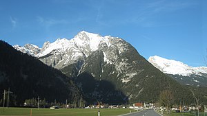
The Brunnensteinspitze from the southwest, Scharnitz in the foreground. The summit of the Rotwandlspitze is hidden from this perspective |
||
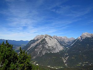
The Rotwandlspitze is a 2191 m above sea level. A. high mountain in the Karwendel on the border between Germany ( Bavaria ) and Austria ( Tyrol ). It forms a double peak with the 2180 m above sea level. A. high Brunnensteinspitze .
Location and surroundings
The Rotwandlspitze is located at the southwestern end of the northern Karwendel range , which separates the Bavarian Isar valley in the west from the Austrian Karwendel valley in the southeast. The nearest towns are Scharnitz, two kilometers southwest, and Mittenwald, northwest . The Brunnensteinspitze, after which the Brunnsteinhütte is named, is 150 meters to the southwest . Up to this point, the state border follows the ridge of the northern Karwendel range, coming from the north, and continues through the western flank through the Marchklamm in the direction of the Porta Claudia fortification in the Scharnitz pass , the eastern side of which forms the mountain range.
About 150 meters northeast of the Rotwandlspitze is the Tiroler Hütte ( 2153 m above sea level ) on a small hill called Auf dem Blanken , which has been closed since 2004. The ridge continues over the Brunnensteinanger ( 2096 m above sea level ) to 2301 m above sea level. A. high Kirchlspitze.
Climbs
A marked path leads from Scharnitz, following the ridge, over the 1924 m above sea level. A. high Brunnensteinkopf and the Brunnensteinspitze to the summit ( UIAA I ). Another, albeit dilapidated, path from Scharnitz runs further east through the south-eastern flank of the mountain over the Pürzlbrünste directly to the Rotwandlspitze. From the west, the mountain can be reached on a partially insured hiking trail via the Brunnsteinhütte and the Brunnensteinanger ( Brunnensteinweg ).
literature
- Walter Klier : Karwendel alpin: Alpine club guide "alpin" for hikers and mountaineers . Rother, Munich 2005, ISBN 3-7633-1121-1 , p. 265-266 ( Google Books [accessed September 11, 2009]).


