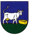
Ruská Bystrá
| Ruská Bystrá | ||
|---|---|---|
| coat of arms | map | |

|
|
|
| Basic data | ||
| State : | Slovakia | |
| Kraj : | Košický kraj | |
| Okres : | Sobrance | |
| Region : | Dolný Zemplín | |
| Area : | 11,958 km² | |
| Residents : | 107 (Dec. 31, 2019) | |
| Population density : | 9 inhabitants per km² | |
| Height : | 418 m nm | |
| Postal code : | 07264 ( Ruský Hrabovec Post Office ) | |
| Telephone code : | 0 56 | |
| Geographic location : | 48 ° 51 ' N , 22 ° 18' E | |
| License plate : | SO | |
| Kód obce : | 523011 | |
| structure | ||
| Community type : | local community | |
| Administration (as of November 2018) | ||
| Mayor : | Ján Sakulič | |
| Address: | Obecný úrad Ruská Bystrá 19 07264 Ruská Bystrá |
|
| Statistics information on statistics.sk | ||
Ruská Bystrá (until 1927 in Slovak "Ruské Bystré"; in Hungarian Oroszsebes - until 1902 and 1939–45 Oroszbisztra - older also Alsóbisztra ) is a municipality in eastern Slovakia . It is located in the Vihorlat Mountains about 6 km from the border with Ukraine and 22 km from Sobrance .
The place was first mentioned in 1405. Until 1918 it belonged to the Kingdom of Hungary and was in Semplin County , then it came to the newly formed Czechoslovakia . Due to the Slovak-Hungarian war , it belonged to Hungary from 1939 to 1945 .
In the village is the Greek Catholic wooden church of St. Bishop Nicholas from the years 1720-30, which was added to the UNESCO World Heritage List in 2008.
Web links
Commons : Ruská Bystrá - collection of images, videos and audio files

