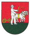
Koromľa
| Koromľa | ||
|---|---|---|
| coat of arms | map | |

|
|
|
| Basic data | ||
| State : | Slovakia | |
| Kraj : | Košický kraj | |
| Okres : | Sobrance | |
| Region : | Dolný Zemplín | |
| Area : | 13.039 km² | |
| Residents : | 424 (Dec. 31, 2019) | |
| Population density : | 33 inhabitants per km² | |
| Height : | 280 m nm | |
| Postal code : | 072 62 | |
| Telephone code : | 0 56 | |
| Geographic location : | 48 ° 43 ' N , 22 ° 18' E | |
| License plate : | SO | |
| Kód obce : | 522643 | |
| structure | ||
| Community type : | local community | |
| Administration (as of November 2018) | ||
| Mayor : | Silvia Žeňuchová | |
| Address: | Obecný úrad Koromľa č. 172 072 62 Koromla |
|
| Website: | www.obeckoromla.sk | |
| Statistics information on statistics.sk | ||
Koromľa (Hungarian: Koromlak , until 1899 Korumlya ) is a small village in okres Sobrance in the far east of Slovakia . It is located in the hill country of eastern Slovakia in the foothills of the Poprič mountain range near the state border with Ukraine . The center of the village is at an altitude of 280 m nm. The village and the district are at an altitude of 215 to 850 m above sea level. Koromla is located about nine kilometers southeast of the city of Sobrance and about ten kilometers from the Ukrainian city of Uzhhorod .
geography
The Koromlianer Dorfbach drains to the Laborec river . Brown forest soils and Lessivé are found in the municipal area as soil types . In the valleys of the northern slope of Poprič there are heavy clay soils and podsoles .
history
The first mention comes from the year 1337 , the first settlement is dated to the Bronze Age. Koromla once belonged to the noble Drugeth family and the Tibava rule . The inhabitants devoted themselves to agriculture for centuries.
Oral tradition says that the first settlers in the village of Koromla were loggers and charcoal burners. Large forests once made it possible to produce charcoal in large quantities. Therefore there was constant smoke in the settlement and the surrounding area. This is probably how the place got its Hungarian name Koromlak , Hungarian for “place of soot ”.
In 1910 there were 636 people in Koromlak (499 Slovaks, 78 Germans, 39 Ruthenians , 19 Magyars). After the Treaty of Trianon , Koromlak came from the Kingdom of Hungary ( Ung County ) to the newly founded Czechoslovakia , which assigned it to the part of Carpathian Ukraine . In March 1939, the Hungarian army occupied the place during the Slovak-Hungarian war . The Red Army occupied the place in 1944. In 1993 Koromľa became part of Slovakia.
In 2001, Korom8a had 538 residents (494 Slovaks, 3 Ukrainians and others), most of whom (75%) had committed themselves to the Greek Catholic Church.
Infrastructure
There is a library, a soccer field and a gym in the village. The religious center is the Greek Catholic Church of St. Michael.
