
Salts (Bega)
| Salts | ||
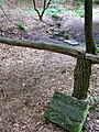
 View from the Steege to the Salts in Bad Salzuflen city center |
||
| Data | ||
| Water code | EN : 4628 | |
| location | North Rhine-Westphalia , Germany | |
| River system | Weser | |
| Drain over | Bega → Werre → Weser → North Sea | |
| source | At Exter 52 ° 9 ′ 30 ″ N , 8 ° 47 ′ 58 ″ E |
|
| Source height | approx. 214 m above sea level NN | |
| muzzle |
Bad Salzuflen in the Bega coordinates: 52 ° 4 ′ 53 ″ N , 8 ° 44 ′ 40 ″ E 52 ° 4 ′ 53 ″ N , 8 ° 44 ′ 40 ″ E |
|
| Mouth height | approx. 71 m above sea level NN | |
| Height difference | approx. 143 m | |
| Bottom slope | approx. 9.5 ‰ | |
| length | 15 km | |
| Catchment area | 49.098 km² | |
| Left tributaries | Glimke , Wüstenbeke | |
| Right tributaries | Exterbach , Finnebach , Schwaghofbach | |
| Medium-sized cities | Vlotho , Bad Salzuflen | |
The Salze is a right tributary of the Bega in the northeast of the German state of North Rhine-Westphalia .
geography
The water has a total length of 15 kilometers. The catchment area extends over the northwestern Lipper Bergland between Weser and Werre . It rises on the grounds of the Kelle farm in Exter an der Steinegge not far from the source of the Mittelbach in the area of the old Solterwisch farmers . In contrast to this, the course of the salts turns to the southwest in the direction of the Bega. At kilometer 13.9, it crosses federal motorway 2 . At Bad Salzuflen it is taken up by the Bega (Bega river kilometer 0.3), which flows into the Werre immediately afterwards. Some maps (incorrectly) record the salts as flowing into the Werre and the Bega as flowing into the salts. The name Salze, like the name Bad Salzuflen, indicates local salt deposits. The name of the Vlothoer place Solterwisch means analogous salt meadow.
The water flows through the communities of Vlotho and Bad Salzuflen on its way from the source to the mouth .
On its way downstream, the salts absorb the following waters:
- Exterbach (R 9.5)
- Glimke (L 7.4)
- Finnebach (R 5.4)
- Caspohl source discharge (R 4.7)
- Wüstenbeke (also "Wüstener Bieke", officially without a name) (L 4,3); rises near the new village , south of deserts and southeast of Langenberg. River length: 4.2 kilometers.
- Schwaghofbach (R 2.3)
- Asen (? L), Asenquelle ( 52 ° 5 ' N , 8 ° 47' O ) in Salzufler City Forest, flows through the Asental and Asenteiche; then underground to the salts
(L / R; KM): Left right inflow, at river kilometers, mouth at KM 0)
environment
Along the Salze and Glimke , the approximately 51 hectare Salze-Glimketal nature reserve (HF – 035) in Exter and Bad Salzuflen and the approximately 61 hectare Salzetal nature reserve (LIP – 039) in Bad Salzuflen have been designated since the end of 1997 . The stream valleys, which are protected along a length of around twelve kilometers, are designed as sieve systems typical of the Ravensberger Land . These near-natural stream valleys and the stream meadows have pronounced wet grassland and forest areas. The salts is almost universally by Erlen - and pastures accompanied -Reihen partially pronounced than alder ash - Auwald . Numerous small bodies of water such as ponds and fish ponds are home to floating leaf and bank vegetation, further endangered species and numerous species of dragonflies. The wetland has many endangered plant species, for example orchids , reeds and sedges in places . Noteworthy in the area are the salt springs near Loose, which are designated as FFH areas. Protected and salt-loving plant species can be found at these inland salt points: beach milkweed , salt bunge , caraway silge and swamp trident .
tourism
The salt feeds the spa park lakes in the landscape park and spa park of the state spa via the salt canal branching off in the game reserve and flows partly covered through the city center towards its confluence at Hoffmannswiesen .
Upstream of the landscape garden, hiking trails lead through the nature reserve Salze-Glimketal .

Source pond of the salts

Source area of the salts on the Vahrenbrinkstraße in Vlotho
Asenquelle in the city forest of Bad Salzuflen
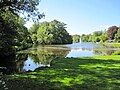
Inflow of the salts (left) into the Kurparksee in Bad Salzuflen

Coverage of the salts in the city center of Bad Salzuflen

Confluence of Bega (from right) and Salts


See also
Web links
Individual evidence
- ↑ a b German basic map 1: 5000
- ↑ a b Topographical Information Management, Cologne District Government, Department GEObasis NRW ( Notes )
- ↑ Description of the nature reserve at www.protectedplanet.net, accessed on March 28, 2020.
- ↑ Description of the nature reserve at the State Office for Nature, Environment and Consumer Protection North Rhine-Westphalia , accessed on March 28, 2020.