Saraktash
| settlement
Saraktasch
Саракташ
|
||||||||||||||||||||||||||||||
|
||||||||||||||||||||||||||||||
|
||||||||||||||||||||||||||||||
| List of large settlements in Russia | ||||||||||||||||||||||||||||||
Saraktasch ( Russian Саракта́ш ) is a settlement in the Orenburg Oblast ( Russia ) with 17,235 inhabitants (as of October 14, 2010).
geography
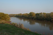
The settlement is located on the edge of the southern foothills of the Ural Mountains , almost 90 km as the crow flies east of the Orenburg Oblast Administrative Center, not far from the confluence of the Bolshoi Ik (Great Ik) in the Ural tributary Sakmara .
Saraktasch is the administrative center of the Saraktasch Rajon of the same name .
history
The place arose in connection with the construction of the railway line from Orenburg to Orsk in 1913, initially as a settlement at a train station. The station and settlement were named after the old Tatar village of Saraktasch , six kilometers north on the far right bank of the Sakmara , which was subsequently renamed Tatarski Saraktasch.
On January 4, 1931, the administration of the Petrovskoye Raion was transferred from the village of Petrovskoye, 20 km northeast, to Saraktash; renamed the Rajon at the same time. In 1939 the place received the status of an urban-type settlement. Since an administrative reform in 2004, Saraktasch has been a rural settlement again.
Population development
| year | Residents |
|---|---|
| 1939 | 6,155 |
| 1959 | 12,075 |
| 1970 | 13,774 |
| 1979 | 14,890 |
| 1989 | 16,250 |
| 2002 | 17,510 |
| 2010 | 17,235 |
Note: census data
Culture and sights
The large Russian Orthodox Trinity Monastery and “ Mercy Center ” (Russian: Свято-Троицкая обитель / Swjato-Troitskaja obitel ) has been built in Saraktasch since the early 1990s . A local history museum has existed since 1982 .
Economy and Infrastructure

Saraktasch is the center of an agricultural area. There is a factory for pumps and hydraulic equipment in the village, as well as businesses in the food and light industry and construction industry.
The settlement is on the line of the Trans-Aral Railway (route km 104), which is operated by the Southern Urals Railway . A local road runs parallel to the railway line. In a southerly direction at the village of Novocherkassk, 30 km away , there is a connection to the regional road R336 , which follows the Ural River from Orenburg to Orsk .
Individual evidence
- ↑ a b Itogi Vserossijskoj perepisi naselenija 2010 goda. Tom 1. Čislennostʹ i razmeščenie naselenija (Results of the All-Russian Census 2010. Volume 1. Number and distribution of the population). Tables 5 , pp. 12-209; 11 , pp. 312–979 (download from the website of the Federal Service for State Statistics of the Russian Federation)
- ↑ a b Saraktasch on the website of the Geographical Institute of the RAN (Russian)
- ↑ Local history on the private website saraktash.ru (Russian)
- ↑ Website of the monastery (Russian)
- ↑ Information about the monastery on the private website saraktash.ru (Russian, photos)
- ↑ Information about the museum at museum.ru (Russian)


