Sarre (Bode)
| Sarre | ||
|
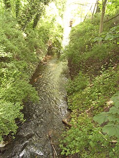
Sarre in Wanzleben at Wanzleben Castle |
||
| Data | ||
| Water code | DE : 56894 | |
| location | Borde district , Saxony-Anhalt ( Germany ) | |
| River system | Elbe | |
| Drain over | Bode → Saale → Elbe → North Sea | |
| source | Outflow of the Great Pond at Bergen 52 ° 6 ′ 21 ″ N , 11 ° 21 ′ 47 ″ E |
|
| Source height | approx. 112.5 m above sea level NHN | |
| muzzle | near Groß Germersleben in the Bode coordinates: 51 ° 59 ′ 45 ″ N , 11 ° 22 ′ 16 ″ E 51 ° 59 ′ 45 ″ N , 11 ° 22 ′ 16 ″ E |
|
| Mouth height | 72.1 m above sea level NHN | |
| Height difference | approx. 40.4 m
|
|
| Catchment area | 67.5 km² | |
| Right tributaries | Röthebach , Sauerbach | |
| Small towns | Wanzleben-Börde | |
The Sarre is a northern and left tributary of the Bode . It flows through the Magdeburg Börde in the Saxony-Anhalt district of Börde .
course
South of Bergen , a north-western district of Wanzleben-Börde , the Dremse flows from the east and the Geesgraben from the north into the Great Pond ( 112.5 m above sea level ), whose drain is the Sarre.
The Sarre initially flows west of the vineyard ( 125.1 m height) in a southerly direction towards Remkersleben, only to turn away to the east shortly before the village through which it does not flow. Near the open Remkersleben Röthebach and Sauerbach in the right side extending to Sarre means digging a. From the Großer Mühlenberg ( 123.6 m ) near Domersleben , the Sarre turns in a north-south direction.
Then the Sarre flows through the local area of Wanzleben in the same direction , on the northern edge of which it passes Wanzleben Castle to the west, and then passes under the federal highway 246 on the southern edge of the village. It maintains this course as far as Bottmersdorf . There the Sarre swings to the southwest in order to flow towards Klein Germersleben . Shortly afterwards, it crosses under the B 180 , flows from east to west towards Groß Germersleben , where it is crossed by state road 76, and then turns south-east.
Finally, the Sarre flows a little southeast of Groß Germersleben at a height of 72.1 m into the Saale tributary Bode coming from the west-northwest .
literature
- State of Saxony-Anhalt (Hrsg.): Monitoring network of the State Office for Flood Protection and Water Management Saxony-Anhalt. Part of surface waters (list of gauges) . 2010, p. 15 ( sachsen-anhalt.de [PDF; 153 kB ; accessed on June 7, 2010]).
- State of Saxony-Anhalt (publisher): Development and provision of an assessment methodology for assessing the hydrological regime of surface water bodies (rivers and lakes) in accordance with the EU WFD in the state of Saxony-Anhalt . 2010, p. 230 .
- State of Saxony-Anhalt (Ed.): Investigations of pesticides in the surface waters of Saxony-Anhalt . S. 4, 7, 13, 24 ff., 34, 46 .
- State of Saxony-Anhalt (ed.): Saxony-Anhalt program of measures . S. 1 .
Individual evidence
- ↑ a b Map services of the Federal Agency for Nature Conservation ( information )
- ↑ State of Saxony-Anhalt (Ed.): Monitoring network of the State Office for Flood Protection and Water Management Saxony-Anhalt. Part of surface waters (list of gauges) . 2010 ( sachsen-anhalt.de [PDF; 153 kB ; accessed on June 7, 2010]). Monitoring network of the State Office for Flood Protection and Water Management Saxony-Anhalt. Part of surface waters (level index) ( memento of the original dated October 6, 2014 in the Internet Archive ) Info: The archive link was inserted automatically and has not yet been checked. Please check the original and archive link according to the instructions and then remove this notice.
