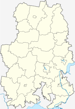
Sawjalowo (Udmurtia)
Village
|
||||||||||||||||||||||||||||||||||
|
||||||||||||||||||||||||||||||||||
|
||||||||||||||||||||||||||||||||||
Sawjalowo ( Russian Завья́лово ; udmurtisch Завьял ) is a village (selo) in the Udmurt Republic in Russia with 8986 inhabitants (as of October 14, 2010).
geography
The place is about 12 km in a straight line southeast of the center of the Republic capital Izhevsk on the river Bydwaika, north the well five kilometers into the left Isch opens creek Posim.
Sawjalowo is the administrative center of the Rajons Sawjalowski and seat of the "municipal entity" (Munizipalnoje obrasowanije) Sawjalowskoje with the status of a rural community (selskoje posselenije), which also includes the eight villages Baschur (4 km east), Beryozka (4 km north), Kabanicha ( 6 km north-north-west), Kaschabegi (8 km south-east), Krasny Kustar (6 km east), Novoje Martjanowo (7 km east-north-east), Pytschanki (adjoining to the east) and Staroye Martjanowo (6 km north-east) as well as the village (pochinok) Shurdymka (4 km south) belong. Staroje Martjanowo has almost 1400 inhabitants, Pytschanki just under 700, Baschur over 100, all others under 100 (as of 2015).
history
An udmurt village called Deri ( udmurt / Russian Дэри or Дери , also Deri-Schudja, Дери-Шудья ) in place of today's place was first mentioned in 1710. However, the official founding year is 1749, when a church was built there for the surrounding twelve villages. By the middle of the 19th century, Sawjalowo developed into the seat of one of the most populous Volosti of Ujesds Sarapul , to which it belonged to the governorship of Vyatka from 1780 and of the Vyatka governorate from 1796.
After the formation of the Votian Autonomous Oblast on November 4, 1920 (renamed the Udmurt Autonomous Oblast on January 1, 1932, reorganized into the Udmurt ASSR on December 28, 1934 ), the village belonged to their Ujesd Izhevsk from 1921 onwards, and on July 15, 1929 was transformed into a Rajon. On June 1, 1937, a new Rajon with its seat in Savjalowo was spun off from one part. On February 1, 1963, the Rajon was temporarily dissolved and its territory was re-incorporated into the Izhevsky Rajon. As early as 1965, other parts of the Ischewski rajon, which was enlarged in 1963, were returned to the original rajons, its administrative seat moved to Zavyalovo and the raion renamed accordingly, while the former administrative seat of Ischewsk became rajon-free.
Population development
| year | Residents |
|---|---|
| 1897 | 931 |
| 1939 | 1715 |
| 1959 | 2208 |
| 1970 | 3156 |
| 1979 | 4757 |
| 1989 | 6830 |
| 2002 | 7457 |
| 2010 | 8986 |
Note: census data
traffic
The regional road 94R-18, part of the southeast bypass of the city of Izhevsk, runs through the village. The 94K-23 leads in the direction of the city center, which continues in the opposite, eastward direction, initially as part of the bypass road, as 94K-24 to the village of Goljany , a good 20 km away on the right bank of the Kama .
There is a city bus and marshrutka connection with Izhevsk . The nearest train station is also located there, on the Agrys - Balesino line with a branch from Izhevsk to Votkinsk . The Izhevsk Airport is located about seven kilometers northeast of the community Sawjalowo part Staroje Martjanowo.
Web links
Individual evidence
- ↑ a b Itogi Vserossijskoj perepisi naselenija 2010 goda. Tom 1. Čislennostʹ i razmeščenie naselenija (Results of the All-Russian Census 2010. Volume 1. Number and distribution of the population). Tables 5 , pp. 12-209; 11 , pp. 312–979 (download from the website of the Federal Service for State Statistics of the Russian Federation)


