Jar (Udmurtia)
| settlement
Jar
Яр
|
||||||||||||||||||||||||||||||||||
|
||||||||||||||||||||||||||||||||||
|
||||||||||||||||||||||||||||||||||
Jar ( Russian and Udmurt urtр ) is a rural settlement in the Udmurt Republic ( Russia ) with 6596 inhabitants (as of October 14, 2010).
geography
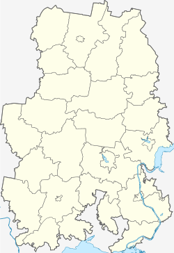
The settlement is located in the extreme northwest of the republic, about 170 km as the crow north-northwest of the Republic capital Izhevsk and 35 km from Glasow away, the far from the left bank of Vyatka -Nebenflusses Cheptsa River .
Jar is the administrative center of the Jar Rajons of the same name .
history
The village of Jar, which was part of the Wolost (village community) of the village of Ukan des Ujesds Glasow in the Vyatka governorate about 10 km south , was first mentioned in 1836. Jar in Russian means a high, steep river bank, in this case the Tschepza. The current settlement, about two kilometers east of the old village, was built in 1898, officially the year of foundation, in connection with the construction of the Perm - Vyatka - Kotlas railway . The line later became part of the (northern) main route of the Trans-Siberian Railway , and in the 1930s it became the starting point of a railway line leading north via Omutninsk and Kirs to the Verkhnekamskaya station , which spanned the northeast of the neighboring Kirov Oblast - with a large number of gulag camps - should be developed and primarily serve forestry purposes.
From 1932 (with interruptions 1962-1964) Jar is the administrative seat of the Rajons of the same name, founded in 1929. In 1938 the place received the status of an urban-type settlement . By decision of the local administration and with the confirmation of the Government of the Udmurt Republic on November 23, 2010, Jar was converted back into a rural settlement. The original village does not belong to the Jar settlement, but to the rural community (selskoje posselenije) Barmaschur .
Population development
| year | Residents |
|---|---|
| 1939 | 2652 |
| 1959 | 4917 |
| 1970 | 5261 |
| 1979 | 6381 |
| 1989 | 6917 |
| 2002 | 7202 |
| 2010 | 6596 |
Note: census data
Culture and sights
There has been a local museum in Jar since 1998.
Economy and Infrastructure
The area and Jar is dominated by agriculture and forestry.
The settlement is on the Trans-Siberian Railway (route kilometer 1126 from Moscow ), from which a branch line branches off to Verkhnekamskaya, and on the road that connects Izhevsk via Glazov with the neighboring oblast capital of Kirov .
Individual evidence
- ↑ a b Itogi Vserossijskoj perepisi naselenija 2010 goda. Tom 1. Čislennostʹ i razmeščenie naselenija (Results of the All-Russian Census 2010. Volume 1. Number and distribution of the population). Tables 5 , pp. 12-209; 11 , pp. 312–979 (download from the website of the Federal Service for State Statistics of the Russian Federation)
- ↑ Order No. 513-IV of the Udmurt Government of November 23, 2010 (Russian)
- ↑ Local history museum Jar at museum.ru (Russian)
Web links
- Rajon Administration website (Russian)

