
Schüpfbach
| Schüpfbach | ||
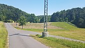
 The Schüpfbach in Kupprichhausen (2017) |
||
| Data | ||
| Water code | DE : 24666 | |
| location |
Building land
|
|
| River system | Rhine | |
| Drain over | Umpfer → Tauber → Main → Rhine → North Sea | |
| source | in the forest northeast of Buch am Ahorn 49 ° 33 ′ 13 ″ N , 9 ° 34 ′ 18 ″ E |
|
| Source height | approx. 393 m above sea level NN | |
| muzzle | In undercuts from the left and north-west in the Umpfer coordinates: 49 ° 30 '55 " N , 9 ° 41' 35" E 49 ° 30 '55 " N , 9 ° 41' 35" E |
|
| Mouth height | approx. 314 m above sea level NN | |
| Height difference | approx. 79 m | |
| Bottom slope | about 6 ‰ | |
| length | 13.2 km | |
| Catchment area | 29.427 km² | |
The Schüpfbach is a 13 km long brook in the Main-Tauber district in the north of Baden-Württemberg , which flows to the left and northwest into the Umpfer at Unterschüpf .
geography
course
The Schüpfbach rises at about 393 m above sea level. NN in the Ahornwald southeast of Brehmen and northeast of Buch am Ahorn in the urban area of Lauda-Königshofen . After a short north-eastern upper reaches, on which it leaves the forest, it turns to the south-east and moves through an open floodplain, which is initially bordered on both sides by forest hills, to the south-east. On this section he passes the Heckfelder See , crosses under the A 81 and then changes to the urban area of Boxberg , where the accompanying edge heights are now mostly exposed at the top.
The village of Kupprichhausen is the first place on the Schüpfbach, here it changes to the east. It now runs through Lengenrieden and Oberschüpf , where it is already turning to the southeast. The Schüpfbach finally flows through Unterschüpf and flows at the lower end of the village from the left to about 314 m above sea level. NN in the lower Umpfer , a tributary of the Tauber .
Tributaries and lakes
List of tributaries and ![]() lakes from source to mouth. Length of water, lake area, catchment area and altitude according to the corresponding layers on the LUBW online map. Other sources for the information are noted.
lakes from source to mouth. Length of water, lake area, catchment area and altitude according to the corresponding layers on the LUBW online map. Other sources for the information are noted.
Source of the Schüpfbach at about 393 m above sea level. NN in the forest northeast of Buch am Ahorn already in the urban area of Lauda-Königshofen . The stream initially flows to the east-northeast.
- Breitenbrunngraben, from the left and west-northwest to about 362 m above sea level. NN a little after the forest emerges, approx. 1.0 km and approx. 0.7 km². Arises at about 388 m above sea level. NN in the loop of a forest path.
- (Ditch through the Hofacker ), from the left and east-northeast to about 355 m above sea level. NN am Messholz , approx. 0.6 km and approx. 0.5 km². Arises at about 372 m above sea level. NN at the edge of the forest.
From here the stream flows to the southeast. - Pfingstbrunnengraben, from the right and west-southwest to about 347 m above sea level. NN , approx. 1.7 km and approx. 0.7 km². Arises at about 386 m above sea level. NN in the forest.

-
 Passes and flows through at about 335 m above sea level. NN the two parts of the Heckfelder See shortly before the A 81 , 0.5 ha and 1.8 ha.
 - Lagewiesengraben, from the right and west to about 382 m above sea level. NN after the bridge of the K 2835 over the Schüpfbach, approx. 2.7 km and 2.8 km². Arises at about 319 m above sea level. NN .
- Pfaffensteiggraben, from the left and northeast to about 306 m above sea level. NN , 1.0 km and about 0.6 km². Arises at about 371 m above sea level. NN .
- (Brook from the Kalten Grund ), from the right and west to about 300 m above sea level. NN , 1.6 km and approx. 1.0 km². Arises at about 370 m above sea level. NN at the Ahornhof.
- Kirchäckergraben, from the right and southwest to about 287 m above sea level. NN shortly before Kupprichhausen , 1.4 km and approx. 1.3 km². Arises at about 365 m above sea level. NN .
- Blade gardens, from the right and southwest to about 274 m above sea level. NN in the center of Kupprichhausen, 1.4 km and 1.2 km². Arises at about 353 m above sea level. NN on the K 2838 from Uiffingen .
- Steiningsgraben, from the right and south-southwest to about 270 m above sea level. NN after the sports fields at the lower end of the village of Kupprichhausen, 1.1 km and approx. 0.5 km². Arises at about 365 m above sea level. NN in the donkey .
From here the Schüpfbach flows to the east. - Heckfelderklingen ditch, from the left and north-northwest to about 253 m above sea level. NN in Lengenrieden , X0.8X km and approx. 1.0 km². Arises at about 320 m above sea level. NN .
- (Bach from the Lekelder ), from the right and southwest to about 247 m above sea level. NN , 1.0 km and about 0.7 km². Arises at about 332 m above sea level. NN .
- (Bach from Wolfertstal ), from the left and north-northwest to about 245 m above sea level. NN shortly before Oberschüpf , 2.1 km and 2.5 km². Arises at about 330 m above sea level. NN south of Heckfeld .
-
Passed at about 242 m above sea level. NN together four ponds on both sides, together 0.6 ha.
- Exit of the Mühlkanal to Oberschüpfer Mühle, to the right to about 237 m above sea level. NN .
- (Bach from the Nenntal ), from the left and west-northwest to about 232 m above sea level. NN , 3.2 km and about 2.2 km². Arises at about 360 m above sea level. NN .
After this tributary, the Schüpfbach flows more and more southeast. - Return of the Mühlkanal to Oberschüpfer Mühle, from the right to about 231 m above sea level. NN shortly before Oberschüpf , 0.8 km.
- Schmertalgraben, from the left and north to about 230 m above sea level. NN at the beginning of Oberschüpf, 2.5 km and approx. 2.5 km². Arises at about 335 m above sea level. NN .
- Bürgeltergraben, from the right and west-southwest to about 225 m above sea level. NN in Oberschüpf, 2.0 km and 1.4 km². Arises at about 340 m above sea level. NN .
Mouth of the Schüpfbach from the left and finally northwest to about 314 m above sea level. NN in underwater in the lower Umpfer . The stream is 13.2 km long and has a catchment area of 29.4 km².
River systems
Geology and natural spaces
The catchment area is in the natural areas of building land , but mainly Tauberland , which is characterized by shell limestone .
Flood
On Corpus Christi Day , June 21, 1984, heavy rain led to a flood disaster. Kupprichhausen and the surrounding communities were affected. There was damage in the high tens of millions.
Schüpfbachtal Bridge

The A 81 federal motorway west of Heckfeld crosses the upper Schüpfbachtal shortly after Lake Heckfeld, 27 meters above ground, via the 280-meter-long Schüpfbachtal bridge .
Schüpfbachtal cycle path
The Schüpfbachtal cycle path runs along large parts of the Schüpfbachtal from Heckfelder See via Kupprichhausen , Lengenrieden and Oberschüpf to Unterschüpf , where there is a connection to the cycle paths of the Umpfertal.
- Views of the Schüpfbachtal cycle path

A cycle path crossing the Schüpfbachtal cycle path near Lengenrieden

The cycle path between Lengenrieden and Kupprichhausen
A cycle path section at the flood retention basin above Kupprichhausen

The Schüpfbachtal cycle path between Kupprichhausen and the Heckfelder See


The approximately 161-kilometer-long Liebliches Taubertal cycle path - the sporty one leads on the third day's stage along the Schüpfbachtal cycle path .
Individual evidence
LUBW
Official online waterway map with a suitable section and the layers used here: Course and catchment area of the Schüpfbach
General introduction without default settings and layers: State Institute for the Environment Baden-Württemberg (LUBW) ( notes )
- ↑ a b c d Height according to the contour line image on the background layer topographic map .
- ↑ a b c d length according to the waterway network layer ( AWGN ) ; a short upper section before the beginning of the polynomial line measured there was measured on the background layer topographic map .
- ↑ a b catchment area after the layer aggregated areas 05 .
- ↑ Length according to the waterway network layer ( AWGN ) .
- ↑ Lake area after the layer standing waters .
- ↑ Catchment area according to the basic catchment area layer (AWGN) .
- ↑ a b c d e f g h i j k l Catchment area measured on the background layer topographic map .
- ↑ Length measured on the background layer topographic map .
Other evidence
- ^ Horst Mernsching, Günter Wagner: Geographical land survey: The natural space units on sheet 152 Würzburg. Federal Institute for Regional Studies, Bad Godesberg 1963. → Online map (PDF; 5.3 MB)
- ↑ Geology roughly based on: Map server of the State Office for Geology, Raw Materials and Mining (LGRB) ( notes )
- ^ Karl Gotsch Bridge Lexicon: Bridges on the A81 Würzburg - Singen motorway . Online at www.karl-gotsch.de. Retrieved March 19, 2017.
literature
Topographic map 1: 25,000 Baden-Württemberg North, as single sheet No. 6423 Ahorn and No. 6424 Lauda-Königshofen