
Locks and weirs of the Thames

This article lists the weirs and locks of the Thames . The Thames is navigable from Cricklade (for smaller boats) and from Lechlade (for larger boats) until reaching the sea. In this course the Thames falls 71 meters. There are 45 locks in the river, each with one or more weirs . This combination of locks and weirs serves on the one hand to control the flow of water - especially when there is a risk of flooding - and to ensure navigability above the Teddington Lock.
history


There have been obstacles in the course of the Thames such as fish ponds or mill weirs for a long time. These obstacles are mentioned by Asser in the 9th century and the Magna Carta (1215) decrees that they are to be removed except for those by the sea. This never seems to have happened. In the Middle Ages, the upper reaches of the river and its middle section were used to power water mills for making flour or paper, and to do other things like hammering metal. This use meant the construction of weirs to divert water into the mills. The weirs, however, created obstacles for shipping and to solve this problem, locks were built along the weirs to allow ships to pass through the weirs.
The original locks were flood gates , which were moving parts of the weir. A boat traveling downstream waited for the gate to open, which caused a torrent of water to pour out and take the boat away. The boat had to be pulled in the opposite direction, which could possibly be done with the help of a winch when the lock was open. The problem with water locks was the loss of water and thus the income for the miller. This led to the fact that the locks were gradually converted to chamber locks . Locks that are similar to these early chamber locks still exist in the course of the river today, even though they have been enlarged and mechanically upgraded over time.
In the lower reaches of the river, where it is influenced by the tides as far as Staines-upon-Thames , it was under the jurisdiction of the City of London . The control area was marked by so-called London Stones, a kind of boundary stone . The control of the water level for the benefit of shipping and to contain the danger of flooding was extended through locks and weir systems over the tidal area to Teddington through a series of locks that were built after 1810.
The first authority charged with shipping and building locks was the Oxford-Burcot Commission , which built locks at Iffley and Sandford below Oxford in 1633 and at Swift Ditch near Abingdon. In 1751 the Thames Navigation Commission was founded, which built eight locks between Shiplake Lock and Boulters Lock between 1770 and 1773. The opening of the Thames and Severn Canal at Lechlade in 1789 meant that numerous locks were built above the Shiplake lock. Locks in the tidal area of the river had to be approved by parliamentary resolution. In 1857 the Thames Conservancy Authority was established to oversee the river from the City of London. In 1866 the Thames Conservancy took over responsibility for all aspects of the river and built more locks over the years. The last lock that was built was the Eynsham and Kings Lock in 1928. In 1908 a parliamentary resolution transferred responsibility for the Thames from a point approximately 320 m below Teddington Lock to the Port of London Authority , this also applied to the Richmond Lock. The Thames Conservancy was transferred to the Thames Water Authority in 1974 . With the privatization of the water supply in the 1990s, river management was first transferred to the National Rivers Authority and then to the Environment Agency in 1996 . Richmond Lock alone is now under the control of the Port of London Authority.
business


administration
From the beginning of the navigable Thames at Cricklade to the beginning of the tidal section at Teddington Lock , the river is managed by the Environment Agency. Its task is to control the flow of water in such a way that the danger of flooding is averted, while at the same time a sufficient depth of the river for shipping is guaranteed. It also has to monitor and support shipping on the river. This is why all locks and weirs, with the exception of the tidal Richmond Lock, are owned and administered by the Environment Agency. Richmond Lock is administered by the Port of London Authority.
Each lock operated by the Environment Agency is manned by a lock keeper who lives in a house by the lock. The lock keeper's duties include operating the lock and regulating the water level by operating the weir.
Locks
Most locks are operated by the lock keepers from 9 a.m. to 7 p.m. in the months from June to August. The operating times become shorter as the daylight decreases and between 1 p.m. and 2 p.m. there is a break during the lock keeper's lunch break. In the summer months, temporary lock keepers are hired to provide support during the heavy shipping traffic and to avoid closure during the lunch break. The Teddington Lock , which is the most downstream lock of the Environment Agency and controls the long section from Kingston upon Thames at Hampton Court Palace to the estuary, which is not influenced by the tides, operates 24 hours a day. Locks are closed for repair work during the winter. The Environment Agency provides relevant information on lock operation.
The locks in the upper part of the river - from St John's Lock to King's Lock are operated manually, all other locks are operated hydraulically. With the exception of the Teddington Lock, all locks can be operated in daylight by the ship's crews in a setting for public operation with a reduced output.
The locks are popular visitor destinations and many offer refreshments. Locks were often built on islands and are therefore in secluded areas that can only be reached on foot.
Weirs
The Environment Agency is responsible for monitoring the entire course of the river in such a way that flooding is prevented in certain sections and a certain minimum depth is guaranteed. The volume and speed of the water are regulated by the settings of the respective weirs. This can lead to strong currents that make shipping dangerous. These conditions are indicated by yellow or red warning signs on the lock gates. The Environment Agency will also publicly announce the situation on the river at the locks. The Environment Agency has no legal means to stop shipping when there are red warning signs, but continuing to sail is not advisable and may result in loss of insurance coverage for the boat.
Floods are not always avoidable. The Environment Agency issues flood warnings that have three increasing levels - Flood Alert , Flood Warning and Severe Flood Warning .
In recent years, the North Atlantic Salmon Conservation Organization has installed fish ladders on the weirs to enable salmon to move upstream.
Today weirs are often used by kayakers and canoeists for activities like canoe slalom and playboarding . The Hambleden Weir and the Boulters Weir in particular have been modified for this purpose, approved by the Environment Agency.
Sections
The locks and weirs divide the river into 44 lock sections. Each lock controls the section upstream and gives it its name. Each section is different and has different places of interest.
Many sections host regattas and other events that are coordinated by a River User Group for the section. The Environment Agency may block part or all of the section from events. Regattas usually only need one side of the river, which is then closed.
When boats were pulled by horses, they needed a towpath . This path is now the basis of the Thames Path , which runs from the source to the mouth of the river. The path runs between the locks and is therefore a major land entry. Ferries used to be used where the path changes from one side of the river to the other. These ferries no longer exist and the Thames Path has to be led to the next bridge, which in some cases means a considerable distance to compensate for this situation.
List of locks and weirs


The footbridge at Marsh Lock
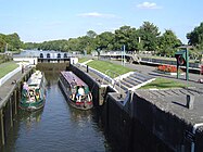
Double lock at Sunbury

Richmond Lock


The list of locks, weirs and ferries is given downstream from the source to the estuary. Most of the old locks no longer exist and there are only three ferries left in operation (Weybridge, Hampton and Hammerton's). Almost all of the old weirs and most of the new ones had a mill, of which 15 are mentioned in the Doomsday Book , but very few of them exist today. Some weirs had eel traps .
| lock | year | First mention of a weir | Height difference | Dimensions (length / width) | Distance from the next lock upstream | Earlier weirs in this section | Ferries |
|---|---|---|---|---|---|---|---|
| St John's Lock | 1790 | 1775 | 0.85 m | 33.60 m / 4.52 m | |||
| Buscot Lock | 1790 | 1.69 m | 33.47 m / 4.47 m | 1.85 km | |||
| Grafton Lock | 1896 | 1762 (Day's / Lower Hart) | 1.11 m | 34.59 m / 4.59 m | 5.37 km | Farmer's, Harts | |
| Radcot Lock | 1892 | 1746 (Beck's, Clare's or Buck's) | 1.48 m | 34.59 m / 4.57 m | 2.98 km | Old Eye | |
| Rushey Lock | 1790 | 1.82 m | 34.59 m / 4.59 m | 4.23 km | Old Nan's | Rushey | |
| Shifford Lock | 1898 | 1762 | 2.23 m | 34.64 m / 4.59 m | 6.92 km | Tadpole (Kent), Thames, Ten foot, Shifford Upper, Duxford | Duxford |
| Northmoor Lock | 1.24 m | 34.59 m / 4.59 m | 7.63 km | Limbre's | Ridge's (Hart's) | ||
| Pinkhill Lock | 1791 | before 1791 | 1.05 m | 34.59 m / 4.9 m | 6.21 km | Ridge's (Langley), Ark, Skinner's | Bablock Hythe |
| Eynsham Lock | 1791 | 0.84 m | 34.51 m / 4.97 m | 2.38 km | |||
| King's Lock | 1928 | 1541 | 0.77 m | 34.46 m / 4.97 m | 4.37 km | Clay | |
| Godstow Lock | 1790 | 1.57 m | 33.52 m / 4.95 m | 1.81 km | |||
| Osney Lock | 1790 | 1227 | 1.89 m | 34.64 m / 5.25 m | 3.87 km | Medley (Binsey) | |
| Iffley Lock | around 1632 | 1585 | 0.81 m | 46.96 m / 6.47 m | 3.73 km | Folly | Iffley |
| Sandford Lock | 1632 (enlarged 1793) | 2.69 m | 53.03 m / 6.62 m | 2.70 km | |||
| Abingdon Lock | 1790 | 1316 | 1.89 m | 36.57 m / 5.71 m | 7.38 km | Nuneham | Thrupp |
| Culham Lock | 1638 (published 1809) | 1580 | 2.41 m | 39.87 m / 5.33 m | 4.15 km | Culham old (1638 in Swift Ditch ), Swift | |
| Clifton Lock | 1812 | 1.03 m | 39.57 m / 5.79 m | 4.52 km | Culham | ||
| Day's Lock | 1789 | 1580 | 1.58 m | 46.93 m / 6.45 m | 4.80 km | Dorchester, Clifton | |
| Benson Lock | 1788 | 1746 | 1.87 m | 40.56 m / 5.46 m | 6.37 km | Shillingford, Keen Edge | |
| Cleeve Lock | 1787 | 1580 | 0.89 m | 40.71 m / 5.53 m | 10.46 km | Pollington's, Chalmore Lock , Moulsford (lock) | Leather Bottle, South Stoke, Littlestoke , Chalmore, Benson |
| Goring lock | 1787 | 1538 | 1.77 m | 54.68 m / 6.40 m | 1.00 km | Streatley | |
| Whitchurch Lock | 1787 | 1580 | 1.01 m | 41.22 m / 5.48 m | 6.55 km | Hart's lock | Gatehampton |
| Mapledurham Lock | 1777 | 1300 | 2.05 m | 61.69 m / 6.42 m | 3.67 km | ||
| Caversham Lock | 1778 | 1493 | 1.44 m | 40.03 m / 5.46 m | 7.08 km | Chawsey | Purley (2) |
| Sonning Lock | 1773 | 1580 | 1.63 m | 47.57 m / 5.46 m | 4.23 km | Breach's | |
| Shiplake Lock | 1773 | 1746 | 1.55 m | 40.64 m / 5.56 m | 4.68 km | Wargrave, Bolney | |
| Marsh lock | 1773 | 1580 | 1.33 m | 41.91 m / 6.42 m | 4.80 km | Beggar's Hole (Bolney), Lashbrook, Wargrave | |
| Hambleden Lock | 1773 | 1338 | 1.44 m | 59.63 m / 7.74 m | 4.59 km | Aston | |
| Hurley Lock | 1773 | 1580 | 1.05 m | 39.82 m / 6.07 m | 5.89 km | Mednam | Medmenham |
| Temple Lock | 1773 | 1580 | 1.23 m | 41.02 m / 5.46 m | 1.03 km | Temple | |
| Marlow Lock | 1773 | 1585 | 2.16 m | 46.10 m / 6.07 m | 3.13 km | ||
| Cookham Lock | 1830 | 1.30 m | 55.77 m / 7.62 m | 6.44 km | Cookham Upper, Spade Oak | ||
| Boulter's Lock | 1772 (published 1828) | 1580 | 2.39 m | 60.80 m / 6.47 m | 3.35 km | My lady, Hedsor | |
| Bray Lock | 1845 | 1328 | 1.46 m | 40.94 m / 5.46 m | 3.43 km | ||
| Boveney Lock | 1838 | 1375 | 1.47 m | 45.59 m / 5.43 m | 5.10 km | Boveney | |
| Romney Lock | 1797 | 2.01 m | 78.50 m / 7.45 m | 3.75 km | Gill's bucks | Windsor | |
| Old Windsor Lock | 1822 | 1300 | 1.74 m | 54.55 m / 7.36 m | 4.83 km | Datchet | |
| Bell Weir Lock | 1817 | 1300 | 1.82 m | 78.51 m / 7.44 m | 4.94 km | Magna Carta Island | |
| Penton Hook Lock | 1815 | 1.22 m | 81.28 m / 7.56 m | 4.33 km | Savory's | Tims', Egham | |
| Chertsey Lock | 1813 | 1.22 m | 61.16 m / 6.40 m | 3.13 km | Laleham | ||
| Shepperton Lock | 1813 | 2.03 m | 53.16 m / 6.04 m | 3.32 km | |||
| Sunbury Lock | 1812 | 1623 | 1.87 m | 47.15 m / 5.86 m (Old Lock) 62.78 m / 7.41 m (New Lock) |
4.75 km | Ballinger's | Shepperton Church, Weybridge |
| Molesey Lock | 1815 | 1.87 m | 81.78 m / 7.56 m | 4.79 km | Hampton | ||
| Teddington Lock | 1811 | 2.68 m |
198.12 m / 7.54 m (Teddington Barge) 54.22 m / 7.41 m (Teddington Launch) 15.08 m / 1.77 m (Teddington Skiff) |
7.74 km | Kingston | Surbiton, Raven's Ait , Thames Ditton | |
| Richmond Lock | 1894 | 2.00 m | 4.90 km | Hammerton's , Twickenham |
There is also Blake's Lock , on the River Kennet , which is managed by the Environment Agency as part of the Thames and is often counted as a Thames Lock. It is the only manual lock below Oxford.
The tides extend as far as Teddington Lock: the weir at Richmond Lock is only used at low tide to maintain the water level above.
The 1838 Chalmore Lock was closed in 1883.
See also
Web links
- A user's guide to the River Thames (published by the Environment Agency )
- More information about the Thames locks, Thames bridges and Thames canals
Individual evidence
- ^ Frank L. Dix, Royal River Highway , David & Charles, Newton Abbott, 1985, p. 12.
- ^ A b Fred S. Thacker The Thames Highway: Volume 1 General History David & Charles 1968
- ^ Environment Agency, EA Winter Lock Closures and Repairs
- ↑ Environment Agency River Thames River Conditions ( Memento of the original from January 16, 2009 in the Internet Archive ) Info: The archive link was inserted automatically and has not yet been checked. Please check the original and archive link according to the instructions and then remove this notice.
- ↑ Flood warnings for England
- ↑ See the website of the River User Groups ( memento of the original from August 4, 2009 in the Internet Archive ). Info: The archive link was inserted automatically and has not yet been checked. Please check the original and archive link according to the instructions and then remove this notice.
- ↑ Frederick S. Thacker, The Thames Highway Vol. 2: Locks and Weirs, 1968 , David & Charles, Newton Abbott
- ^ Cruising Guide to the River Thames and Connecting Waterways, British Marine Federation
- ↑ River Thames: bridges, locks and facilities for boaters data from the Environment Agency