Schneeerner
| Schneeerner | ||
|---|---|---|
|
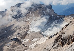
The Nördliche Schneeferner as well as the remains of the Südliches Schneeferner (left) at the end of July 2006 |
||
| location | Bavarian Alps , Germany | |
| Mountains | Wetterstein Mountains | |
| surface | 0.21 km² (2015) | |
| Ice volume | 5.56 million m³ (2006) | |
| Coordinates | 47 ° 24 '50 " N , 10 ° 58' 30" E | |
|
|
||
| drainage | Partnach , Loisach , Isar , Danube | |
The Schneeerner is a glacier in the Bavarian Alps . It is located on the Zugspitzplatt , a plateau sloping from west to east south of the Zugspitz summit, which forms the end of the Reintal valley . The melt water from the glacier seeps into the karstified plateau and reappears in the Reintal, where it feeds the Partnach . The Schneeerner is one of the northernmost glaciers in the Alps .
history
Towards the end of the Little Ice Age in the 19th century, a large glacier called the Plattachferner covered almost the entire Zugspitzplatt between the Jubiläumsgrat and the Plattspitzen . At that time it had an area of about 300 hectares and when it retreated it left behind large moraines that are still visible today .
From around 1860 to the 1950s, it lost around 23,000 m² of surface area each year and thus finally shrank to 60 hectares . It split into a northern and a southern part around 1900; The eastern snowman , located below the Zugspitze summit , separated from the northern part later and has since completely disappeared.
After that, the decline in area was less drastic; In particular, the remaining parts of the Northern Snow Fern tend to sink in the surface due to their location in a basin . Between 1965 and 1968 and between 1974 and 1980 phases that were favorable to the glacier even led to the glacier bulging; there was also a significant increase in area at the southern Schneeferner.
The glaciers on the Zugspitzplatt have been on the decline again since 1980. In 2006 the two remaining glaciers covered an area of 39 hectares; there are also a few smaller firn fields .
The global warming has meant that were observed on the Zugspitze since 1990 consistently above-average summer temperatures. The increasingly rare summer snowfalls, which reduce the glacier's energy consumption due to the increasing albedo and interrupt the melting process, are particularly harmful to the glaciers .
Since then (as of 2003) an average of about 80 cm of ice has melted each year. In 2003 it was assumed that if these melting rates were to remain, the glaciers on the Zugspitzplatt will have disappeared sometime between 2015 and 2030. After the hot summer of 2015, the Munich glaciologist Wilfried Hagg reported that the glacier had sunk further and that some slopes that were ice-covered in the previous year are now ice-free. If the (then) melting rate were to continue, there would still be 2050 remains of ice on the Zugspitzplatt.
The years 2016, 2017, 2018 and 2019 were also among the ten warmest years since 1880 ; in 2020 there will only be remains of ice from the southern Schneeferner.
Northern Schneeerner
| Northern Schneeerner | |
|---|---|
|
Northern Schneeerner in September 2009 |
|
| Type | Kar glacier |
| length | 0.85 km |
| surface | 0.209 km² (2015) |
| Exposure | east |
| Altitude range | 2685 m - 2551 m (2015) |
| Tilt | ⌀ 14 ° (25%) |
| width | Max. 2.8 km |
| Ice thickness | ⌀ 16.8 m; Max. 35 m (2015) |
| Ice volume | 3.5 million m³ (2015) |
| Coordinates | 47 ° 24 ′ 50 " N , 10 ° 58 ′ 30" E |
With an area of 28 hectares (as of 2009), the Nördliche Schneeferner is the largest German glacier. With an average altitude of 2,630 m, it is also higher than the other German glaciers Höllentalferner , Watzmanngletscher and Blaueis . Its ice thickness was determined in 2006 to be an average of 17 m; at the most powerful point it was 52 m. The Furthermore, runs from west to east and has only a very slight slope, especially in the lower area. To the north of the glacier is the ridge from the Zugspitze to the Zugspitzeck; in the west it reaches almost as far as the wide Schneefernerscharte . It is open to the east and south; even the snow fernerkopf in the southwest can give it little shade in summer.
The glacier is mainly nourished by precipitation falling directly on its surface; In addition, there is snow from avalanches that fall from the rocks of the Zugspitzeck and the Schneefernerkopf. The speed at which the glacier moves is only 25 to 30 cm per year in the middle area; So there is hardly any mass transport to lower altitudes. In the steep flanks of the Schneefernerkopf, the flow speed can also be several meters per year. Here, however, the glacier has almost completely disappeared in recent years or its remains have been covered by rubble, and there is hardly any accumulation .
Management of the glacier
Today the northern snow farmer is all about winter sports . Since 1955, five lifts have been built on the ice, which form the only German glacier ski area; once even summer skiing was possible here. The natural development of the glacier had to be subordinate to this. As snow has been brought in from surrounding areas, the ice thickness has temporarily increased again in individual areas since 1990.
Since 1993, certain areas of the glacier have been covered with tarpaulin over the summer to protect the ice and snow of winter from solar radiation and rain. In 2007, 9,000 m², or almost 3% of the glacier, were covered; in the previous years it was 6,000 m². This is expected to, the snow melt delaying of rocks, which could hamper the winter sports, as long as possible. However, this has hardly any impact on the lifespan of the glacier, because the ice obtained in this way only compensates for around 1% of the loss that is to be expected in the unprotected areas of the glacier. In addition, the areas where the glacier would have disappeared fastest under natural conditions are preferred.
The glacier in the record summer of 2003
On hot days, the ice surface of the Nördlicher Schneeferner sinks by up to 11 cm. In August 2003 the glacier released 35,000 m³ of water a day, which corresponds to about a tenth of the average water consumption of Munich. Experts refer to this enormous melting of the ice as glacier noise (which the meltwater streams create).
Southern Schneeerner
| Southern Schneeerner | |
|---|---|
|
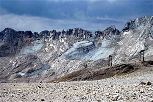
Southern Schneeerner at the end of August 2003 |
|
| Type | Firnfield |
| surface | 3.4 ha (2015) |
| Exposure | Northeast |
| Altitude range | 2641 m - 2557 m (2015) |
| Ice thickness | ⌀ 4.6 m; Max. 16.5 m (November 2006) |
| Ice volume | 0.3 million m³ (2015) |
| Coordinates | 47 ° 24 '8 " N , 10 ° 58' 23" E |
The southern Schneeferner once covered the entire south-western part of the Zugspitzplatt. In 2015 only an area of less than 4 hectares was preserved. Its ice thickness, determined in 2006, was also only very low with an average of less than 5 m. At the end of the 20th century, the glacier split into a southeastern part below the Wetterwandeck and a northwestern part below the Wetterspitze , which then disintegrated into the last remaining larger ice surface and several smaller firn fields . These remains can no longer be called glaciers today. It can be assumed that they will also be completely melted away in a few years.
Web links
- Archive of the Bavarian glaciers
- Webcams of the Bavarian Zugspitzbahn (offer a view of the glaciers or parts of them)
Individual evidence
- ↑ a b c d e f g h i j k l m bayerische-gletscher.de
- ↑ On the behavior of glaciers in the Alps in the twentieth century ( Memento of the original from September 27, 2007 in the Internet Archive ) Info: The archive link was automatically inserted and not yet checked. Please check the original and archive link according to the instructions and then remove this notice. , Climate status report 2001 of the DWD
- ↑ a b c d The formation of the Zugspitze massif and its glaciers ( Memento of the original from September 28, 2007 in the Internet Archive ) Info: The archive link has been inserted automatically and has not yet been checked. Please check the original and archive link according to the instructions and then remove this notice. , Information from the Bavarian Zugspitzbahn
- ↑ Weather station Garmisch-Partenkirchen / Zugspitze 1900 to 2006 (PDF; 5.9 MB), DWD
- ↑ a b Information on glacier shrinkage - glacier shrinkage and climate change on the Zugspitze and Vernagtferner (Ötztal Alps) ( memento of the original from April 23, 2009 in the Internet Archive ) Info: The archive link was inserted automatically and has not yet been checked. Please check the original and archive link according to the instructions and then remove this notice. , Commission for Glaciology of the Bavarian Academy of Sciences , 2003
- ↑ How the record summer affects Bavaria's glaciers . In: Süddeutsche Zeitung , October 2, 2015
- ↑ spiegel.de August 18, 2020: The glaciers are disappearing in the German Alps
- ↑ Glacier coverage 2007 ( Memento of the original dated May 30, 2007 in the Internet Archive ) Info: The archive link was inserted automatically and has not yet been checked. Please check the original and archive link according to the instructions and then remove this notice. , Report of the Bavarian Zugspitzbahn
- ↑ Information from the Commission for Glaciology on glacier cover 2007 ( memento of the original from April 23, 2009 in the Internet Archive ) Info: The archive link has been inserted automatically and has not yet been checked. Please check the original and archive link according to the instructions and then remove this notice.


