Carving tower
|
Carving tower
|
||
|---|---|---|
| Basic data | ||
| Place: | Stansstad | |
| Canton: | Nidwalden | |
| Country: | Switzerland | |
| Altitude : | 435 m | |
| Coordinates: 46 ° 58 '51.2 " N , 8 ° 20' 15.6" E ; CH1903: six hundred and sixty-eight thousand four hundred / 203706 | ||
| Use: | Observation tower | |
| Accessibility: | Observation tower open to the public | |
| Tower data | ||
| Construction time : | 1315 | |
| Building material : | stone | |
| Total height : | 18 m | |
| Viewing platform: | 16 m | |
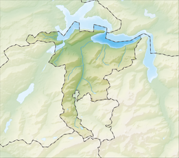
| Position map | ||
|
|
||
The Schnitzturm is a sight in Stansstad , a political municipality in the Swiss canton of Nidwalden .
The former defense tower and today's observation tower was built between around 1310 and 1315. For centuries it was part of an extensive lakeside fortification; this stretched from Harissen Bay to today's Garnhänki on the Alpnachersee shore on Lake Lucerne .
Today the landmark is owned by the municipality of Stansstad. Originally, two thirds of it belonged to the canton of Obwalden and one third to the canton of Nidwalden; 1997 Obwalden donated its part to the local community. The carving tower can be found in the Stansstad coat of arms. The tower is a listed building and entered on the list of cultural assets of national importance in the canton of Nidwalden .
Trivia
The carving tower is exhibited as a model replica in the Swissminiatur open-air miniature facility in Melide as building no.28.
Web links
- Burgenwelt: Schnitzturm
- Nidwald: Schnitzturm Castle , page on swisscastles.ch with photos of the tower
- Schnitzturm , information page on the website of the municipality of Stansstad


