Ompert
|
Ompert
City of Viersen
Coordinates: 51 ° 13 ′ 48 ″ N , 6 ° 24 ′ 10 ″ E
|
||
|---|---|---|
| Height : | 44–60 m above sea level NN | |
| Incorporated into: | Viersen | |
| Postal code : | 41748 | |
| Area code : | 02162 | |
|
Location of Ompert in Viersen |
||
Ompert is a district of the North Rhine-Westphalian district town of Viersen . Within the Viersen urban area, the street village of Ompert is located in the south of the Alt-Viersen district , approx. 1.5 km north of the city limits of Mönchengladbach . Within North Rhine-Westphalia, Ompert also belongs to the Lower Rhine region and, as a district of Viersen, also belongs to the Rhine-Ruhr metropolitan region . Earlier names for the place were Unkepoet , Unckepoet or Umpert . Insofar as it has ever handed down, Ompert is already since the Middle Ages a Viersener district, from any local political independence is not known, Ompert was part of Altviersener Honnschaft Ummer . In church terms, too, Ompert was not independent, the village does not have its own Catholic parish church, but belongs to the parish of " St. Helena " in nearby Helenabrunn .


Settlement structure and traffic
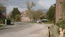
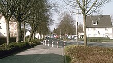
Ompert is a street village and essentially consists of only one street, the " Omperter Weg ", from which smaller side paths branch off occasionally, which are closed to general vehicle traffic. At the northeast end of the Omperter Weg , the development of Ompert merges seamlessly with that of the neighboring Ummer.
Road traffic
The Omperter Weg is an inner-city street in Viersen, which branches off the state road L71 (" Gladbacher Straße ") in Ummer and runs via Ompert to Bötzlöh . Since the Omperter Weg in Bötzlöh de jure becomes a dead end , Ompert can only be reached by motor vehicles via this access from Gladbacher Straße in Ummer.
Rail transport
There is no railway line in Ompert and there has never been, but a tram line existed between 1906 and 1959 in Ummer, not far from the northeast end of Ompert. The tram line originally connected Mönchengladbach with Alt-Viersen and Süchteln and ran in Ummer along Gladbacher Straße . There was also a bus stop on Gladbacher Strasse near the confluence of Omperter Weg . From 1955 the connection was shut down in sections. Initially, the tram went from M'gladbach to the old town of Viersen and ended there at Remigiusplatz, from 1959 the tram ended (like bus line 009 today) directly behind the Gladbach city limits at the stop already in the Viersen city area " Helenabrunn, signpost ". Since then, no trams have passed Omperter Weg . Tram traffic in neighboring Mönchengladbach was finally shut down completely in 1969.
The closest train stations to Ompert that are still in operation are now Viersen train station and Mönchengladbach main train station .
Bus transport
As a district of Viersen, Ompert is part of the tariff area of the Rhein-Ruhr transport association . At the confluence of Omperter Weg on Gladbacher Strasse , in Ummer, there is the bus stop of the same name, " Omperter Weg ", which can be easily reached on foot from Ompert. Two NEW AG bus lines operate here :
| line | route | Hints |
|---|---|---|
| 009 | ( Süchteln ↔ Viersen Busbf. ↔ Beberich ↔ Ummer, Omperter Weg ↔) Helenabrunn, Signpost ↔ M'gladbach, Alter Markt ↔ M'gladbach Hbf ↔ M'gladbach, Ohlerfeld |
NEW AG The section between Süchteln and Helenabrunn, signposted, is only used occasionally at peak times, as a reinforcement for line 019. |
| 019 | ( Vinkrath ↔ Grefrath ↔) Süchteln ↔ Viersen Busbf. ↔ Beberich ↔ Ummer, Omperter Weg ↔ Helenabrunn, signpost ↔ M'gladbach, Alter Markt ↔ M'gladbach Hbf ↔ Rheydt, Hbf |
NEW AG The section between Vinkrath and Süchteln is not always used. |
| (As of June 2017) |
Bike trails
The village of Ompert is touched on the northeastern edge of the village by an officially designated cycle path, the Irmgardispfad , which is an inner-city path for pedestrians and cyclists. The Irmgardis path leads from the Irmgardiskapelle in the Süchtelner heights on the western outskirts of Alt-Viersen past Hoser , Bockert and the Oberbebericher seat town to Ompert and on via Ummer to Helenabrunn .
sport and freetime
- Riding : Siemes riding school
Attractions
- Ompert Section Cross : This cross was built in 1923. It had been previously donated a year by an Omperter farmer in gratitude for past illness and for being spared from military service during the First World War . The cross bears the inscription " We are healed through his wounds " and has been a listed building since 2007.
The closer environment
| Bockert | Oberbeberich | Ummer |
| Bockerter heather |

|
Heimer |
| Bötzlöh | MG-Großheide | Helenabrunn |
Web links
- Official website of the city of Viersen
- Official website of the district of Viersen
- Association for Home Care eV Viersen
- Ompert yesterday - memories
Individual evidence
-
↑ Topographic map 1: 25000, sheet 4704 (Viersen)
(published by the state of North Rhine-Westphalia, accessed on March 23, 2019) -
↑ Topographic map 1: 100000, sheet C4702 (Krefeld) ( Memento of the original from October 29, 2013 in the Internet Archive ) Info: The archive link was inserted automatically and has not yet been checked. Please check the original and archive link according to the instructions and then remove this notice. (4th edition, published in 1989 by the Land Survey Office of North Rhine-Westphalia (now: Cologne District Government), accessed on October 31, 2013)
-
↑ Ferdinand Dohr: Die Viersener Landwehren , published in the Heimatbuch des Kreis Kempen-Krefeld 1972
(now: Heimatbuch des Kreis Viersen , ISSN 0948-6631 , accessed on October 30, 2013) -
↑ a b c Peter Norrenberg : From the Viersener Bannbuch, Viersen 1886
(online presentation of the university library of the Heinrich Heine University Düsseldorf , accessed on April 9, 2011) -
↑ Map of the Rhineland 1: 25000 by Tranchot and v. Müffling (1803–1820), sheet 42 (Viersen) ( Memento of the original from October 29, 2013 in the Internet Archive ) Info: The archive link was inserted automatically and has not yet been checked. Please check the original and archive link according to the instructions and then remove this notice. (Reprinted in 1966 by the Land Surveying Office of North Rhine-Westphalia, Bonn-Bad Godesberg (now: Cologne District Government), accessed on October 31, 2013)
- ^ Jürgen Lehmann: "Tram in Mönchengladbach", published by: Verlag Kenning, Nordhorn 1997
- ↑ Irmgardispfad - Lie'nepäsch (Helenenpfad) (official website of the city of Viersen, accessed on April 9, 2011)
- ^ Website of the Siemes Riding School (accessed on April 9, 2011)
- ↑ Monuments: Ompert Section Cross (official website of the city of Viersen, accessed on April 9, 2011)


