Ummer
|
Ummer
City of Viersen
Coordinates: 51 ° 14 ′ 14 " N , 6 ° 24 ′ 49" E
|
||
|---|---|---|
| Height : | 46 (39-65) m | |
| Incorporated into: | Viersen | |
| Postal code : | 41748 | |
| Area code : | 02162 | |
|
Location of Ummer in Viersen |
||
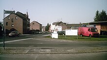
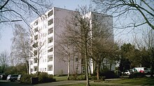
Ummer is a district of the North Rhine-Westphalian district town of Viersen . Within the Viersen urban area, the village of Ummer is located in the south of the Alt-Viersen district , approx. 1.5 km north of the city limits of Mönchengladbach .
In the past, the place was also called Umerade , Ummerade , Umeradt or Ummelrath .


Infrastructure
Road traffic
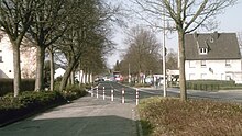
- Ummer is cut through in a north-south direction by the four-lane state road L116, which is also called " Kölnische Strasse " here , and which is one of the main traffic axes in the greater Mönchengladbach area, along with the region's motorways .
- The "Mönchengladbach-Nord" motorway junction on the A 52 is located about 2 km south of Ummer, immediately behind the Viersen city limits .
- In the west of Ummer, the state road L71 (the former federal road 59 ) runs as " Gladbacher Straße " , roughly parallel to Kölnische Straße . Similar to Kölnische Strasse , Gladbacher Strasse also serves traffic between the cities of Viersen and Mönchengladbach, albeit to a lesser extent.
- The " Neuwerker Straße " also runs on the northeastern outskirts of Ummer , which mainly connects the neighboring districts of Hamm and Heimer .
- In a west-east direction, " Ummerstraße " connects Gladbacher Straße with Neuwerker Straße , crossing Kölnische Straße .
Rail transport
- Railway : The railway line from Duisburg to Mönchengladbach originally (since 1850) ran right through Ummer, but there was no train station here, but about 800 m further south between Heimer and Helenabrunn . In 1917, however, the line was moved about 1–2 km to the east and now only touches the neighboring towns of Heimer and Hamm on the north-eastern edge of the town. The original railway line was converted into a country road (" Kölnische Straße "), and in the early 1970s it was finally expanded to four lanes. The closest train stations to Ummer that are still in operation are now Viersen train station and Mönchengladbach main train station .
- Tram : The tram connection from Mönchengladbach to Süchteln , opened in 1906, ran along Gladbacher Straße in Ummer . From 1955 the connection was shut down in sections. Initially, the tram went from M'gladbach to the old town of Viersen and ended there at Remigiusplatz, from 1959 the tram ended (like bus line 009 today) directly behind the Gladbach city limits at the stop already in the Viersen city area " Helenabrunn, signpost ". Since then, Ummer has stopped trams.
Bus transport
As a district of Viersen, Ummer is part of the Rhein-Ruhr transport association and is served by a total of three bus routes:
| Type | line | route | Hints |
|---|---|---|---|
| CE 89 | Dülken ↔ Viersen bus station. ↔ Viersen train station ↔ Hamm ↔ Ummer, Hubertusweg ↔ Heimer ↔ Helenabrunn, signpost / M'gladbach Hbf | The City-Express CE 89 runs from Viersen-Heimer alternately to Helenabrunn, Wegweiser or to the main station M'gladbach | |
| 009 | ( Süchteln ↔ Viersen Busbf. ↔ Beberich ↔ Ummer ↔) Helenabrunn, Signpost ↔ M'gladbach, Alter Markt ↔ M'gladbach Hbf ↔ M'gladbach, Ohlerfeld | The section between Süchteln and Helenabrunn, signposts, is only used occasionally at rush hour, as a reinforcement for line 019. | |
| 019 | ( Vinkrath ↔ Grefrath ↔) Süchteln ↔ Viersen Busbf. ↔ Beberich ↔ Ummer ↔ Helenabrunn, signpost ↔ M'gladbach, Alter Markt ↔ M'gladbach Hbf ↔ Rheydt, Hbf | The section between Vinkrath and Süchteln is not always used. | |
| (As of March 2011) |
Bike trails
The town of Ummer is touched by several cycle paths on its periphery , a total of three officially designated cycle paths lead through the area on 2 axes:
- On the eastern outskirts of Ummer (roughly on the border with Heimer) on the same road from the Bockerter Heide and Helenabrunn and continuing towards Niers :
- - the medlar route ( Alt-Viersen circular route )
- - the [V] route (circular route in the city of Viersen)
- On the western outskirts of the Irmgardispfad :
- The Irmgardis path is designed as both a bicycle and a pedestrian path and leads from Helenenbrunnen via Ummer and Beberich on the western outskirts of Alt-Viersen to the Irmgardiskapelle in the area of the Süchtelner Heights .
Approx. 1.5 km north of Ummer, the international cycling route Fietsallee leads past the North Canal and the main route of the Lower Rhine Route .
Association and social life
- St. Helena Rifle Brotherhood Viersen-Ummer
Attractions
- Wegekapelle Tiefenstrasse : Next to Tiefenstrasse there is a strikingly large holy house , a so-called Wegekapelle . The wayside chapel was built in 1864 and has been a listed building since 1986.
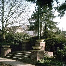
- Mission cross Nelsenstrasse : There is a wooden mission cross at the corner of Nelsenstrasse and Neuwerker Strasse . The cross was originally installed in 1864 to commemorate a so-called popular mission that was carried out at that time and after several renovations (1934, 1949) it was finally completely renewed in 2004, although the cast iron body of the original from 1864 was retained. In 2007 the mission cross was placed under monument protection by the city of Viersen.
- Ummer Memorial : The large crossroads in the middle of a decorative green area on the corner of Gladbacher Strasse and Omperter Weg is a memorial .
The closer environment
|
Sub-division |
Robend Düpp Hamm |
Anrath Vennheide Neersen VIE-Donk |
| Oberbeberich |

|
MG-Donk |
| Bockerter Heide Ompert | Helenabrunn | Heimer MG Lockhütte |
Web links
- Official website of the city of Viersen
- Official website of the district of Viersen
- Association for Home Care eV Viersen
Individual evidence
-
↑ Topographic map 1: 25000, sheet 4704 (Viersen)
(published by the state of North Rhine-Westphalia, accessed on March 23, 2019) -
↑ a b c Peter Norrenberg : From the Viersener Bannbuch , Viersen 1886 (p. 106/107)
(online presentation of the university library of the Heinrich Heine University Düsseldorf , accessed on March 27, 2011) -
↑ Ferdinand Dohr: Die Viersener Landwehren , published in the Heimatbuch des Kreis Kempen-Krefeld 1972
(now: Heimatbuch des Kreis Viersen , ISSN 0948-6631 , accessed on October 30, 2013) -
↑ Prussian map recording 1: 25000 -Neuaufnahme (1892) -, sheet 4704 (Viersen) ( Memento of the original from May 11, 2013 in the Internet Archive ) Info: The archive link was inserted automatically and has not yet been checked. Please check the original and archive link according to the instructions and then remove this notice. (Copy, Internet presentation of the University of Greifswald, requested on March 28, 2011)
- ^ Jürgen Lehmann: "Tram in Mönchengladbach", published by: Verlag Kenning, Nordhorn 1997
- ↑ Irmgardispfad - Lie'nepäsch (Helenenpfad) (official website of the city of Viersen, accessed on March 28, 2011)
- ^ ADFC regional map : Niederrhein-Süd , 1: 75,000, Bielefelder Verlag, ISBN 978-3-87073-318-6
- ^ Associations: St. Helena Schützenbruderschaft Viersen-Ummer (official website of the city of Viersen, accessed on March 28, 2011)
- ↑ Monuments: Wegekapelle Tiefenstraße (official website of the city of Viersen, accessed on March 29, 2011)
- ↑ Monuments: Missionskreuz Nelsenstraße (official website of the city of Viersen, accessed on November 6, 2011)


