Shiliguri
| Shiliguri | ||
|---|---|---|
|
|
||
| State : |
|
|
| State : | West Bengal | |
| District : | Darjiling | |
| Location : | 26 ° 43 ′ N , 88 ° 25 ′ E | |
| Height : | 124 m | |
|
Inhabitants : - Agglomeration : |
647,804 (2011) 701,489 (2011) |
|
| Website : | www.siligurismc.com | |
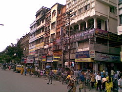
| Street scene in Shiliguri | ||
Shiliguri ( Bengali শিলিগুড়ি IAST Śiliguṛi , English Siliguri ) is a city in the north of the Indian state of West Bengal with about 650,000 inhabitants (2011 census). It is the largest city in the Darjiling district and is located on the Mahananda riverside . The predominant languages in the city are Bengali and Nepali .
Shiliguri has been a municipal corporation since 1994 . A special feature is that 14 of the 47 wards are located in the neighboring Jalpaiguri district.
The center of Shiliguri is about 10 kilometers north of the New Jalpaiguri (NJP Train Station), which is important for the region , from where all rail traffic leads to the East Indian regions of Assam , Tripura and Nagaland , but also to the north of Bangladesh . The nearest airport is to the west in Bagdogra, 15 km away .
From Shiliguri there are bus connections to Bhutan , Kalimpong , Gangtok and Darjiling , which makes the city the starting point for trips to the eastern Himalayan region . The Toy Train of the Darjeeling Himalayan Railway runs from the train station in Shiliguri to Darjiling, only 80 kilometers away, but 2,000 meters higher.
The Coronation Bridge, opened in 1941, crosses the Tista River about 25 km north of the city and thus provides an important road connection to the regions further east.
Shiliguri corridor
The city gives its name to the so-called Shiliguri corridor (also known colloquially as chicken's neck ). This is understood to mean the land bridge that connects northeast India with the rest of India. At its narrowest point, this strip of Indian territory between Nepal in the west and Bangladesh in the east is only about 27 kilometers wide. A large number of economically and strategically important infrastructure facilities run through the corridor (roads, railway lines, high-voltage power lines, petroleum pipelines, cable connections, etc.). The city of Shiliguri owes its current importance as the third largest city in West Bengal to its location in this corridor, which made it an important infrastructure hub. The corridor itself is an artificial structure, created in 1947 by the partition of India , which separated East Bengal and annexed it to Pakistan, so that almost all existing infrastructure connections to the Indian northeast were interrupted or had to be relocated to the corridor due to the new border.
Personalities
- Soumyajit Ghosh (* 1993), table tennis player


