Stamford (Vermont)
| Stamford | ||
|---|---|---|
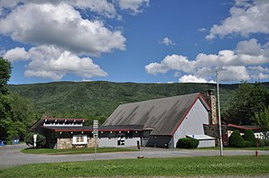
 Town Building Stamford |
||
| Location in Vermont | ||
|
|
||
| Basic data | ||
| Foundation : | March 3, 1753 | |
| State : | United States | |
| State : | Vermont | |
| County : | Bennington County | |
| Coordinates : | 42 ° 46 ′ N , 73 ° 5 ′ W | |
| Time zone : | Eastern ( UTC − 5 / −4 ) | |
| Residents : | 824 (as of 2010) | |
| Population density : | 8.1 inhabitants per km 2 | |
| Area : | 102.6 km 2 (about 40 mi 2 ) of which 102.3 km 2 (about 39 mi 2 ) is land |
|
| Height : | 638 m | |
| Postal code : | 05352 | |
| Area code : | +1 802 | |
| FIPS : | 50-69775 | |
| GNIS ID : | 1462215 | |
| Website : | www.Stamfordvt.org | |
Stamford is a town in Bennington County of the state of Vermont in the United States with 824 inhabitants (according to the 2010 census).
geography
Geographical location
Stamford is in the south of Bennington County, in the Green Mountains , on the Massachusetts border. The town is crossed by a few, rather smaller rivers. There are smaller lakes in the north. The largest is Lake Hancock . The surface of the town is very hilly and the highest point is the 940 m high Houghton Mountain .
Neighboring communities
All information as air lines between the official coordinates of the places from the 2010 census.
- North: Woodford , 2.1 miles
- East: Readsboro , 7.2 mi
- South: Clarksburg, Massachusetts , 3 mi
- West: Pownal , 9.2 miles
climate
The mean mean temperature in Stamford is between -7.2 ° C (19 ° Fahrenheit ) in January and 20.6 ° C (69 ° Fahrenheit) in July. This means that the place is around 10 degrees cooler than the long-term average in the USA. At over five and a half meters, the snowfalls between October and May are almost twice as high as the average snow depth in the USA, the daily sunshine duration is at the lower end of the range in the USA.
history
The Grand for Stamford was awarded on March 6, 1753 by Benning Wentworth as part of his New Hampshire Grants with 23,040 acres (about 93 km²). It was one of the first New Hampshire grants. However, the French and Indian War prevented settlers from using the land and so Wentworth renewed the grant in 1761 with the condition that the land should now be settled within one year, otherwise it would fall back to the Crown.
However, the grant recipients did not find any settlers who wanted to settle in Stamford. That is why Wentworth awarded the grant again two and a half years later. Some of the people who were already beneficiaries in the 1753 grant were also beneficiaries again in the 1764 grant, but there were also new recipients. The name was changed to New Stamford in the Grant because Wentworth wanted to make it clear that it was a new Grant. However, the residents did not take the name and left it at Stamford.
The Queen Anne / Colonial Revival style Tudor House , built by John Tudor in 1900 on Vermont State Route 8, was inscribed on the National Register of Historic Places in 1979 in 1979.
Stamford hit the headlines when the two-time murderer Lem Davis Tuggle was caught and arrested in Stamford in 1984 after escaping with the Briley brothers .
Population development
| Census Results - Town of Stamford, Vermont | ||||||||||
|---|---|---|---|---|---|---|---|---|---|---|
| year | 1700 | 1710 | 1720 | 1730 | 1740 | 1750 | 1760 | 1770 | 1780 | 1790 |
| Residents | 272 | |||||||||
| year | 1800 | 1810 | 1820 | 1830 | 1840 | 1850 | 1860 | 1870 | 1880 | 1890 |
| Residents | 383 | 378 | 490 | 563 | 662 | 833 | 759 | 633 | 726 | 645 |
| year | 1900 | 1910 | 1920 | 1930 | 1940 | 1950 | 1960 | 1970 | 1980 | 1990 |
| Residents | 677 | 510 | 374 | 370 | 418 | 514 | 600 | 752 | 773 | 773 |
| year | 2000 | 2010 | 2020 | 2030 | 2040 | 2050 | 2060 | 2070 | 2080 | 2090 |
| Residents | 813 | 824 | ||||||||
Culture and sights
Culinary specialties
The Winchell grape variety is a white grape that was selected in 1850 as a presumably spontaneous hybrid of James Milton Clough in Stamford. It was later used to develop new varieties at Cornell University in Geneva. It has the synonym: Green Mountain.
Economy and Infrastructure
traffic
The Vermont State Route 8 runs from north to south and connects with Stamford Readsboro and Searsburg in the north, or east and Clarksburg, Massachusetts in the south.
Public facilities
Shaftsbury has no public facilities other than the usual municipal facilities and public elementary school. The closest hospital, Southwestern Medical Center , is in Bennington.
education
Stamford is part of the Windham Southwest Supervisory Union with Halifax, Readsboro, Searsburg and Wilmington . Stamford is home to the Stamford Elementary School , with classes from pre-kindergarten through eighth grade. For further education the surrounding communities have to be approached.
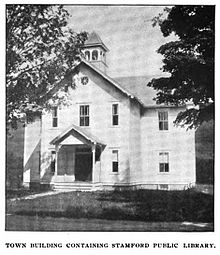
The Stamford Community Library is located on Main Road in Stamford.
Personalities
sons and daughters of the town
- Stephen C. Millard (1841–1914), politician and New York State representative in the US House of Representatives
literature
- Zadock Thompson: History of Vermont, natural, civil and statistical, in three parts . 3rd volume. Chauncey Goodrich, Burlington 1842, p. 164 f . ( limited preview in Google Book search).
- Abby Maria Hemenway: The Vermont historical Gazetteer . 1st volume. Burlington 1867.
Web links
- Homepage of the municipality (English)
- Profile of the municipality on the official portal www.Vermont.gov
- Entry on VirtualVermont (English) ( Memento from May 13, 2016 in the Internet Archive )
Individual evidence
- ^ Stamford in the United States Geological Survey's Geographic Names Information System , accessed July 23, 2017
- ↑ Population data from the 2010 US Census in the American Factfinder
- ↑ Houghton Mountain on Peakery.com , accessed July 23, 2017
- ↑ Coordinates of the locations of the Census Authority 2010
- ↑ Climate data and school information at www.City-Data.com (English)
- ↑ a b Stamford, Vermont, New England, USA. In: virtualvermont.com. Retrieved July 23, 2017 .
- ↑ Population 1790–2010 according to the census results
- ^ Windham Southwest Supervisory Union , accessed July 23, 2017
- ^ Stamford Community Library. In: stamfordlibrary.org. Retrieved July 23, 2017 .


