Woodford (Vermont)
| Woodford | ||
|---|---|---|
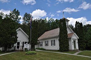
 Woodford Town Offices |
||
| Location in Vermont | ||
|
|
||
| Basic data | ||
| Foundation : | March 6, 1753 | |
| State : | United States | |
| State : | Vermont | |
| County : | Bennington County | |
| Coordinates : | 42 ° 53 ′ N , 73 ° 5 ′ W | |
| Time zone : | Eastern ( UTC − 5 / −4 ) | |
| Residents : | 424 (as of 2010) | |
| Population density : | 3.5 inhabitants per km 2 | |
| Area : | 123.3 km 2 (approx. 48 mi 2 ) of which 122.8 km 2 (approx. 47 mi 2 ) is land |
|
| Height : | 555 m | |
| Postal code : | 05201 | |
| Area code : | +1 802 | |
| FIPS : | 50-85675 | |
| GNIS ID : | 1462271 | |
| Website : | www.Woodfordvt.org | |
Woodford is a town in Bennington County of the state of Vermont in the United States with 424 inhabitants (according to the 2010 census).
geography
Geographical location
Woodford is south of Bennington County, in the Green Mountains . The largest river that flows through the town to the west is the Walloomsac River . It flows into the Hoosic River . There are several lakes in the area of the town. The largest is the centrally located Big Pond in the east of the town. The surface is hilly and the highest point is the 842 m high Prospect Mountain, centrally located in the town .
Neighboring communities
All information as air lines between the official coordinates of the places from the 2010 census.
- North: Glastenbury , 1.4 miles
- Northeast: Somerset , 7.6 mi
- East: Searsburg , 8 miles
- Southeast: Readsboro , 7.7 mi
- South: Stamford , 2.1 miles
- Southwest: Pownal , 15.2 km
- West: Bennington , 9.3 miles
- Northwest: Shaftsbury , 9.4 mi
climate
The mean average temperature in Woodford is between −7.78 ° C (18 ° Fahrenheit ) in January and 18.3 ° C (65 ° Fahrenheit) in July. This means that the place is around 10 degrees cooler than the long-term average in the USA. At over five and a half meters, the snowfalls between October and May are almost twice as high as the average snow depth in the USA, the daily sunshine duration is at the lower end of the range in the USA.
history
The Grant for Woodford was awarded on March 6, 1753 by Benning Wentworth as part of his New Hampshire Grants with 23,040 acres (about 93 km²). Since the town was initially not populated, the grant was awarded again on August 12, 1762 after the end of the American War of Independence .
The first settlers in the town were Avid Serril and Josiah Lawrence in the summer of 1781. They settled in the southwest of the town. The town's constituent assembly took place in 1789.
In 1985 Woodford State Park was established. It covers an area of 400 acres.
Population development
| Census Results - Town of Woodford, Vermont | ||||||||||
|---|---|---|---|---|---|---|---|---|---|---|
| year | 1700 | 1710 | 1720 | 1730 | 1740 | 1750 | 1760 | 1770 | 1780 | 1790 |
| Residents | 60 | |||||||||
| year | 1800 | 1810 | 1820 | 1830 | 1840 | 1850 | 1860 | 1870 | 1880 | 1890 |
| Residents | 138 | 254 | 212 | 395 | 487 | 423 | 379 | 371 | 487 | 353 |
| year | 1900 | 1910 | 1920 | 1930 | 1940 | 1950 | 1960 | 1970 | 1980 | 1990 |
| Residents | 279 | 187 | 231 | 139 | 170 | 198 | 207 | 286 | 314 | 331 |
| year | 2000 | 2010 | 2020 | 2030 | 2040 | 2050 | 2060 | 2070 | 2080 | 2090 |
| Residents | 414 | 424 | ||||||||
Economy and Infrastructure
traffic
The Vermont State Route 9 , and Molly Stark Trail called, extending centrally through the town in east-west direction of Bennington in the west to the east Searsburg.
Public facilities
There are no public facilities in Woodford other than the usual municipal facilities and elementary school. The closest hospital, Southwestern Medical Center , is in Bennington.
education
Woodford is part of the Southwest Vermont Supervisory Union with Bennington, North Bennington, Pownal and Shaftsbury .
Woodford Hollow Elementary School is located in Woodford .
There is no library in Woodford. The closest are in Bennington, Arlington or Wilmington.
literature
- Zadock Thompson: History of Vermont, natural, civil and statistical, in three parts . 3rd volume. Chauncey Goodrich, Burlington 1842, p. 198 f . ( limited preview in Google Book search).
- Abby Maria Hemenway: The Vermont historical Gazetteer . 1st volume. Burlington 1867.
Web links
- Homepage of the municipality (English)
- Profile of the municipality on the official portal www.Vermont.gov
- Entry on VirtualVermont (English) ( Memento from November 13, 2016 in the Internet Archive )
Individual evidence
- ↑ Woodford in the United States Geological Survey's Geographic Names Information System , accessed July 27, 2017
- ↑ Population data from the 2010 US Census in the American Factfinder
- ↑ Prospect Mountain on Peakery.com , accessed July 27, 2017
- ↑ Coordinates of the locations of the Census Authority 2010
- ↑ Climate data and school information at www.City-Data.com (English)
- ^ History of Vermont, Natural, Civil, and Statistical . For the author, by C. Goodrich, 1842 ( books.google.de ).
- ^ Woodford, Vermont, New England, USA. In: virtualvermont.com. Retrieved July 27, 2017 .
- ↑ Town Plan Woodford 2009 (PDF) ( page no longer available , search in web archives ) Info: The link was automatically marked as defective. Please check the link according to the instructions and then remove this notice. , accessed July 27, 2017
- ↑ Woodford State Park | fpr. In: vermont.gov. fpr.vermont.gov, accessed on July 27, 2017 .
- ↑ Population 1790–2010 according to the census results
- ^ Southwest VT Supervisory Union. In: google.com. sites.google.com, accessed July 27, 2017 .
- ↑ Woodford. In: google.com. sites.google.com, accessed July 27, 2017 .


