Staufenberg (Reinhardswald)
| Staufenberg | ||
|---|---|---|
|
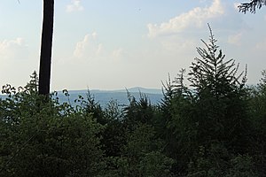
View from the Plattenweg in the Kaufunger Wald near Hann. Münden to the northwest to Staufenberg in Reinhardswald, 15 km away |
||
| height | 472.2 m above sea level NHN | |
| location | District of Kassel , North Hesse ( Germany ) | |
| Mountains | Reinhardswald | |
| Dominance | 17.6 km → Kleiner Steinberg , Kaufunger Wald | |
| Notch height | 220 m ↓ Im Breitenbusch , Espenau -NW | |
| Coordinates | 51 ° 30 '30 " N , 9 ° 33' 41" E | |
|
|
||
| particularities | highest mountain in the Reinhardswald | |
The Staufenberg is 472.2 m above sea level. NHN in front of the Gahrenberg ( 472.1 m ) the highest mountain in the Reinhardswald low mountain range in the Kassel district in Hesse .
Geographical location
The wooded Staufenberg is located in northern Hesse about 3.5 km northwest of Veckerhagen (a part of the municipality of Reinhardshagen ) and about 7.5 km (distances as the crow flies ) east of Hombressen (a district of Hofgeismar ).
The southern branch of the Staufenberg is called "Kleiner Staufenberg" ( 421 m ), not far northwest of the mountain is the first German Friedwald . The water-rich Holzape , which is the longest flowing water in the Reinhardswald and a south-eastern tributary of the Diemel , rises on its western slope . The small Tiefenbach rises a little to the southwest of the mountain peak and flows eastward into the Weser .
Natural allocation
The Staufenberg belongs in the natural spatial main unit group Weser-Leine-Bergland (No. 37) and in the main unit Solling, Bramwald and Reinhardswald (370) to the sub-unit Reinhardswald (370.4). Its landscape falls to the east into the Weser breakthrough valley (370.3).
Diemel-Weser watershed
A section of the Diemel-Weser watershed runs over the Staufenberg summit , which is part of the rather elongated Diemel-Eder / Fulda / Weser watershed : the water of all streams, such as the Holzape from Staufenberg, reaches earlier or later through the Diemel the Weser ; on the other hand, the very short rivers , for example the Tiefenbach, which flow in an easterly direction, reach the Weser directly after a few kilometers.
Individual evidence
- ↑ a b Map services of the Federal Agency for Nature Conservation ( information )
- ↑ To the correspondingly high point at Helfenstein ( 509.8 m ) and Kleinem Schreckenberg ( 474.7 m ), both in the natural area Dörnberg and Schreckenberge ( Habichtswälder Bergland ), the distance would be 21.9 km each; to the Großer Steinberg im Solling , in the opposite direction, it would be just a little more at 22.5 km.
- ↑ dominance and prominence according to TK 25; the notch is about 252 m high
- ^ Jürgen Hövermann: Geographical land survey: The natural space units on sheet 99 Göttingen. Federal Institute for Regional Studies, Bad Godesberg 1963. → Online map (PDF; 4.1 MB)


