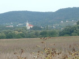
Szentbékkálla
| Szentbékkálla | ||||
|
||||
| Basic data | ||||
|---|---|---|---|---|
| State : | Hungary | |||
| Region : | Central Transdanubia | |||
| County : | Veszprém | |||
| Small area until December 31, 2012 : | Tapolca | |||
| District since 1.1.2013 : | Tapolca | |||
| Coordinates : | 46 ° 53 ' N , 17 ° 34' E | |||
| Height : | 170 m | |||
| Area : | 10.7 km² | |||
| Residents : | 185 (Jan 1, 2011) | |||
| Population density : | 17 inhabitants per km² | |||
| Telephone code : | (+36) 87 | |||
| Postal code : | 8281 | |||
| KSH kódja: | 07092 | |||
| Structure and administration (as of 2020) | ||||
| Community type : | local community | |||
| Mayor : | Csaba Sárvári (Magyar Vállalkozók és Munkaadók Pártja) | |||
| Postal address : | Kossuth Lajos u. 11 8281 Szentbékkálla |
|||
| Website : | ||||
| (Source: A Magyar Köztársaság helységnévkönyve 2011. január 1st at Központi statisztikai hivatal ) | ||||
Szentbékkálla is a Hungarian community in the district Tapolca in Veszprém County .
history
The Romans discovered early on that the province of Pannonia was a very popular country. After the Great Migration, one of the leaders of the conquering Hungarians, Kál Horka, settled here with his tribe in the nineties. Since then there has been a permanent Hungarian successor. In the Middle Ages there was a Benedictine monastery in the village.
This also explains the name of the village, which used to be Szentbenedekkál: it is made up of Szentbenedek ( Saint Benedict ) and the name of the chief Kál . The village, first mentioned in old documents in the 13th century, consists essentially of houses from the 18th and 19th centuries. In summer 2012 all houses were connected to a central sewer system.
nature
The potash basin has been a nature reserve since 1984, an archaic land almost untouched by the damage of modern times. Here are figs , almonds , chestnuts , lavender and rosemary home. Stone junipers and heather thrive here with the sub-Mediterranean vegetation. The meeting of alpine and Atlantic vegetation is interesting. Wild ducks and geese, black storks , spoonbills and various herons also feel at home here. The “Stone Sea” is located very close to Szentbékkálla . Stones and rocks lie as if they had been scattered by a giant. It is a mystery where the boulders, some of which are the size of a house, lying over a layer of sand eight meters thick, come from.
economy
The inhabitants cultivate wine, fruit and agriculture or run small pensions. Great importance is attached to viticulture in particular . Almost every house has its own wine cellar and a bunch of grapes is depicted on the coat of arms of the village.
Parish partnership
-
 Dürnten , Switzerland (2001–2019)
Attractions
- Local history museum ( Helytörténeti Múzeum )
- Roman Catholic Church Gyümölcsoltó Boldogasszony , built from 1790 to 1799, baroque
traffic
The secondary road no. 73135 runs through Szentbékkálla. The nearest train station is about 10 kilometers south in Ábrahámhegy .
Web links
- Official website ( Hungarian , English )
Individual evidence
- ↑ Helyi önkormányzati választások 2019 - Szentbékkálla (Veszprém megye). Retrieved February 25, 2020 (Hungarian).
- ^ Partner municipality Szentbékkálla (HU): The Hungarian village. Municipality of Dürnten, accessed on February 25, 2020 .
- ↑ partner municipality Szentbékkálla (HU). Municipality of Dürnten, accessed on February 25, 2020 .


