Tōhō (Fukuoka)
| Tōhō-mura 東峰 村 |
||
|---|---|---|
|
|
||
| Geographical location in Japan | ||
| Region : | Kyushu | |
| Prefecture : | Fukuoka | |
| Coordinates : | 33 ° 24 ' N , 130 ° 52' E | |
| Basic data | ||
| Surface: | 51.93 km² | |
| Residents : | 1947 (October 1, 2019) |
|
| Population density : | 37 inhabitants per km² | |
| Community key : | 40448-9 | |
| Symbols | ||
| Flag / coat of arms: | ||
| town hall | ||
| Address : |
Tōhō Village Hall 6425 Ōaza Hōshuyama Tōhō -mura, Asakura-gun Fukuoka 838-1792 |
|
| Website URL: | www1.vill.toho.fukuoka.jp | |
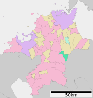
| Location Tōhōs in Fukuoka Prefecture | ||
Tōhō ( Japanese 東峰 村 , - mura ) is a village in Asakura-gun in Fukuoka Prefecture , Japan .
geography
Tōhō is located in the southeast of Fukuoka Prefecture at the intersection of the Hiko - Kubote Mountains ( 英 彦 ~ 求 菩 堤 山地 ) in the east with the Kosho - Hōman Mountains ( 古 処 ~ 宝 満 山地 ) in the west. North of the community is the Chikuhō Basin ( 筑 豊 盆地 , Chikuhō-banchi ) of the Onga-gawa River , to the southwest the Chikugo Plain ( 筑 後 平野 , Chikugo-heiya ) of the Chikugo-gawa and southeast the Hita Basin ( 日 田 盆地 , Hita -banchi ).
In the municipality itself there is only the Koishiwara Basin ( 小石 原 盆地 , Koishiwara-banchi ) in the northwest as the only larger open area. This is traversed by four brooks, which unite at their southwestern end to Koshiwara-gawa ( 小石 原 川 ). The remaining settlements lie along the narrow valleys of the Ōhi-gawa ( 大 肥 川 ) which rises south of the plain and its tributary Hōshuyama-gawa ( 宝珠 山川 ), which rises in the northeast , both of which unite to the south on municipal territory. This means that 86% of the municipal area are mountain forests and meadows.
Annual rainfall averages 2000 mm, compared to 300 mm in the plains of the prefecture where the big cities are located. Despite the southern location (roughly the same latitude as Crete ), winters are often snowy, while summers have temperatures of 25 ° C.
history
Tōhō was founded on March 28, 2005 from the merger of the villages Koishiwara ( 小石 原 村 , -mura ) and Hōshuyama ( 宝珠 山村 , -mura ) in Asakura-gun .
Koishiwara is known for its Koishiwara pottery ( 小石 原 焼 , Koishiwara-yaki ), which in turn has its origin in Takatori ceramics .
traffic
- Streets:
- Train:
Neighboring cities and communities
Web links
Individual evidence
- ↑ a b c d 東峰 村 の 概要 . Tōhō, accessed June 29, 2013 (Japanese).
- ↑ official topographic map
- ↑ 高 取 焼 の 歴 史 . Tōhō, accessed June 29, 2013 (Japanese).


