Tutuba
| Tutuba | ||
|---|---|---|
| Looking Tutuba of Espiritu Santo from | ||
| Waters | Pacific Ocean | |
| Archipelago | Sanma | |
| Geographical location | 15 ° 34 '12 " S , 167 ° 16' 50" O | |
|
|
||
| length | 7.5 km | |
| width | 2.5 km | |
| surface | 13.82 km² | |
| Highest elevation | 30 m | |
| Residents | 600 43 inhabitants / km² |
|
| main place | Patumbuma | |
| Tutuba to the east (right) of the 1950 US nautical chart | ||
Tutuba (also: Île Setovi , Île Toutouba ) is an island in the province of Sanma in the Pacific island state of Vanuatu . The island also bears the settlement of the same name and the native language Tutuba is spoken.
geography
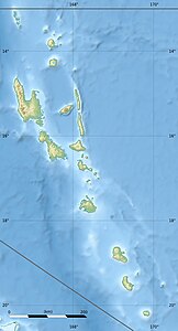
Tutuba is across from Luganville ( Palikulo ) on Espiritu Santo with the Million Dollar Point at Scorff Passage . It rises to a height of about 30 m . It forms an extension of Santo, which also continues in the two islands of Malo and Aore to the south. Small rock islands in the west of the island are Bokissa and Voïsa . The island itself has an elongated bean shape, with Pointe Anousa in the southwest and Pointe Sabato in the southeast , while the slightly narrower northeast end is known as Pointe Narouroundo . The settlement area of the island is on the west coast, with the three villages Vunamalee, Patumbuma and Vunavae (from northeast to southwest). "Golden beaches line the west coast."
climate
Tutuba's climate is humid and tropical . The annual amount of precipitation is 3000 mm. The island is often hit by cyclones and earthquakes.
Individual evidence
- ↑ Vanuatu . Haos Blong Volkeno. Retrieved August 8, 2018.
- ↑ Tangoa . Retrieved August 29, 2015.
- ↑ Surrounding Islands . Espiritu Santo Tourism. Retrieved August 17, 2018.
- ^ UNEP Islands Directory .
- ↑ Tutuba at GeoNames , geonames.org 2020-05-29.
- ↑ "golden beaches line Tutuba's west coast." David Harcombe, Denis O'Byrne, Vanuatu. Lonely Planet 1995: p. 245.


