
Underground line 4 (Hamburg) historic
In Hamburg there were plans for an underground line U4 in the 1960s and 1970s .
| Subway line |
|||||||||||||||||||||||||||||||||||||||||||||||||||||||||||||||||||||||||||||||||||||||||||||||||||||||||||||||||||||||||||||||||||||||||||||||||||||||||
|---|---|---|---|---|---|---|---|---|---|---|---|---|---|---|---|---|---|---|---|---|---|---|---|---|---|---|---|---|---|---|---|---|---|---|---|---|---|---|---|---|---|---|---|---|---|---|---|---|---|---|---|---|---|---|---|---|---|---|---|---|---|---|---|---|---|---|---|---|---|---|---|---|---|---|---|---|---|---|---|---|---|---|---|---|---|---|---|---|---|---|---|---|---|---|---|---|---|---|---|---|---|---|---|---|---|---|---|---|---|---|---|---|---|---|---|---|---|---|---|---|---|---|---|---|---|---|---|---|---|---|---|---|---|---|---|---|---|---|---|---|---|---|---|---|---|---|---|---|---|---|---|---|---|
.png) Route of line U4 (old)
| |||||||||||||||||||||||||||||||||||||||||||||||||||||||||||||||||||||||||||||||||||||||||||||||||||||||||||||||||||||||||||||||||||||||||||||||||||||||||
| Gauge : | 1435 mm ( standard gauge ) | ||||||||||||||||||||||||||||||||||||||||||||||||||||||||||||||||||||||||||||||||||||||||||||||||||||||||||||||||||||||||||||||||||||||||||||||||||||||||
|
|||||||||||||||||||||||||||||||||||||||||||||||||||||||||||||||||||||||||||||||||||||||||||||||||||||||||||||||||||||||||||||||||||||||||||||||||||||||||
However, this had a different route than that of the U4 line, which was opened in 2012 . This “historic” U4 was to be built from the mid-1970s. Since the city of Hamburg was stuck in a massive financial crisis at that time, the preparations were stopped in 1974 despite several preliminary work that had already been done.
Today plans for the realization of parts, especially the eastern section, of this relation as line U5 are up to date again.
Planned course
The line was supposed to begin at Sengelmannstrasse underground station on the existing underground line on the U1 line, where passengers could have changed to and from the U1 line . Then the route of the U4 would have been led under the western part of City Nord with a stop north of the Jahnring as well as the city park and the Borgweg stop (transition to the U3 ring line ) to the western edge of the Jarrestadt . In the zoning plan , the stop is provided here under Barmbeker Straße between Jarrestraße and Gertigstraße. The route would have continued under the Uhlenhorst and Hohenfelde with the stops Winterhuder Weg and Mundsburger Brücke east of the Alster to St. Georg . The construction of a Barcastraße underground station was planned here. In the Hauptbahnhof Nord underground station , the new line was to meet the current U2 line, which was completed in 1969, and follow its route to the next Jungfernstieg station under the Inner Alster. Here the U4 would have been unthreaded again and built via Großneumarkt and St. Pauli to Altona station and then via Ottensen and Lurup to Osdorfer Born . The following stops were planned for the western section of Altona – Lurup in 1973:
- Altona (transition to the S-Bahn)
- Great Brunnenstrasse
- Daimlerstrasse
- Von-Sauer-Strasse
- Ebertallee
- Stadionstrasse
- Rugenbarg
- Lurup
- Osdorfer Born
The Altona - Osdorfer Born section was to be built first. In the absence of a connection to the rest of the subway network, the trains would have had to be delivered on low-loaders and transported to the workshops for maintenance. The question of whether the connection to Lurup should take place with an underground or S-Bahn was long controversial at the time.
After completion of the route sketched here, a northern extension from Sengelmannstrasse to Hamburg Airport was planned , which has been reached via an S-Bahn connection since 2008 .
The travel time between Sengelmannstrasse and the main train station should be 15 to 16 minutes.
Advance payments
In several places there are major advance payments for the new line, most of which were built during the expansion of other underground lines in the late 1960s and early 1970s:
- Sengelmannstrasse station on the embankment on the U1 line has another central platform next to the one in operation, which would be required for the U4 line to be routed out (directional platforms). It is now largely overgrown with weeds and is used as a space for advertising posters. U1 trains in the direction of the city center now use the platform on which the U4 trains arriving from the city center would have traveled. With the U4 built, operation would be comparable to that at the Wandsbek-Gartenstadt transfer station .
- The underground station Hauptbahnhof Nord , located at a great depth, was given four platforms. Only the two middle ones are in operation for the U2. The unused parts of the station were only accessible shortly after the opening and have long been closed, but can be seen. The installation Hauptbahnhof-Nord by Stephan Huber and Raimund Kummer has been located in the northern tube since 1994 as part of the Art in Public Space project , which can be viewed through barriers. During the barrier-free expansion of the station in 2006, the elevator shafts were built into the unused, outer track troughs.
- At the Jungfernstieg junction there are also four track troughs on two (directional) platforms on the lowest platform level. The two inner ones are also used here by the U2, the outer ones initially remained without tracks. HafenCity-U4 has been using this advance service since 2012.
- In Altona station, a concrete ceiling was put in under the platforms of the City S-Bahn to make it easier to build the station for the underground.
- A similar advance service was carried out under the A7 motorway at the Hamburg-Bahrenfeld junction .
- The Bornheide road is said to have been built on piles to make it easier to build the underground tunnel underneath.

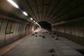
To this day unused platform (right) at Sengelmannstrasse underground station

U4 advance service in the Hauptbahnhof Nord station
Installation of Hauptbahnhof Nord in the north tube of the Hauptbahnhof Nord station

Gleistrog on Jungfernstieg as an advance payment (photo 2001)


Construction
With the exception of a few short sections such as in the Sengelmannstrasse station area and two sections in Lurup, the U4 was to be built as a tunnel. In large parts of the tunnel construction, the shield driving method would have been necessary, which had been used shortly before for the construction of the U2 inner-city route between Berliner Tor and Schlump . Accordingly, there are access shafts for the tunnel boring machines in the Jungfernstieg station, which was already built as a preliminary work . These were later used by the VERA tunnel boring machine to build the new U4 line to HafenCity.
The Winterhuder Weg underground station was to extend over two platform levels, each with two tracks in one direction , similar to the Berlin underground stations Schloßstraße and Jungfernheide . The U4 would have traveled on one track on each platform level. The second tracks on each level were intended for a branch line in the direction of Goldbekplatz, which was to become part of the Alster half-ring .
Chances of realization today
Due to the construction of the “U4 new” from Jungfernstieg , the “U4 old” can no longer be easily realized on the western section between Jungfernstieg and Osdorfer Born . Instead, however, a S-Bahn line could be built between Altona and Osdorfer Born and this could then be connected to the route to Rahlstedt and Ahrensburg as line S4. This possibility was already discussed in the 1970s. Only the third east-west connecting route between Hamburg's city center and Altona (next to the connecting railway and the city tunnel ) would then not be realized.
The eastern section of the "U4 old" between the north central station and Sengelmannstrasse , however, can still be built in a way that is compatible with the old plans. A realization is currently planned as part of the U5 . The situation at the Hauptbahnhof Nord stop is problematic , as the shield driving machines for tunneling can only be positioned underground with enormous effort, which would require large and long construction sites on both sides of the stop. In addition, there is the underpass of the U2 tunnel to the east, which would have to drop too steeply to be able to connect to the platform and still be able to cross under the existing tunnel. In the planning phase of the route in the early 1970s, this was not necessarily a problem, as the city of Hamburg was planning far-reaching urban development changes under the name Alsterzentrum in the area around the station, the implementation of which would then have integrated the construction of the U4 tunnel.
Large parts of the route of the eastern U4 section are now largely served by Metrobus line 6 (Borgweg subway station - main station, the bus line sometimes runs one main street further west). This bus line is one of the busiest in Hamburg. In the plans for a light rail system that appeared in Hamburg politics at the end of the 1990s, light rail lines are also planned in the corridor of the U4 planning at the time (for example in 2000).
Extension variants in contemporary planning
In the "General Verkehrsplan Region Hamburg" (General Transport Plan for the Hamburg Region) from 1976, scenarios were examined that included an extension of the underground line outlined above. Among them was a variant that would have continued the U4 from Sengelmannstraße via the airport and today's U1 stop Fuhlsbüttel Nord to Hummelbüttel.
Web links
- Unused and left over / The "old" line U 4 on gleismann.de
Individual evidence
- ^ Hamburg cultural authority: Art in public space: Stephan Huber & Raimund Kummer "Hauptbahnhof-Nord" 1994
- ↑ http://www.abendblatt.de/hamburg/article134808283/Der-Hamburg-Traum-von-1966-Manhattan-an-der-Alster.html
- ↑ U5: Where should it go and why? Hochbahn blog article from July 24, 2015. http://dialog.hochbahn.de/u-bahn-heute-und-morgen/u5-wo-solls-lang-iegen-und-warum-eigentlich/ accessed on December 6 2015.
- ^ Opponents of the tram criticize the new bus offensive. Local transport HAMBURG, July 6, 2011, archived from the original on December 27, 2011 ; Retrieved April 2, 2017 .
- ↑ The tram is supposed to run through these streets . In: Hamburger Abendblatt of February 24, 2000, page 14
U1 | U2 | U3 | U4 • Lines currently being planned: U5 • Former planning: U4 historic | Alster half-ring