
Hamburg-Lurup
 district of Hamburg |
|
|---|---|
  |
|
| Coordinates | 53 ° 35 '35 " N , 9 ° 52' 58" E |
| height | 20 m above sea level NHN |
| surface | 6.4 km² |
| Residents | 36,610 (Dec. 31, 2019) |
| Population density | 5720 inhabitants / km² |
| Post Code | 22525, 22547, 22549 |
| prefix | 040 |
| district | Altona district |
| Source: Statistical Office for Hamburg and Schleswig-Holstein | |
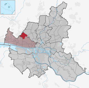
Lurup is a district on the north-western edge of Hamburg in the Altona district .
etymology
The name "Lurup" was first mentioned in 1752 in the Nienstedten church book. At that time should carters after a long drive through the Lüneburg Heath gave the place its name: "Dor luert wi op!" (Logically: But since we are excited at what you want to ...) The sentence components luert and op formed thus later the name Lurup .
According to tradition, there was also an inn called "Luur Up" (Low German for to lie in wait ) in this area. There is also the assumption that the place name describes the natural course of the country road, which rises slightly from Bahrenfeld (Low German lau rup ).
In contrast to these folk etymological and therefore rather improbable derivations, the place name also originates from Lu (h) - (Low German for Lohe, Gerberlohe , general wood, grove ) and - (t) rup (Low German for village , see the local endings -dorp / -torp) conceivable - the occurrence of oaks in the Schenefelder Heide, the bark of which can be used for tanning, or the proximity of the settlement to the forest may indicate this.
In any case, the village of “Luhrup” in the parish of Nienstedten is already drawn on the map of the Pinneberg rule from 1789.
Neighboring districts and communities
Lurup is bordered by the Schleswig-Holstein communities of Schenefeld (Pinneberg district) and Halstenbek in the northwest , as well as the Hamburg districts of Eidelstedt in the northeast, Bahrenfeld in the southeast and Osdorf in the southwest.
history
Beginning of settlement
In 1746, a resident in the area of what would later become Lurup was first mentioned in a document in the Pinneberg debt and pledge record: Franz Hinrich Lüders acquired a settlement on the so-called Schenefelder Heide near the road from Ottensen to Schenefeld. This is where the field marks of the villages of Schenefeld, Osdorf and Groß-Flottbek met.
The topography of the Duchy of Holstein , published in 1908, gives Lurup an area of 266 hectares (203 hectares of which are fields, meadows and pastures), plus 45 apartments with 377 inhabitants. According to another source, 762 people were living there by the end of 1910. Until it was incorporated into Altona (1927), the community leader was the farmer Klaus Eckhoff.
In the early 20th century, citizens of Altona leased a few areas in Lurup to create allotment gardens; one of the larger farms also belonged to a citizen from the Altona district of Ottensen .
1927-1945

When the tiller bergische rural community Lurup 1927 by the United-Altona-law to Altona / Elbe was incorporated, it was not much more than a street village of pre-industrial appearance with around 950 inhabitants: a collection of simple house with no recognizable center, behind Altona main cemetery, airfield and Volkspark located in the middle of a typical Holstein field mark and characterized by agriculture (especially cattle farming with dairy farming), plus some gravel pits. In 1928 there were only two craft businesses: the Heine carpentry and the Reyher painting business.
There was a New Apostolic congregation with around 250 members (some of which were presumably located in neighboring villages), a local group of the Fatherland Women's Association , which mainly dealt with baby care and counseling for mothers, and a district committee for workers' welfare . Lurup was also largely remote from the city in terms of traffic: the railway lines from Altona main station passed the town far north and south, and it was not until 1926 that VAGA bus line IV from Altona to Schenefeld also connected Lurup to the local transport network. Until then, there was only a 90-minute walk to get to Altona's center.
In the general building plan that Altona's Senator for Construction Gustav Oelsner had drawn up for Altona and other Prussian areas around Hamburg as early as 1923, Lurup intended housing (single, row houses), while areas for commercial and industrial development in the neighboring areas were provided by the railway developed districts of Bahrenfeld and Eidelstedt should be created - this is also a structural feature of Lurup, which can be experienced to this day. At the height of the global economic crisis , a small suburban settlement arose along field paths in the area of today's streets Elbgaustraße, Farnhornweg, Lüttkamp and Elbkamp, in which the unemployed and large working-class families from the densely populated inner districts of Altona built single-storey semi-detached houses on urban leased land. The building plans made available free of charge by the building construction department provided for 52 m² of living space and a 700 m² kitchen garden for each settlement - albeit in a peripheral location: the Lurup elementary school was around 20 minutes' walk away. The first 51 semi-detached houses were occupied at the end of 1932. Because of the building materials used (for example packaging waste from the fish industry), these and similar settlements (especially in Osdorf) were popularly known as “fish crate villages”, although many of the houses were built solidly despite their simplicity and all had electricity and water connections.
Presumably mainly with the help of these new citizens of Lurup, the SPD and KPD were able to significantly increase their number of votes in the Reichstag election in 1933 , contrary to the national trend. On April 1, 1938, Lurup became a Hamburg district due to the Greater Hamburg Act .
The airfield that was built on Luruper Landstrasse was expanded by the German Air Force into a home defense air base.
Eidelstedt subcamp

On September 27, 1944, the Hamburg-Eidelstedt subcamp of the Neuengamme concentration camp was set up in an already existing barrack camp for forced laborers on Friedrichshulder Weg , in which Eastern European forced laborers were housed, including 500 Hungarian and Czech Jewish women. They were used in neighboring Eidelstedt companies and for clearing and construction work in Hamburg on behalf of the city. In view of the approaching British troops, the 469 women still alive were forced to go on a death march to Bergen-Belsen on April 4, 1945 .
As early as 1979, a memorial stone for the victims of National Socialism was erected on Kleiberweg, a result of an initiative of the Emmaus parish, which wanted to clarify with a working group against neo-fascism about the goals, crimes and delusion of the National Socialist movement. Later a bronze plaque was added to commemorate the concentration camp prisoners deployed in the Eidelstedt subcamp. In 1985, on the initiative of the Geschwister-Scholl-Gesamtschule, a memorial stone was also erected on Friedrichshulder Weg, the former camp site.
After 1945
After the end of the war, the area of the air base was largely unused, and the Bundeswehr's new air force , which was created in 1955/56, did not want the area because it was too small and too close to Fuhlsbüttel and Finkenwerder. This later turned out to be advantageous because the Hanseatic city was able to locate the German Electron Synchrotron (DESY) there.
Population development
Lurup is the largest district in terms of population in the Altona district and is in thirteenth place in Hamburg. Since 2000, the population has grown by 4.2 percent (as of 2008).
| 1987 | 1988 | 1989 | 1990 | 1991 | 1992 | 1993 | 1994 | 1995 | 1996 | 1997 | 1998 | 1999 |
| 31,041 | 31,010 | 31,321 | 31,636 | 31,754 | 32,015 | 31,868 | 31,751 | 31,625 | 31,558 | 31,884 | 32,035 | 31,986 |
| 2000 | 2001 | 2002 | 2003 | 2004 | 2005 | 2006 | 2007 | 2008 | 2011 | 2016 |
| 32,089 | 31,979 | 32,565 | 33,011 | 33,252 | 33,132 | 33,459 | 33,517 | 33,421 | 33,842 | 36,053 |
Demographics
- Minor quota: 20.1% [Hamburg average: 16.3% (2017)].
- Elderly rate: 18.4% [Hamburg average: 18.2% (2017)].
- Proportion of foreigners: 20.1% [Hamburg average: 17.1% (2017)].
- Unemployment rate: 7.4% [Hamburg average: 5.2% (2017)].
The average income per taxpayer in Lurup is 26,665 euros annually (2013), the Hamburg average is 39,054 euros.
politics
For citizenship elections , Lurup belongs to the Blankenese constituency . The 2015 state election led to the following result:
Buildings

- On Eckhoffplatz , a small square paved with pavement slabs next to Luruper Hauptstrasse , around which there is a small shopping center , there is a high-rise in the style of the 1950s. Since the late 1990s, more and more shops have moved from Eckhoffplatz. Public facilities such as the library and the local office were also closed.
- South of the Rugenbarg street , behind an industrial park with large construction and supermarkets, is a substation for the energy supplier Vattenfall .
- The Church of the Twelve Apostles is located directly on Elbgaustraße .
- Listed buildings see
Economy and Infrastructure
Lurup is predominantly characterized by small industry and craft businesses as well as retail stores and some larger supermarkets and hardware stores.
traffic
There are no federal highways or railway lines through Lurup. However, Lurup is limited in the north by the Hamburg-Altona-Kiel railway line .
Lurup is only indirectly connected to the Hamburg S-Bahn network by buses ( broken traffic ) to the Elbgaustraße station on the edge of the district with Eidelstedt . The lines stop there
- S21 Elbgaustraße - Sternschanze - Dammtor - Central Station - Bergedorf - Aumühle
- S3 Pinneberg - Elbgaustraße - Altona - Central Station - Harburg - Neugraben - Buxtehude - Stade
Lurup is connected to the public transport network by the following bus lines:
Xpressbus line
- X3 Schenefelder Platz - Osdorfer Born - Kressenweg - Stadionstraße - Trabrennbahn Bahrenfeld - S Holstenstraße - U Feldstraße - U Gänsemarkt - U / S Jungfernstieg - U Meßberg (does not stop at every stop)
Metrobus routes
- 2 Schenefeld , Achterndiek / Aneken - Schenefeld, Dorfplatz - Schenefelder Platz - Rugenbarg (north) - Stadionstr. - Trabrennbahn Bahrenfeld - Ottensen Nord - Altona station
- 3 ( Schenefelder Platz - Rugenbarg (North) -) Stadionstraße - Trabrennbahn Bahrenfeld - S Holstenstraße - U Feldstraße - Rödingsmarkt - Rathausmarkt - Central Station - Rothenburgsort - Tiefstack power station )
- 21 U Niendorf Nord - Schnelsen - Eidelstedt - S Elbgaustr . - Schenefelder Platz - Osdorfer Born - Osdorf - EEZ - S Klein Flottbek (- Teufelsbrück , ferry)
- 22 S Blankenese - Osdorf - EEZ - Rugenbarg (north) - S Stellingen - U Hagenbecks Tierpark - Lokstedt - Eppendorfer Marktplatz - U Kellinghusenstraße
City bus routes
- 184 S Halstenbek - Eidelstedt - S Elbgaustr. - Lurup, Neissestrasse
- 284 U Niendorf Nord - IKEA - Schnelsen - Eidelstedt - S Elbgaustr. - Rugenbarg (North) (- Kressenweg ) / - Trabrennbahn Bahrenfeld - S Othmarschen - AK Altona
- 384 (Kalvslohtwiete →) Eidelstedter Platz - S Elbgaustr. - Lurup, Neissestrasse
- 186 S Halstenbek - Schenefeld, Dorfplatz (turn) - Schenefelder Platz - Neißestr . - S Elbgaustr. - Rugenbarg (north) - Kressenweg - EEZ - S Othmarschen
- 392 U / S Ohlsdorf - Lufthansa shipyard - U Lattenkamp - Lokstedt - U Hagenbecks Tierpark - S Elbgaustr . - Osdorf - Nienstedten - Teufelsbrück , ferry
Night bus line
- 602 Osdorfer Born - Schenefelder Platz - Rugenbarg (north) - Trabrennbahn Bahrenfeld - S Holstenstraße - U Feldstraße - Rathausmarkt - HafenCity
Overall, the development is not adequately recognized by the public transport as, therefore there since July 2018 tentatively to demand services Ioki Hamburg in the area Lurup / Osdorf, which includes the S-Bahn stations Elbgaustraße, Eidelstedt (S21, S3) and Klein Flottbek and Hochkamp (S1, S11).
Between 1955 and 1973 Lurup was connected to the Hamburg tram network by tram lines 1 and 11 .
The four-lane main road from Bahrenfeld to Schenefeld ( Luruper Hauptstraße ) and Ring 3 , the outermost of the three Hamburg ring roads ( Rugenbarg / Elbgaustraße ) , also cross in Lurup .
Established businesses

The Hermes Abrasives GmbH & Co. KG is a resident headquartered since 1927 in Lurup. The companies Montblanc , Oticon Germany and Alfons Haar Maschinenbau , among others, are based in the industrial area around Hellgrundweg .
Public facilities
The youth center “Luur-up” (workshop and leisure meeting point for young people), formerly located at the intersection of the streets Luckmoor / Flaßbarg, has found new premises in Spreestrasse 22 after it was closed in 2006, where group activities such as music, computer and creative activities homework and tutoring are also offered. At a second location, the “Underground” youth cellar, at Luruper Hauptstrasse 155, the association offers numerous courses in woodworking, metalworking and tailoring workshops for professional orientation. There are also open meeting places for young people as well as theater and fantasy role-play groups. The Lurup Center with over 25 shops has been located on the corner of Luruper Hauptstraße and Lüttkamp since 2012.
education
In 2007 Lurup had 19 kindergartens as well as eleven schools with a total of 3,280 students. Since 1969 it has also had its own grammar school, which was founded as the Langbargheide grammar school , was now called the Rispenweg grammar school and was renamed the Goethe grammar school in 1982 . It is attended by around 750 students.
Personalities
- Willi Fick (1891–1913), national soccer player
literature
- Matthäus Becker (ed.): The city of Altona. Deutscher Kommunal-Verlag, Berlin 1928.
- Kay Dohnke: National Socialism in Northern Germany - an Atlas. Europa Verlag, Hamburg / Vienna 2001. ISBN 3-203-76040-1
- Paul Th. Hoffmann: Neues Altona 1919–1929 - Ten years of building a major German city. 2 volumes, Eugen Diederichs Verlag, Jena 1929.
- Small guide through the city of Altona / Elbe. Verlag Hammerich + Lesser, Altona 1927
- Anke Schulz: Fischkistendorf Lurup - settlement projects, allotments, site trailers and camps from 1920 to 1950. VSA, Hamburg 2002. ISBN 3-87975-892-1
- Christoph Timm: A kind of Wild West - the Altona jobless settlements in Lurup and Osdorf. In: Arnold Sywottek (Ed.): The other Altona. Results, Hamburg 1984.
See also
- List of streets in Hamburg-Lurup
- List of cultural monuments in Hamburg-Lurup
- List of stumbling blocks in Hamburg-Lurup
Individual evidence
- ^ Hamburger Abendblatt: The district series: Lurup: Name & Geschichte. Retrieved March 21, 2012.
- ^ Horst Beckershaus: The names of the Hamburg districts. Where do they come from and what they mean , Hamburg 2002, ISBN 3-434-52545-9 , p. 75
- ^ Theo Vennemann: Europa vasconica - Europa Semitica . Ed .: Patrizia Noel Aziz Hanna. De Gruyter, Berlin a. a. 2003, ISBN 3-11-017054-X , pp. 753-802 .
- ^ Cell. Retrieved July 29, 2019 .
- ↑ according to gemeindeververzeichnis.de
- ↑ Guide to memorials in Hamburg (PDF; 1.1 MB) published in 2008, accessed on January 8, 2010
- ↑ Statistics North: Special information on population development in the Hamburg districts, accessed October 15, 2009 (PDF; 261 kB)
- ↑ a b Statistics North website, accessed October 15, 2009.
- ↑ Quota of minors in the Hamburg districts in 2017
- ↑ Proportion of 65-year-olds and older in the Hamburg districts in 2017
- ↑ Proportion of foreigners in the Hamburg districts in 2017
- ↑ Unemployment rate in the Hamburg districts in 2017
- ↑ Statistical Office for Hamburg and Schleswig-Holstein (ed.): Hamburg District Profile 2016 (= NORD.regional . Volume 19 ). 2018, ISSN 1863-9518 ( Online PDF 6.6 MB [accessed February 12, 2018]).
- ↑ Result of the 2015 mayor elections in the Hamburg districts, voter turnout and share of votes (state votes - total votes) of the parties in percent. (PDF; 94.9 kB) Statistical Office for Hamburg and Schleswig-Holstein, February 27, 2015, accessed on March 10, 2016 .
- ↑ Final result of the 2011 mayor election (state votes - total votes) in the Hamburg districts: voter turnout and votes of the parties in percent. (PDF; 60.6 kB) Statistical Office for Hamburg and Schleswig-Holstein, May 18, 2011, accessed on March 10, 2016 .
- ↑ Imprint of the website of the Montblanc company. Retrieved February 11, 2019.
- ↑ Imprint of the website of Oticon GmbH. Retrieved February 11, 2019.
- ↑ Contact details on the website of the Alfons Haar company. Retrieved February 11, 2019.
- ↑ Website www.luur-up.de
Web links
- Lurup on hamburg.de
- Lurup history workshop.
- Luur-up eV - Association for the promotion of district-related cultural and social work in Hamburg-Lurup.
- Historical walk through Lurup.
Altona old town | Altona-North | Bahrenfeld | Blankenese | Groß Flottbek | Iserbrook | Lurup | Nienstedten | Osdorf | Othmarschen | Ottensen | Cracks | Sternschanze | Sülldorf