
Halstenbek
| coat of arms | Germany map | |
|---|---|---|

|
Coordinates: 53 ° 38 ' N , 9 ° 51' E |
|
| Basic data | ||
| State : | Schleswig-Holstein | |
| Circle : | Pinneberg | |
| Height : | 13 m above sea level NHN | |
| Area : | 12.58 km 2 | |
| Residents: | 17,944 (Dec. 31, 2019) | |
| Population density : | 1426 inhabitants per km 2 | |
| Postal code : | 25469 | |
| Area code : | 04101 | |
| License plate : | PI | |
| Community key : | 01 0 56 018 | |
| LOCODE : | DE HAK | |
| Community structure: | 2 districts | |
| Address of the municipal administration: |
Gustavstrasse 6 25469 Halstenbek |
|
| Website : | ||
| Mayor : | Claudius von Rüden ( SPD ) | |
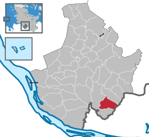
| Location of the municipality of Halstenbek in the Pinneberg district | ||
  |
||


Halstenbek ( Low German : Halstenbeek ) is a municipality in the Pinneberg district in the south of the German state of Schleswig-Holstein . Halstenbek-Ort, Halstenbek-Krupunder and Halstenbek-Brande / Nienhöfen are located in the municipality.
geography
location
Halstenbek is located in the south of the Pinneberg district, about 15 kilometers from Hamburg city center. Halstenbek borders in the east on Hamburg-Eidelstedt and Hamburg-Lurup , in the south on Schenefeld , in the west on Pinneberg and in the north on Rellingen . The community consists of the districts Halstenbek and Krupunder . The streams Burbek and Düpenau as well as the Ballerbek, which earlier originated from the Krupund lake , flow through the municipality . The municipality is located in a now cultivated moor and heathland , which is now dominated by settlement and agricultural areas, here mainly tree nurseries and arable farming.
history

Occasional finds of flint blades , stone axes and core stones suggest that people have lived here since the early Stone Age. The earliest established traces of settlement were excavated in Halstenbek in the 1920s and 1930s; urn graves from the Stone Age , Bronze and Iron Ages , as well as remnants of early medieval lawn iron ore smelting sites and a field forge from the 12th century were found. Halstenbek is mentioned for the first time on May 15, 1296 in a Hamburg debt register, according to which a Hamburg citizen borrowed 30 marks from a Hartwicus from Halstenbeke . At that time Halstenbek already existed as a village . The next written mention comes from the will of Marquard Potekouwe from 1309. The form of the name Halstenbeke appears several times in later records. The village of Halstenbek was under the administration of the County of Holstein-Pinneberg, which had belonged to the Danish kingdom since 1460 .
In the course of the Thirty Years' War , from 1625 to 1627, Danish soldiers raided the village. After that, the inhabitants of the village Halstenbek were plagued by the so-called Swedish and Pollak Wars in the Second Northern War (1658–1660) and the War of Spanish Succession (1701–1714). Up until the industrial revolution at the beginning of the 19th century, the upswing of the village, which had been dominated by smallholders, began. Agriculture in the Pinneberg district specialized in tree nurseries , since after the devastating fire in 1842 the city of Hamburg needed large quantities of trees for building houses and for reforesting parks and street trees.
After the victory of Prussia and Austria in the German-Danish War in 1864, Holstein, and with it Halstenbek, fell to Austria and with the founding of the North German Confederation and the Pinneberg district in 1867 under Prussian administration. The direct administration was in the Drostei in Pinneberg . In 1883 Halstenbek was connected to the railway network with its own freight station, which significantly boosted sales of Halstenbeck's tree nurseries. Since the turn of the century, Halstenbeck's population has increased continuously. The next big economic slump in the community came with the First World War .
The administration in Halstenbek was brought into line with the “ Third Reich ”. The tree nurseries found new sales markets and supplied plants for the green strips of the new highways. Later in the Second World War , when the food supply situation deteriorated, the tree nurseries had to convert part of their production to food cultivation. Still, they continued to deliver plants, but now for camouflage purposes . At the beginning of the war, there were heavy flak batteries at the Halstenbeck freight yard . Later, four flak positions with quadruple flak were built in the tree nursery at Lübzer Strasse. Towards the end of the war Halstenbek was affected by the bombing of Hamburg and the freight yard was destroyed. When Hamburg was declared a fortress, the "Festungsring" ran between the districts of Halstenbek and Krupunder. To the south of the railway line, an anti-tank ditch was built roughly parallel to today's Lübzer Strasse. To the north of the railway line, the anti-tank ditch ran parallel to the railway. The southern anti-tank ditch was built by male prisoners from Neuengamme concentration camp , while the northern ditch was built by Jewish women from the Lurup concentration camp outpost. After the war the community came under British occupation. New administrative structures have been set up. First of all, living space had to be created for refugees.
In the course of the reconstruction, the demand for forest plants also increased steadily and thus one of the most important livelihoods of the community. In 1970 the freight yard was closed. The majority of the new Halstenbeckers no longer worked in the community, but in nearby Hamburg. In the 1970s, new industrial areas were set up and the so-called "Halstenbek residential mile" or, for short, the "furniture mile" developed on the newly built federal highway B 5 .
Population development
The population of Halstenbek was for a long time at the village level and only increased again significantly from the turn of the 20th century and especially after the end of the Second World War. Until the 18th century, only the number of taxable citizens and for the year 1788 the number of families residing in Halstenbek were recorded:
- 1464: 6 taxpayers
- 1591: 16 taxpayers
- 1666: 18 taxpayers
- 1787: 203 taxpayers
- 1788: 73 families
- 1803: 407 inhabitants
- 1909: 2,189 inhabitants
- 1939: 3,627 inhabitants
- 1950: 6,579 inhabitants
- 1985: 15,209 inhabitants
- 2006: 16,200 inhabitants
- 2011: 16,789 inhabitants
- 2019: 18,198 inhabitants
politics
Community representation
The result of the local elections on May 6, 2018 is shown in the following table. The diagram opposite shows the distribution of seats in the municipal council.
| Parties and constituencies | Voices 2018 |
% 2018 |
Seats 2018 |
Voices 2013 |
% 2013 |
Seats 2013 |
Voices 2008 |
% 2008 |
Seats 2008 |
Voices 2003 |
% 2003 |
% 1998 |
||
|---|---|---|---|---|---|---|---|---|---|---|---|---|---|---|
| CDU | Christian Democratic Union of Germany | 2,230 | 34.3 | 9 | 2,086 | 36.1 | 13 | 2,071 | 35.2 | 14th | 3.128 | 47.3 | 41.0 | |
| SPD | Social Democratic Party of Germany | 1,668 | 25.6 | 7th | 1,645 | 28.5 | 10 | 1,441 | 24.5 | 9 | 1,583 | 23.9 | 37.3 | |
| GREEN | Alliance 90 / The Greens | 1,843 | 28.3 | 8th | 1,591 | 27.5 | 10 | 1,616 | 27.5 | 10 | 1.311 | 19.8 | 14.4 | |
| FDP | Free Democratic Party | 671 | 10.3 | 3 | 455 | 7.9 | 3 | 707 | 12.0 | 4th | 595 | 9.0 | 7.3 | |
| total | 98.5 | 27 | 100 | 36 | 99.2 | 37 | 6,617 | 100 | 100 | |||||
| voter turnout | 46.4% | 42.7% | 52.0% | 62.5% | ||||||||||
coat of arms
The coat of arms was approved on October 21, 1969.
Blazon : "In gold on a black shield base, in it a silver wavy bar, three green fir trees, the middle one slightly higher than the other two, with golden roots reaching down into the shield base."
The coat of arms of Halstenbek was developed from an older municipal coat of arms. Even today the community rightly calls itself the cradle of the German forest; After all, 75% of their acreage is used for forest tree cultivation alone. Millions of forest plants of all kinds are shipped from Halstenbek every year. 60% of all forest plants that are transplanted annually for the cultivation of the German forest are grown in Halstenbek. In addition, a lot of shipments go to other European countries. The town's coat of arms confirms the town's reputation for global economic importance. The tree nursery is represented by three fir trees in the coat of arms, corresponding to the predominance of conifers as a breeding plant. The golden roots of the trees indicate the commercial return. The corrugated bar in the base of the shield is intended to reproduce the second part of the place name “-bek”, meaning the same as the stream, and to refer to the mainly underground village stream “Ballerbek”, which only runs approx. 50 m above ground at the Halstenbeck train station.
The coat of arms was designed by the Brunsbüttel heraldist Willy "Horsa" Lippert .
flag
The flag was approved on April 19, 1985.
The flag cloth is divided into a wider middle and a narrower strip at the top and bottom - the upper one green, the lower one black. On the yellow central stripe and in the lower black stripe with the roots reaching down, the three fir trees of the municipal coat of arms, clearly shifted from the center in the direction of the flagpole; on the lower stripe the continuous wave bar of the municipal coat of arms in flag-appropriate tinging.
Town twinning
Halstenbek has twinned towns with Hartkirchen in Upper Austria (since 1984) and with Lübz in Mecklenburg-Western Pomerania (since October 6, 1990).
Honorary award
The Halstenbek community has awarded the honorary prize annually since 2010. It is intended to honor the voluntary commitment of those citizens who have worked particularly hard for the well-being of their fellow citizens. Those to be honored receive a personal "work of art" designed by the artist Rupprecht Matthies and are named on the volunteer board in the town hall. The Halstenbek municipal works are sponsoring the prize with a sum of € 500. The decision on the award is made by the Committee for Social Affairs, Culture and Sport of the Halstenbek community. So far the following citizens have been honored:
- 2010: Lore Loerbrocks (social commitment) and Joachim Stahl (youth sports supervisor)
- 2011: Ursula Lüdemann ( AWO )
- 2012: Dorothea Carstensen, Andreas Stanislaus and Wilfried Bestmann (over 100 blood donations)
- 2013: Hildegart Lunau (history workshop and tree nursery museum)
- 2014: Helmut Salinger (nature conservation)
- 2015: Harald Grelck (70 years volunteer fire brigade)
- 2016: Christine Blanckenburg (welcoming culture in refugee aid) and Ude Hintz (social commitment)
- 2018: Claudia Daffertshofer (Nature Conservation at Krupund Lake)
Culture and sights
Buildings
The oldest house in Halstenbeck is the "Tante Dora House", built in 1795 at Hauptstrasse 22. The former full yard was shortened to include the stable in 1938 and it remained the living area. The second oldest house is the thatched roof house in Königstrasse 24 from 1843, known as the former "poor house".
Halstenbek became known throughout Germany in 1997 when the roof structure of a sports hall in a modern design collapsed. The building, which has since been referred to by all citizens as the " Knick-Ei ", collapsed again after being rebuilt in 1998. From December 16, 2006, the collapsed hall was removed and a new conventional sports hall was built on the vacated site, which was inaugurated on September 5, 2008.
Natural monuments
In the district of Krupunder lies the Krupunder See, a protected landscape area, a popular local recreation destination.

Religion / parishes
There have been two independent parishes in the parish since the mid-1950s; the Evangelical Lutheran and Catholic parishes came into being as a result of the influx of refugees in the period after the Second World War and the growth of the political community in Halstenbek. A New Apostolic church community existed until mid-2012.
The Evangelical Lutheran parish of Halstenbek emerged from the neighboring parish of Rellingen , to which it belonged until 1957. It was ausgepfarrt and independently with the construction of the Church of the Redeemer as a red brick building - hall on Friedrichstrasse mid-1950s. Today the community has two places of worship and sermon: In addition to the Church of the Redeemer, the Noah's Ark community center was built in Halstenbek-Krupunder on Haselweg in the early 1980s. The municipal area is identical to that of the political municipality Halstenbek. Today around 6500 women, men and children belong to the Evangelical Lutheran Church Congregation.
The Catholic parish of Halstenbek with its Sacred Heart Church on the corner of Dockenhudener Chaussee / Friedrichshulder Weg, a single-nave brick building with a small apse and low tower, has around 2350 members of the Catholic community. Around 180 of them can be accommodated in the single-nave church. In addition to the political community Halstenbek, the communities Ellerbek and Bönningstedt and parts of the community Rellingen also belong to the parish. On April 1, 2007 the parishes Herz-Jesu Halstenbek and St. Michael / St. Pius Pinneberg were merged to form the newly founded parish of St. Katharina von Alexandrien (Pinneberg). However, the parishes are still independent.
Cultural event
Theater AG Wolfgang Borchert High School
Halstenbek cultural area
Economy and Infrastructure
The community is still characterized by a large number of tree nurseries ("community in the green") and bears the slogan "Halstenbek - the cradle of the forest". It is located in the largest tree nursery area in the world. However, since the extent of the cultivated areas has recently declined due to company closures, larger areas could be designated as building land, which is mainly used for building private homes, e.g. In some cases, however, commercial operations are also used. Due to the good transport connections, Halstenbek is particularly attractive to young families from the neighboring metropolis of Hamburg who are looking for a new home. In Halstenbek there is what is known as the "Halstenbek residential mile", in which companies from various industries as well as furnishing and furniture stores and restaurants are located. In the early 1990s attended at the year up to 100,000 people A 23 located residential street.
traffic
The Halstenbek stop is on the S-Bahn line that runs parallel to the Hamburg-Altona – Kiel line. Local public transport is within the Hamburg Transport Association (HVV) through the Halstenbek and Krupunder S-Bahn stations on line S3 and bus lines 184, 185, 186, 281 and 285 of the Hamburg-Holstein transport company (VHH). In addition to the A 23 motorway , Halstenbek is also connected to the neighboring communities by a close-knit road network.
education

The community has six kindergartens or day-care centers, the primary and community school on the Bek in the old town center, a primary school and the Wolfgang Borchert grammar school in the Krupunder district. The youth center JubA23 of the community is responsible for extracurricular education and as a youth welfare facility. The Japanese school , which has been in existence in Halstenbek since 1994, is also highly valued. Its catchment area extends as far as Hamburg and has evidently even encouraged a large number of families from Japan to move to Halstenbek.
Community College
The Volkshochschule Halstenbek gGmbH is a state-recognized institution at the municipal level, which is responsible for the further training of adults, children and young people. It offers an open offer in the program areas
- Society & Life
- Job & career
- Languages & understanding
- Health & fitness
- Young vhs
- Special
Others
The name Halstenbek is made up of three parts. In Halsten is a word doubling from the Gothic Hal or Hallus ( Old English Hae II and Danish Hald ) in the first syllable and the Low German term Sten with all terms in the second syllable, for stone stand. The term Bek denotes Bach in Low German . Accordingly, the name Halstenbek would stand for Steinbach (more precisely Steinsteinbach ).
Personalities
Born in Halstenbek
- Ernst Pein (1883–1962), entrepreneur, under whose direction the Pein & Pein company developed into the largest German forest nursery; 1953 honorary citizen of Halstenbek
- Marlon Krause (* 1990), soccer player
Associated with Halstenbek
- Reinhard Suhren (1916–1984), frigate captain, submarine commander, died in Halstenbek
- Franz Erhard Walther (* 1939), artist, lives in Halstenbek
- Valeri Krivoborodov (* 1947), cellist, lives in Halstenbek
- Martin Vandreier , b. Schrader (* 1974), musician ( Fettes Brot ), lived in Halstenbek
- Manfred Steffen (1916–2009), actor, lived in Halstenbek
- Bernhard Koch (* 1962), journalist, filmmaker and Low German author, lives in Halstenbek
- Stéphane Richer (* 1966), sports director of the Hamburg Freezers , lives in Halstenbek
- Matti Schindehütte , b. Lembke (* 1975), German pastor, Protestant theologian and film producer, lived in Halstenbek
- Larissa Boehning (* 1971), writer, grew up in Halstenbek
- Christian Titz (* 1971), soccer coach, lives in Halstenbek
- Gzuz (* 1988), rapper, lives in Halstenbek
literature
- Municipality of Halstenbek (ed.): Municipality of Halstenbek. Anniversary font for the 700th anniversary (1296–1996) . WEKA, Kissing 1996.
- Brigitte Wolf: Halstenbek community chronicle . Halstenbek municipality, Halstenbek 1991.
Web links
- Halstenbek municipality
- Literature by and about Halstenbek in the catalog of the German National Library
Individual evidence
- ↑ North Statistics Office - Population of the municipalities in Schleswig-Holstein 4th quarter 2019 (XLSX file) (update based on the 2011 census) ( help on this ).
- ↑ Schleswig-Holstein topography. Vol. 4: Groß Sarau - Holstenniendorf . 1st edition Flying-Kiwi-Verl. Junge, Flensburg 2004, ISBN 978-3-926055-75-0 , p. 87 ( dnb.de [accessed on May 1, 2020]).
- ^ Claus Ahrens: Prehistory of the Pinneberg district and the island of Helgoland. Wachholtz, Neumünster 1966.
- ↑ Brigitte Wolf: Halstenbek community chronicle . Halstenbek municipality, Halstenbek 1991.
- ^ Municipality of Halstenbek (ed.): Municipality of Halstenbek. Anniversary font for the 700th anniversary (1296-1996) . WEKA, Kissing 1996.
- ↑ http://www.halstenbek.de/verwaltung-politik/kommunalpolitik/
- ↑ Schleswig-Holstein's municipal coat of arms
- ↑ partner communities . Homepage of the Hartkirchen community, accessed on June 23, 2016.
- ↑ Honor civic engagement in Halstenbek! February 7, 2019, accessed April 24, 2019 .
- ↑ Hamburger Abendblatt: Ehrenamtspreis 2018. January 25, 2018, accessed on January 28, 2018 .
- ↑ wo-bo-theater-ag. Retrieved September 13, 2018 .
- ↑ aktuell - Kulturkreis Halstenbek eV Accessed on September 13, 2018 (English).
- ^ Municipality of Halstenbek (ed.): Municipality of Halstenbek. Anniversary font for the 700th anniversary (1296-1996) . WEKA, Kissing 1996, p. 19 . after Wolfgang Laur: The place names in the district of Pinneberg . Wachholtz, Neumünster 1978, ISBN 3-529-04352-4 .
Cities: Barmstedt | Elmshorn | Pinneberg | Quickborn | Schenefeld | Tornesch | Uetersen | Fronds . Other municipalities: Appen | Bevern | Bilsen | Bokel | Bokholt hand grinder | Bönningstedt | Borstel-Hohenraden | Brande-Hörnerkirchen | Bull hollows | Ellerbek | Ellerhoop | Great North End | Great Offenseth-Aspern | Halstenbek | Haselau | Haseldorf | Hasloh | Heede | Heidgraben | Heist | Heligoland | Shirtingen | Hetlingen | Spar | Klein Nordende | Klein Offenseth-Sparrieshoop | Kölln-Reisiek | Kummerfeld | Langeln | Lutzhorn | Bog rain | Neuendeich | Osterhorn | Prisdorf | Raa-Besenbek | Rellingen | Seester | Starfish | Seeth-Ekholt | Tangstedt | Westerhorn .