
Osterhorn
| coat of arms | Germany map | |
|---|---|---|

|
Coordinates: 53 ° 52 ' N , 9 ° 42' E |
|
| Basic data | ||
| State : | Schleswig-Holstein | |
| Circle : | Pinneberg | |
| Office : | Horn churches | |
| Height : | 9 m above sea level NHN | |
| Area : | 6.38 km 2 | |
| Residents: | 419 (Dec. 31, 2019) | |
| Population density : | 66 inhabitants per km 2 | |
| Postal code : | 25364 | |
| Area code : | 04127 | |
| License plate : | PI | |
| Community key : | 01 0 56 038 | |
| LOCODE : | DE 63H | |
| Office administration address: | Am Markt 1 25355 Barmstedt |
|
| Website : | ||
| Mayor : | Ralf Henning | |
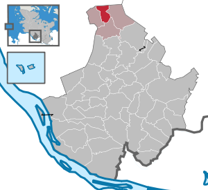
| Location of the municipality of Osterhorn in the Pinneberg district | ||
  |
||

Osterhorn ( Low German : Oosterhoorn ) is a municipality in the Pinneberg district in Schleswig-Holstein .
Geography and traffic
Osterhorn is about 8 km north of Barmstedt . Osterhorn is on the Hamburg-Altona-Kiel railway line . The federal motorway 23 runs from Elmshorn to Itzehoe southwest of the municipality .
politics
Community representation
The Osterhorn voter association, which has existed since 1966, provides all members of the municipal council.
coat of arms
Blazon : "In green a slanted silver wave bar, accompanied above by a golden horn with the mouthpiece pointing outwards, below by three golden cattails."
Attractions
The Osterhorner Moor natural history museum is located in the municipality.
literature
- Helmut Trede: Die Hörner Dörfer - From the history of Bokel, Bokelseß, Brande-Hörnerkirchen, Osterhorn and Westerhorn , self-published in 1989.
Web links
Individual evidence
- ↑ North Statistics Office - Population of the municipalities in Schleswig-Holstein 4th quarter 2019 (XLSX file) (update based on the 2011 census) ( help on this ).
- ↑ Schleswig-Holstein's municipal coat of arms
Cities: Barmstedt | Elmshorn | Pinneberg | Quickborn | Schenefeld | Tornesch | Uetersen | Fronds . Other municipalities: Appen | Bevern | Bilsen | Bokel | Bokholt hand grinder | Bönningstedt | Borstel-Hohenraden | Brande-Hörnerkirchen | Bull hollows | Ellerbek | Ellerhoop | Great North End | Great Offenseth-Aspern | Halstenbek | Haselau | Haseldorf | Hasloh | Heede | Heidgraben | Heist | Heligoland | Shirtingen | Hetlingen | Spar | Klein Nordende | Klein Offenseth-Sparrieshoop | Kölln-Reisiek | Kummerfeld | Langeln | Lutzhorn | Bog rain | Neuendeich | Osterhorn | Prisdorf | Raa-Besenbek | Rellingen | Seester | Starfish | Seeth-Ekholt | Tangstedt | Westerhorn .