
Lutzhorn
| coat of arms | Germany map | |
|---|---|---|

|
Coordinates: 53 ° 50 ' N , 9 ° 47' E |
|
| Basic data | ||
| State : | Schleswig-Holstein | |
| Circle : | Pinneberg | |
| Office : | Rantzau | |
| Height : | 20 m above sea level NHN | |
| Area : | 21.72 km 2 | |
| Residents: | 771 (Dec. 31, 2019) | |
| Population density : | 35 inhabitants per km 2 | |
| Postal code : | 25355 | |
| Area code : | 04123 | |
| License plate : | PI | |
| Community key : | 01 0 56 035 | |
| LOCODE : | DE 63S | |
| Office administration address: | Chemnitzstrasse 30 25355 Barmstedt |
|
| Website : | ||
| Mayor : | Hans-Jürgen Kublun (FWG) | |
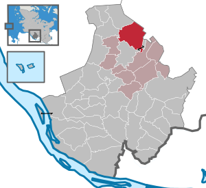
| Location of the municipality of Lutzhorn in the Pinneberg district | ||
  |
||


Lutzhorn ( Low German : Lutzhoorn ) is a municipality in the Pinneberg district in Schleswig-Holstein . The municipality includes the districts Schmiedeberg, Hinterm Holz, Kuhhagen, Überstör, Krummendiek, Stahfast, Einhorn, Im Dorf ,führung, Seis, Schaftritt, Reihe, Wahrensberg, Im Busch, Morgernländerhof, Voßberg, Grenzhöhe, Wiesenhof, Hellwiese, Im Pohl, Wendelohe , Blessing, Auf dem Berg, Im Grund, Hölln and Höllenberg.
Geography and traffic
Lutzhorn is about four kilometers north of Barmstedt . The Höllenbek, the Störbek and the Krumm-Bach flow through the municipality, further parts of the state forest Rantzau (today: Schleswig-Holsteinische Landesforsten ) lie in the municipality.
history
The community is first mentioned in 1255.
politics
Community representation
The Free Voting Association Lutzhorn (FWL), founded on January 10, 1966, is the only political group in the village and therefore provides all community representatives.
coat of arms
Blazon : “Divided diagonally by red and silver on the left. Above a seven-year golden sheaf of corn, below a slanted blue hip horn. "
Economy and Infrastructure
In Lutzhorn there is a primary school with around 70 pupils and a kindergarten. During the week a school bus drives to Barmstedt.
Culture and sights
leisure
The community has an extensive network of bridle paths. There is also an 18-hole golf course.
Web links
Individual evidence
- ↑ North Statistics Office - Population of the municipalities in Schleswig-Holstein 4th quarter 2019 (XLSX file) (update based on the 2011 census) ( help on this ).
- ↑ Schleswig-Holstein topography. Vol. 6: Kronprinzenkoog - Mühlenrade . 1st edition Flying-Kiwi-Verl. Junge, Flensburg 2006, ISBN 978-3-926055-85-9 , pp. 246 ( dnb.de [accessed July 29, 2020]).
- ↑ Schleswig-Holstein's municipal coat of arms
Cities: Barmstedt | Elmshorn | Pinneberg | Quickborn | Schenefeld | Tornesch | Uetersen | Fronds . Other municipalities: Appen | Bevern | Bilsen | Bokel | Bokholt hand grinder | Bönningstedt | Borstel-Hohenraden | Brande-Hörnerkirchen | Bull hollows | Ellerbek | Ellerhoop | Great North End | Great Offenseth-Aspern | Halstenbek | Haselau | Haseldorf | Hasloh | Heede | Heidgraben | Heist | Heligoland | Shirtingen | Hetlingen | Spar | Klein Nordende | Klein Offenseth-Sparrieshoop | Kölln-Reisiek | Kummerfeld | Langeln | Lutzhorn | Bog rain | Neuendeich | Osterhorn | Prisdorf | Raa-Besenbek | Rellingen | Seester | Starfish | Seeth-Ekholt | Tangstedt | Westerhorn .