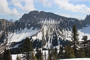
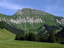
Vanil des Artses
| Vanil des Artses | ||
|---|---|---|
|
View from Molard to the Vanil des Artses |
||
| height | 1991 m above sea level M. | |
| location | Canton of Vaud , Switzerland | |
| Mountains | Freiburg Pre-Alps | |
| Dominance | 3 km → Dent de Lys | |
| Notch height | 290 m ↓ pass north of the Folliu Borna | |
| Coordinates | 565 345 / 147 965 | |
|
|
||
| rock | Sedimentary rock | |
| Normal way | difficult alpine hiking | |
The Vanil des Artses is a 1991 m above sea level. M. high mountain of the Friborg Prealps on the border of the municipalities of Châtel-Saint-Denis in the west and Haut-Intyamon in the east in the Swiss canton of Friborg .
Name and Height
The national map of Switzerland recorded it from 1847 to 1892 as an unnamed mountain at 1995 m above sea level. M. height. From 1893 to 1903 he was called "Les Arches" at 2004 m above sea level. M. recorded. Since 1904 it has been called Vanil des Artses. In 1958 the height was 1993 m above sea level. M. corrected. The digital map shows an altitude of 1991 m above sea level. M. at.
In the Geographical Lexicon of Switzerland from 1910 it is listed as 2004 m above sea level. M. high Vanil des Artzes or Vanil des Ardzes. The name comes from the mighty rock steps (in the vernacular: artzes ) with which it drops to the northeast. Vanil is an expression of the Friborg patois and denotes rock bands and couloirs as well as mountain peaks whose flanks are criss-crossed by such gullies . An alternative origin is a Celtic term for rock .
Location and surroundings
The 1991 meter high summit lies between the valley of the Hongrin in the east and the valley of the Veveyse de Fégire in the west, which flows into the Veveyse . The main European watershed runs along the north-south ridge on which the summit is located between Dent de Lys and Folliu Borna in the north and Le Pila and Cape au Moine in the south . The dominance of the mountain is about three kilometers to the Dent de Lys ( 2013 m above sea level ). The height of the gap in the Vanil des Artses is about 290 meters; the saddle is just over 1700 m above sea level. M. between Folliu Borna and Col de Lys .
In the area of the mountain, the ridge forms the western border of the Parc naturel régional Gruyère Pays-d'Enhaut , a park of national importance .
Climb and caves
The ascent, classified as difficult alpine hiking (T6 +) according to the SAC hiking scale, is possible from the south from Col de Pierra-Perchia (1860 m) via Le Pila and from the north.
In August 2013, around ten cave explorers discovered an ascent inside the mountain: starting at the entrance to the Grotte du dragon , 260 meters below the summit in the valley of the Hongrin , they climbed through a difficult cave in the karst rock and reached the west face of the mountain after seven hours Vanil des Artses 25 meters below the summit. They crossed under the main European watershed . As a technical challenge, the cave contained a ten-meter shaft and a four-meter ledge. The temperature was between 5 ° C and 7 ° C and the humidity was 100%. The researchers had spent months digging away some clay plugs so that these places could be passed on all fours in the mud. Elsewhere, the path had to be found between menhir-like stones and a 20 meter high hall, the “Hall of the Dragon”, had to be crossed. In the end, a large stone blocked the exit, which was destroyed with a cordless hammer drill . According to research by the Swiss Alpine Club at the time , this is the first underground ascent to a mountain - at least in Switzerland. The first climbers stated that some people had referred to them in advance as “dreamers” ( French affabulateurs ). They "strongly advise against" repeating the adventure by inexperienced people.
Web links
- Charles Knapp, Maurice Borel, Victor Attinger, Heinrich Brunner, Société neuchâteloise de géographie (editors): Geographical Lexicon of Switzerland . Volume 6: Tavetsch Val - Zybachsplatte, supplement - last additions - appendix . Verlag Gebrüder Attinger, Neuchâtel 1910, p. 328, keyword Vanil des Artzes ( scan of the lexicon page ).
Individual evidence
- ↑ a b c d Vanil des Artses with measurement to determine dominance and notch height on the national map of Switzerland .
- ↑ Freiburg Pre-Alps at geofinder.ch
- ^ Charles Knapp, Maurice Borel, Victor Attinger, Heinrich Brunner, Société neuchâteloise de geographie (editor): Geographical Lexicon of Switzerland . Volume 6: Tavetsch Val - Zybachsplatte, supplement - last additions - appendix . Verlag Gebrüder Attinger, Neuchâtel 1910, p. 328, keyword Vanil des Artzes or Vanil des Ardzes ( scan of the lexicon page ).
- ^ Charles Knapp, Maurice Borel, Victor Attinger, Heinrich Brunner, Société neuchâteloise de geographie (editor): Geographical Lexicon of Switzerland . Volume 6: Tavetsch Val - Zybachsplatte, supplement - last additions - appendix . Verlag Gebrüder Attinger, Neuchâtel 1910, p. 327, keyword Vanil, Vanel ( scan of the lexicon page ).
- ^ Daniel Anker, Manuel Haas: Alpine hiking - Freiburg summit destinations . SAC Verlag, Bern 2014, p. 33 , ISBN 978-3-85902-318-5 .
- ↑ Tours and photos for Vanil des Artses at hikr.org, accessed on March 5, 2020.
- ↑ La voie intérieure du Vanil des Artses . In: La Liberté , August 24, 2013, with numerous pictures and a detailed description.
- ↑ Jean Godel: Le Vanil-des-Artses, première montagne gravie de l'intérieur , lagruyere.ch, August 27, 2013.
- ↑ Suisse: des trous dans la Gruyère . In: France 3 , September 6, 2013.
- ↑ Grotte du Dragon, l'incroyable ascension souterraine , website of the cave exploration group with numerous pictures, folliu-bornes.ch, accessed on March 5, 2020.


